Weather
Wildfire Haze To Continue In Wayne: See Latest Forecast
Forecasters with the National Weather Service office said visibility could worsen Monday night as the haze thickens.

Editor's note: This story was last updated at 4:40 p.m. Monday.
WAYNE, NJ — After a stormy weekend, Passaic County residents are experiencing high temperatures near 90 degrees and the return of smoky skies from ongoing wildfires in Canada.
The New Jersey Department of Environmental Protection issued a statewide "Air Quality Action Day" for fine particulate matter on Monday, because it may be difficult for some people to breathe normally if they're outside.
Find out what's happening in Waynefor free with the latest updates from Patch.
"Sensitive individuals, including those with heart or lung disease, the elderly, and the young should limit strenuous activities and the amount of time active outdoors," said the NJ DEP.
Forecasters with the National Weather Service office said visibility could worsen Monday night as the haze thickens.
Find out what's happening in Waynefor free with the latest updates from Patch.
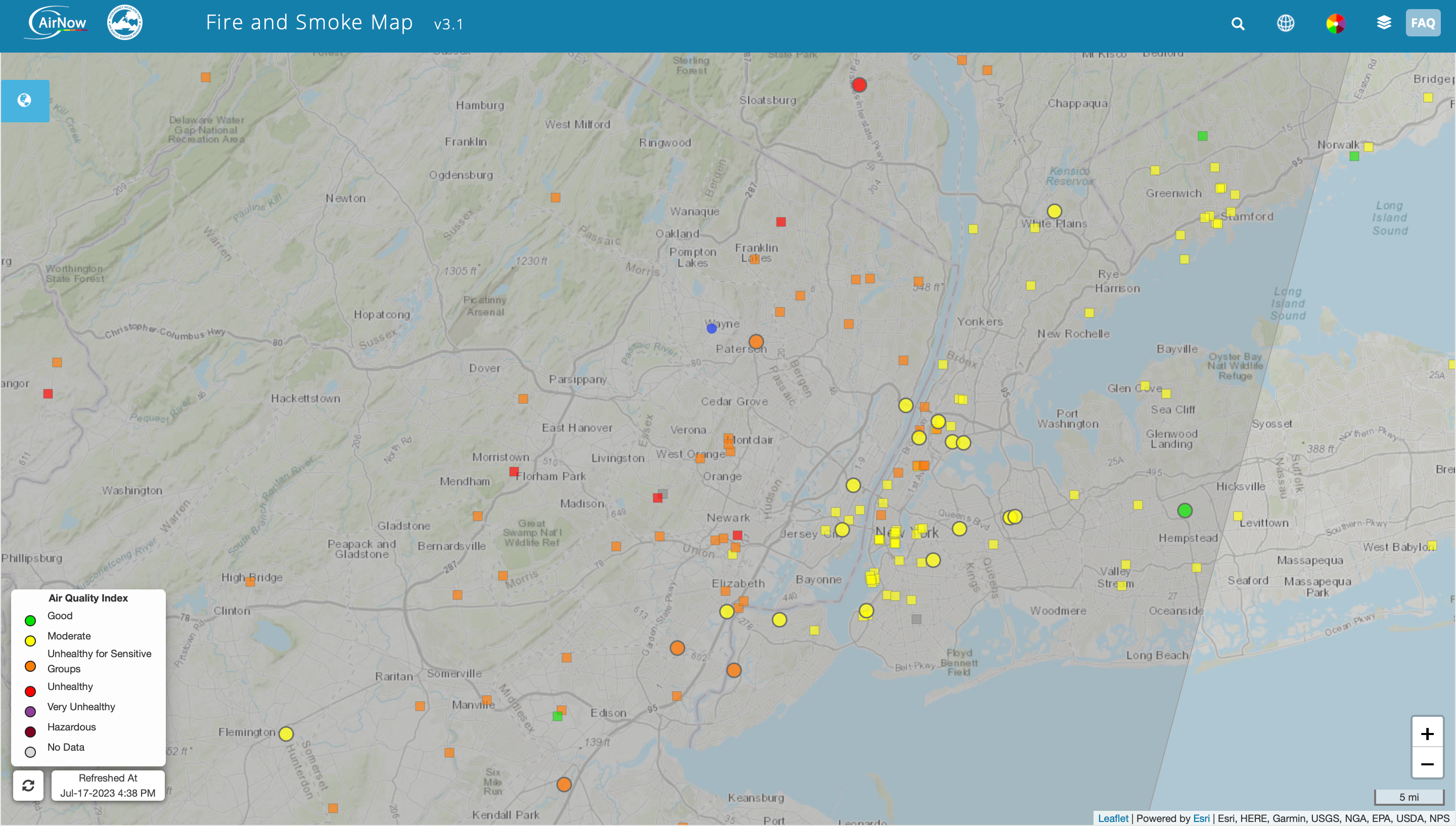
Air quality levels across Passaic County registered in the "unhealthy for sensitive groups" category on Monday at 4 p.m, according to AirNow.gov. Wayne's air quality index (AQI) was 122 when the site was last updated.
Risky AQI, which may pose a hazard for people who are sensitive to air pollution, begins at values above 50.
Here is the forecast through Wednesday for Wayne, courtesy of the National Weather Service:
Monday afternoon: Widespread haze. Sunny, with a high near 90. Southwest wind around 7 mph.
Monday night: Widespread haze. Partly cloudy, with a low around 70. South wind around 5 mph becoming calm in the evening.
Tuesday: Showers and thunderstorms likely, mainly after 2pm. Widespread haze before 2pm. Partly sunny, with a high near 88. Light south wind increasing to 5 to 9 mph in the morning. Chance of precipitation is 60 percent. New rainfall amounts between a tenth and quarter of an inch, except higher amounts possible in thunderstorms.
Tuesday night: Showers and thunderstorms likely, mainly before 8pm. Partly cloudy, with a low around 67. Southwest wind around 5 mph becoming light and variable after midnight. Chance of precipitation is 60 percent. New rainfall amounts of less than a tenth of an inch, except higher amounts possible in thunderstorms.
Wednesday: A 20 percent chance of showers and thunderstorms after 2pm. Mostly sunny, with a high near 87. Northwest wind 3 to 5 mph.
Wednesday night: A 30 percent chance of showers and thunderstorms, mainly after 8pm. Partly cloudy, with a low around 68. North wind 3 to 5 mph.
More than 900 wildfires are burning in Canada right now, and more than 26.4 million acres (41,250 square miles) have been scorched by fires this year — an area bigger than Kentucky or the country of Iceland, according to reports from The Guardian and Accuweather.
Two Canadian firefighters have died in this record-breaking wildfire season, the Guardian added.
Get more local news delivered straight to your inbox. Sign up for free Patch newsletters and alerts.