Community Corner
Udalls Cove Hot Spots, Part Two
Preservation committee president suggests five more sites to visit at the cove.
In , I gave three suggestions for visitors to the neighborhood who’d like to spend a little time exploring the Udalls Cove Park and Preserve. This week’s column has several more.
The times noted are estimates of the minimum you’d need to get some appreciation of the area. You can, of course, spend as much time as you’d like.
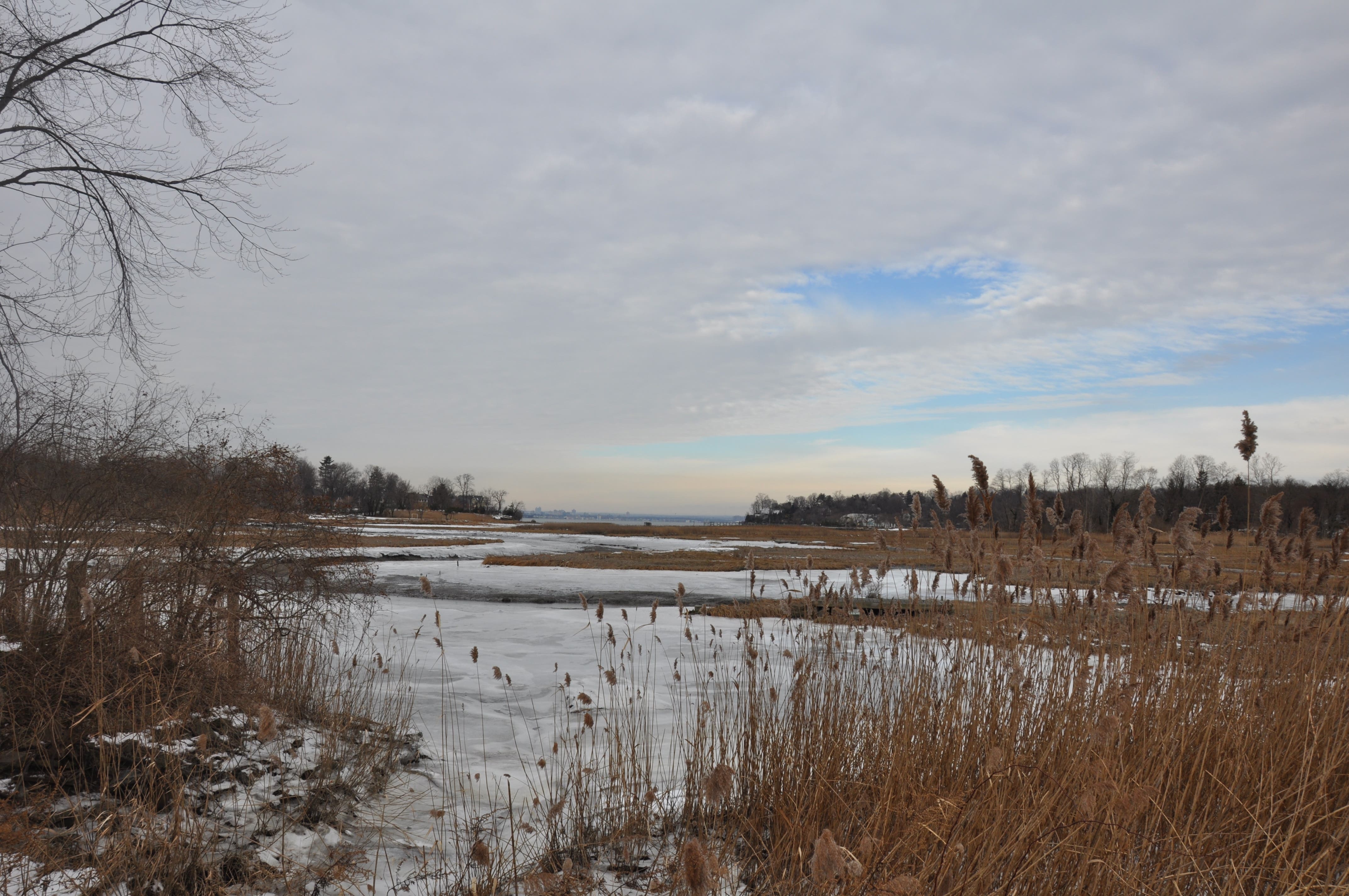
4. Virginia Point Part I [10 - 15 minutes]
Find out what's happening in Bayside-Douglastonfor free with the latest updates from Patch.
This is the section of Udalls Cove Park that affords the most opportunity for exploration. From Aurora Pond, drive back on Sandhill Road and turn left onto Little Neck Parkway. Continue north three blocks from the Long Island Rail Road crossing and park near the intersection of 34th Avenue.
You’ll see a split rail fence at the corner. A trail lined with wood chips enters the park at this point. The trail extends a few hundred feet west through woods and then turns north at edge of a large stand of Phragmites reeds. Here the trail forks and the wood chips come to an end.
Find out what's happening in Bayside-Douglastonfor free with the latest updates from Patch.
From here on, the casual stroll turns into a miniature hike as the trail winds through marsh and more woodlands. Warning: after a rainstorm, parts of the trail are likely to be wet. You’ll see occasional evidence of past human occupation in what is now wilderness: some rusted truck beds, a section of chain link fencing and an old boat trailer.
The trail has several loops and there are a few muddy spots as well as a small stream over which to step. About a block north of where you started, you will emerge near the Point, where there are fine views of the marsh and the open water of Udalls Cove.
Along the water’s edge, you’ll see old pilings and a couple of dead boat hulls. Similar to the rusting truck beds, these are remnants of two commercial boat yards that operated here until about 1960. Follow the trail to the right (east) a few yards and you’ll find yourself back on Little Neck Parkway at its northern terminus and about a block from where you parked.
5. Virginia Point Part II [2 minutes]
Here at the northern terminus of Little Neck Parkway is a small parking area for five or six cars. Ahead of you to the north, you will see an open area covered with woodchips and young plantings. This was an impenetrable tangle of invasive weeds until late 2009 when the Udalls Cove Preservation Committee carried out a restoration project, planting several dozen native trees, shrubs and wild flowers. Walk north across the woodchips for another great view of the marsh and the cove.
6. Virginia Point Part III and the Udalls Cove Marsh [5 - 30 minutes]
Feeling ambitious? Have reasonably good balance? Then here’s your opportunity for a bit of adventure. At the back of the woodchip-covered restoration area (in #5), you’ll see an open, grassy area to your right behind a low chain stretched between two posts. Step through the narrow opening and walk east a couple dozen yards across this grassy area – the backyard fences of several houses will be on your right – until you reach a rail fence constructed of old phone poles.
Turn left and walk about 50 feet until you reach the water. Now, turn right and pick your way along the shoreline another 40 feet until you come to a large iron pipe that is about 30 inches in diameter. This is the outfall pipe from the nearby Belgrave Sewage Treatment Plant. You can walk on the top of the pipe for about a quarter mile. The pipeline crosses the Udalls Cove marsh, traversing several streams and inlets along the way.
Provided you’re not wearing street shoes, you’ll have no difficulty walking atop the pipe, but watch out for goose and/or raccoon feces. Starting in the spring, the area is filled with an abundance of wildlife, including egrets, herons, bitterns, ducks, geese, swans and myriad other birds. As you near the end of the pipeline, you’ll see ahead and to your right the 17-foot high osprey nesting platform that the preservation committee installed in 2004. A pair of ospreys will typically be in residence from late March until late September, with chicks hatching in late May or early June.
During these times, the ospreys may be worried about your approach and start peeping loudly. One may even fly over your head a few times to check you out more closely. Don’t worry - they won’t attack. You can’t follow the pipeline all the way to where it reaches the open water. When you reach a dead end, just turn around and head back.
7. The Alley Creek Marsh and Another Osprey Platform [5 - 15 minutes]
On the opposite, western side of the Douglaston peninsula is another area with fine viewing of the Alley Creek salt marsh and Little Neck Bay. There’s also another osprey nesting platform here that can be easily viewed. This platform was installed by UCPC in 1997 and has been occupied ever since.
From Northern Boulevard, turn north onto Douglaston Parkway (opposite the CVS store). Continue across the viaduct over the LIRR tracks, pass the Community Church of Douglaston on your left and then turn left (west) onto 38th Drive. Go straight for two blocks to the T-intersection with 233rd Street. Turn left (south) onto 233rd, drive one short block to the intersection with 39th Drive and park the car.
Opposite the intersection is a wooden guardrail. Behind the left end of the railing is a trail that leads due west into a wooded area. Follow the trail several hundred feet to the edge of the marsh and the shore of the bay. There are several spots along this trail from which you can look out to your left and see the osprey platform on top of a tall utility pole at the edge of a tide pool. The platform can also be seen from 233rd Street, south of where you parked.
Bring a pair of binoculars to catch a good view of these magnificent birds, which are close relatives of the eagle. As with most wildlife, viewing is best in the early or late part of the day, but once the eggs are laid at least one bird will be on the nest nearly all the time. After the chicks are hatched in June, the parents will be busy bringing them food. For several weeks before the chicks fledge in late July or early August, you’ll see them standing in the nest and occasionally flapping their wings as they prepare for their first flight.
8. Old Oak Pond
The entrance to this interesting and somewhat hidden part of Alley Pond Park is on Douglaston Parkway opposite the intersection with 43rd Avenue. At the south side of the wooded area, you’ll find a trail that leads down a short, steep hill to the pond. The trail turns left and continues about half way around the pond.
Keep an eye out for the remnants of the foundation of a small cottage where a fisherman used to live. You’ll also see evidence of dumping that took place in the 1950s and 1960s when the site was to be developed for a Ford dealership. Bring your binoculars for good bird watching, especially during migration times.
If you have kids, bring them along when you explore the park. They won’t believe they’re in New York City.