Home & Garden
Another Snow Forecast, Freeze Warning in the Hudson Valley for Monday
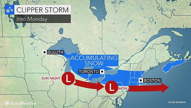
The Mid-Hudson Valley faces the most accumulation. The further south you are the less snow you will see.

It does seem that winter, which didn’t want to arrive, now will not leave us alone.
After the snow and high winds of Saturday and Sunday, we are looking at yet another round of frozen participation.
Southern Westchester is under a Freezing Warning from 8 p.m. Sunday until 10 a.m. Monday, and Dutchess Ulster counties are under a Winter Weather Advisory from 2 a.m. until 6 p.m. Monday.
Find out what's happening in Bedford-Katonahfor free with the latest updates from Patch.
The simple story for the weather for Sunday night and Monday is that the further south you are in the Hudson Valley the less snow you will see accumulate.
Plus the fact that we are now in April helps—after the sun rises.
Find out what's happening in Bedford-Katonahfor free with the latest updates from Patch.
“The sun’s radiation will warm the paved surfaces enough, so that unless it is snowing heavily, the snow will begin to melt on paved surfaces,” said Bill Potter of Hudson Valley Weather.
“This should help to improve travel conditions during the daylight hours. But the morning commute could be quite nasty, with snow falling,” he said.
The heaviest snow fall amount will likely be in the Mid-Hudson Valley.
The National Weather Service said Poughkeepsie’s temperatures will dip to 26 Sunday night.
Snow is expected after 3 a.m. Monday, with less than 1 inch of accumulation possible.
During Monday there will be a mix of rain, snow and sleet, turning to all rain after noon. The high will be around 42. Total accumulation of snow and sleet could be 1 to 3 inches.
The Brewster area will see temps overnight around 24 degrees.
One to 2 inches of snow could fall, before it turns to rain after 11 a.m.
The high Monday will be around 40.
New City and White Plains are looking at overnight temperatures around 30 degrees and accumulations of snow of less than a half inch.
Precipitation in the form of snow, rain and sleet are expected before it turns to all rain Monday morning before 11 a.m.
The high temperature Monday will be around 45 degrees.
New Rochelle will have a low temperature Sunday night around 33.
Rain, snow and sleet is in the forecast after 2 a.m. There will be little to no accumulation.
The high on Monday for New Rochelle will be around 47.
Map: AccuWeather.com
Get Patch’s Daily Newsletter and Real Time News Alerts
Get more local news delivered straight to your inbox. Sign up for free Patch newsletters and alerts.