Weather
Predicted Rain Totals Rise: When Will It End In Hudson Valley?
Here are the updated details on the nor'easter which is dropping heavy rain throughout the Hudson Valley.

HUDSON VALLEY, NY — I know what you are thinking: "When is the rain going to end?" Well, it look like you will need to keep the rain gear handy for a little while longer.
The forecast from the National Weather Service calls for the possibility of rain into Saturday.
But the remainder of the pre-Christmas weekend will likely be dry.
Find out what's happening in Bedford-Katonahfor free with the latest updates from Patch.
However, before we get to that point, we need to get through an extremely wet Friday.
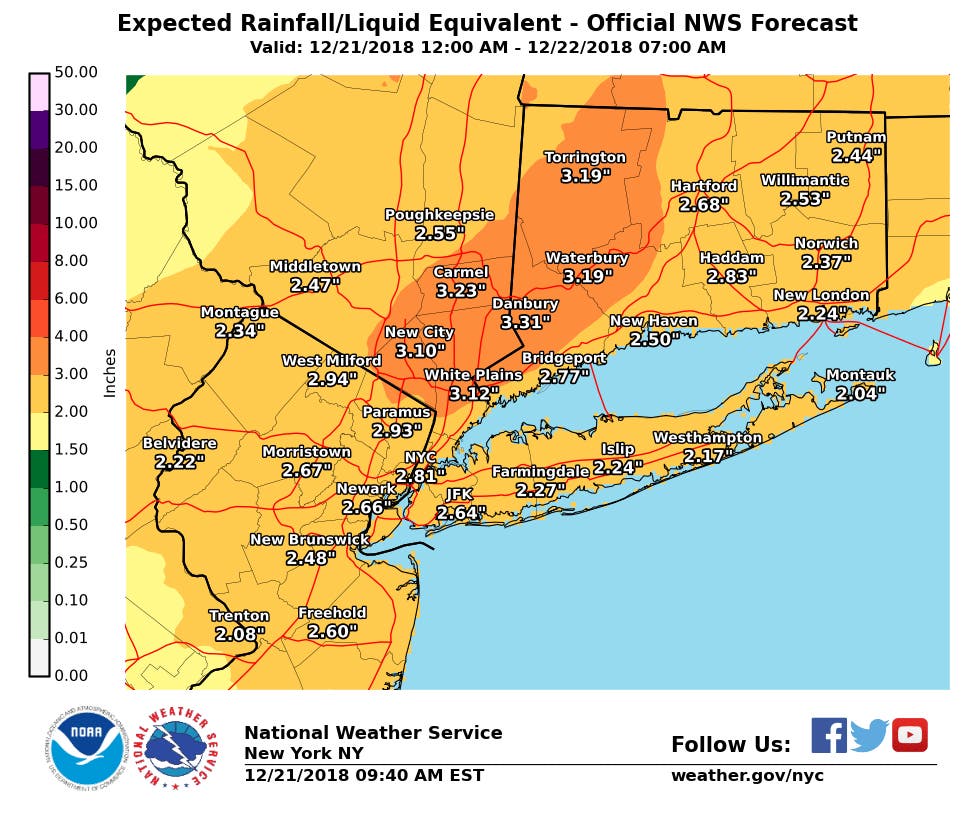
The meteorologists increased the forecast amount of rain during the overnight hours. Now portions of the Hudson Valley, including New City, White Plains and Carmel, may be receiving more than 3 inches of precipitation before it all ends, more than what was predicted Thursday.
Find out what's happening in Bedford-Katonahfor free with the latest updates from Patch.
There is a flood warning in effect for the Hudson River at Poughkeepsie until 6:10 p.m. Friday. The river was forecast to be near flood stage around 9 a.m., and it will continue to rise to near 5.3 feet by midday.
Flood watchs exists for Columbia, Dutchess and Ulster counties and Orange, Putnam, Rockland and Westchester counties until 1 a.m. Saturday.
Flood advisories are also in effect for the region until 12:30 p.m. Friday.
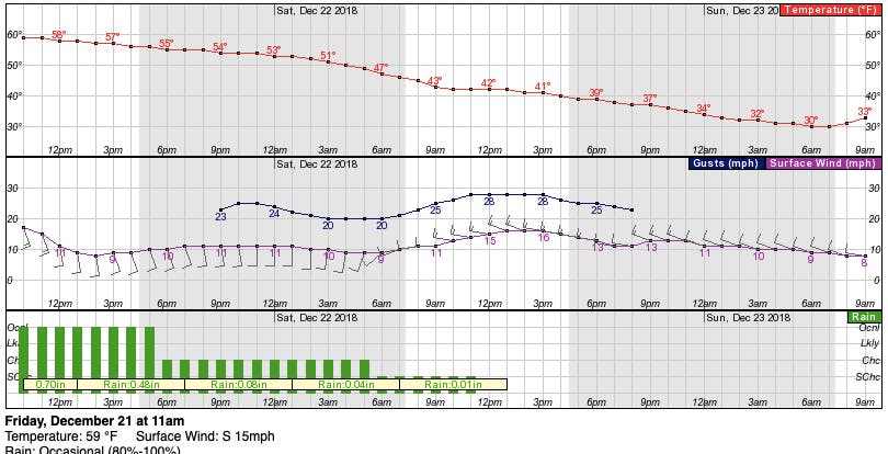
Here is the forecast for the weekend from the NWS for northern Westchester:
- Friday: Rain and possibly a thunderstorm. Some of the storms could produce gusty winds and heavy rain. Patchy fog. Temperature falling to around 56 by 4pm. South wind 13 to 17 mph, with gusts as high as 37 mph. Chance of precipitation is 100%. New rainfall amounts between 1 and 2 inches possible.
- Friday Night: A 50 percent chance of showers. Patchy fog. Otherwise, cloudy, with a low around 45. South wind 9 to 11 mph, with gusts as high as 25 mph.
- Saturday: A 20 percent chance of showers before noon. Mostly cloudy, with a temperature falling to around 39 by 5pm. West wind 10 to 16 mph, with gusts as high as 28 mph.
- Saturday Night: Partly cloudy, with a low around 28. West wind 10 to 13 mph, with gusts as high as 24 mph.
- Sunday: Mostly sunny, with a high near 40. West wind 6 to 9 mph.
- Sunday Night: A 30 percent chance of snow showers after midnight. Mostly cloudy, with a low around 30.
Get Patch’s daily newsletters and news alerts right in your inbox. Find and “Like” Hudson Valley Patches' Facebook Pages.
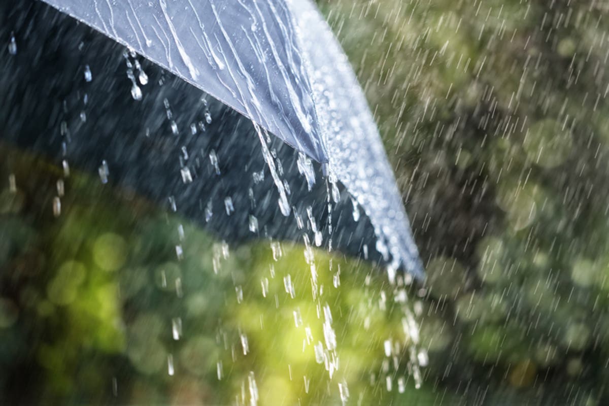
Image via Shutterstock.
Get more local news delivered straight to your inbox. Sign up for free Patch newsletters and alerts.