Weather
Hudson Valley Weather: New Details On Nor’easter Impact
BREAKING: The strongest storm of the season may descend at the evening commute. Here's the latest on what to expect.


The worst of the nor'Easter isn't expected until later today. It looks as if the big storm will arrive in the Hudson Valley just in time for the Monday evening commute, with dangerous winds, heavy rain, plus some sleet, snow and ice depending on where you are. Localized flooding is expected.
"Once the sun sets on Monday, we expect the storm to really pick up over the Hudson Valley," said Bill Potter of Hudson Valley Weather. "As the storm moves northeast, it should rotate some moderate to heavy precipitation northward, into the Hudson Valley."
Some light rain is possible intermittently during the morning, mixed with sleet at times. Precipitation will become steadier between 2 and 7 p.m., with moderate to heavy rain/sleet/snow (depending on where you are) overnight.
Find out what's happening in Bedford-Katonahfor free with the latest updates from Patch.
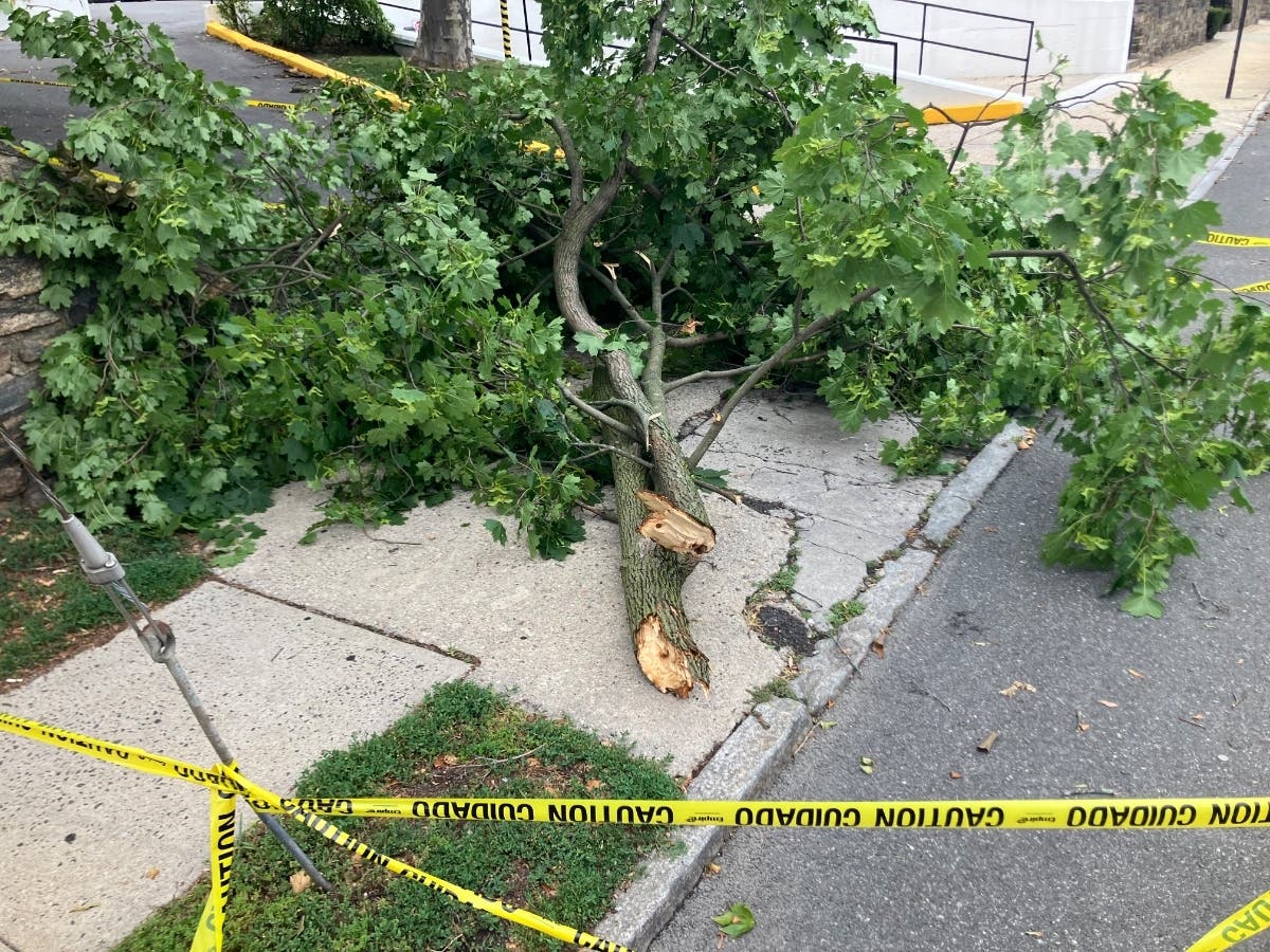
The storm will make travel difficult and dangerous, according to the National Weather Service, which also warns of downed power lines and tree limbs.
Strong east winds are what most worry the power companies and the New York State Thruway Authority. The National Weather Service has issued High Wind Advisories throughout the Hudson Valley as well as flooding notices for southern Westchester, where the issue is high seas on the Sound Shore, and Rockland County, where local streams often flood in heavy rain.
Find out what's happening in Bedford-Katonahfor free with the latest updates from Patch.
Hudson Valley Weather's accumulation prediction (subject to changes):
- Rockland, Westchester, Putnam counties: Coating to half inch of sleet possible
- Orange, Ulster, Dutchess, Columbia counties: 2 to 6 inches of snow and sleet possible
- Sullivan, Delaware, Greene counties: 3 to 8 inches, locally 10 inches
"The bulk of the Hudson Valley… should be quite a mashup of precipitation," Potter said. "Most of us will start out as a mix of sleet and snow...The thought has been, that a thin warm slot of air will cause the snow to melt and fall as sleet… but with such a dynamic storm, if that thin warm slot gets eroded by the developing cold air… parts of the region could see a burst of heavy snow, that could fall at a rate of 1″ per hour or more. It’s going to be an interesting night, because we’ll have to wait and see how it plays out."
Image via AccuWeather.com
Get more local news delivered straight to your inbox. Sign up for free Patch newsletters and alerts.