Community Corner
Update: Hurricane Watches Issued for Parts of Connecticut, New York
Irene is forecast to bring winds up to 95 miles per hour and drop nearly eight inches of rain.

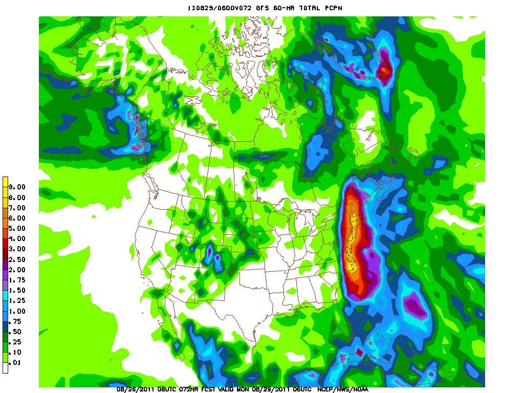


With the latest forecasts predicting that Irene will bring winds up to 95 miles per hour and nearly eight inches of rain to Connecticut and New York, Hurricane Watches have been extended into our area.
The watches have been issued for Long Island; New York City; Westchester, Rockland and Putnam counties, and southern counties of Connecticut. Tropical Storm Watches have been issued for the northern counties of Connecticut, as well as Ulster and Dutchess counties in New York.
A Hurricane Watch means that hurricane conditions (winds in excess of 74 miles per hour) are possible within the next 48 hours.
Find out what's happening in Bronxville-Eastchesterfor free with the latest updates from Patch.
As of 8 a.m., Irene has weakened just slightly with maximum sustained winds of 110 miles per hour. This is still a very strong category 2 hurricane, and may reintinsify slightly before first hitting the North Carolina coast sometime tomorrow.
The latest projections from the National Hurricane Center are putting Irene just off the Maryland coast by 2 a.m. Sunday with maximum sustained winds projected to still be near 100 miles per hour.
Find out what's happening in Bronxville-Eastchesterfor free with the latest updates from Patch.
During the day Sunday, Irene is forecast to make a direct hit through central Connecticut. Winds are still forecast to be at Category 1 strength (between 74 and 95 miles per hour) by that time. In addition to the strong winds, new model data is suggesting between six and eight inches of rain by the time Irene passes.
According to AccuWeather.com, the storm will hit the Eastchester area the hardest around 2 p.m. Sunday, when winds are predicted to be as strong as 75 miles per hour.
While local residents -- and experts for that matter -- may not know exactly when and where Irene is going to hit this weekend, what they can ensure is that when and wherever she does preparations are made, including the following:
BEFORE THE STORM:
- Bring inside all loose objects from your yard, porch or terrace, including yard furniture;
- Secure your doors and windows;
- Stay tuned to local news sources for word on the storm’s timing and severity, and possible evacuation orders;
- Check on relatives, friends and neighbors with disabilities or special needs;
- Make sure you have on hand plenty of bottled water (1 gallon per person, per day), nonperishable food and plenty of batteries for all of your flashlights and portable radios;
- Make sure valuables are secured in waterproof containers;
- Pack a “Go Bag” and bedding in case you need to evacuate;
- Keep friends and family notified of your whereabouts if you choose to leave your home;
- Make sure you have supplies for your pets, infants and chronically ill family members.
And, in the unfortunate case that evacuation is required, here is what the experts suggest should go in your "Go Bag":
A GO BAG SHOULD INCLUDE:
- Copies of your important documents in a waterproof and portable container (insurance cards, photo ID’s, proof of address, etc.
- Extra set of car and house keys
- Copies of credit/ATM cards and $50-$100 cash in small denominations
- Bottled water and nonperishable food such as energy or granola bars
- Flashlight
- Battery operated AM/FM radio and extra batteries
- Up-to-date medication information and other essential personal items. Keep a list of the medications each member of your household taxes, why they take them, and their dosages, Also include all doctors’ names and phone numbers
- First aid kit
- Contact and meeting place information for your household and a small regional map
- Child care supplies
Check back in with us later today and throughout the weekend on Patch for frequent updates on Hurricane Irene. Also, follow us on Twitter and visit our Facebook page for tips, alerts and photos.
Get more local news delivered straight to your inbox. Sign up for free Patch newsletters and alerts.