Weather
Record-Breaking Snow Totals, Wind Gusts Recorded Across LI During Blizzard Of 2026
See how much fell in your area when all was said and done.

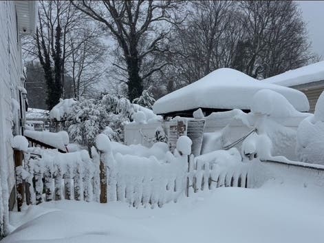
LONG ISLAND, NY — Tuesday dawned sunny and bright as Long Islanders continued the big dig-out after a blizzard slammed the area with up to 31 inches of snow and wind gusts of up to 84 miles an hour on Sunday into Monday.
Here are the current snow totals and wind gusts recorded for Long Island, according to the National Weather Service on X.
SNOW TOTALS
Find out what's happening in East Hamptonfor free with the latest updates from Patch.
Nassau County
North Merrick: 25.4 inches
Find out what's happening in East Hamptonfor free with the latest updates from Patch.
East Massapequa: 24.5 inches
Bethpage: 24.4 inches
Lynbrook: 24 inches
Plainview: 23.8 inches
East Meadow: 23.7 inches
South Massapequa: 22.4 inches
Wantagh: 22 inches
Elmont: 21.5 inches
Bellmore: 21 inches
Glen Cove: 19 inches
Levittown: 19 inches
Malverne: 18.5 inches
Westbury: 18 inches
East Williston: 16.9 inches
Syosset: 16.3 inches
Sea Cliff: 15.8 inches
Jericho: 15.2 inches
Suffolk County
Central Islip: 31 inches
East Islip: 30 inches
North Patchogue: 30 inches
Babylon: 29.5 inches
Islip: 29.1 inches
Holbrook: 29 inches
Nesconset: 28.8 inches
Shirley Airport: 28.5 inches
Bay Shore: 28.2 inches
Montauk: 28.1 inches
Medford: 27.8 inches
East Farmingdale: 27.5 inches
Remsenburg-Speonk: 27.5 inches
Fort Salonga: 27.2 inches
Orient Point: 26.5 inches
Quogue: 26 inches
Southampton: 26 inches
Islip: 25.3 inches
Lindenhurst: 25 inches
Shinnecock Hills: 25 inches
Bay Shore: 24.7 inches
Lindenhurst: 24.3 inches
Davis Park: 24.2 inches
Ridge: 24 inches
Islandia: 23.5 inches
Mattituck: 23.3 inches
Flanders: 23.0 inches
Hauppauge: 23 inches
Islip Terrace: 23 inches
Lake Ronkonkoma: 23 inches
Middle Island: 23 inches
Selden: 1.6 inches
West Islip: 22.8 inches
Manorville: 22 inches
Shelter Island: 21.1 inches
East Northport: 21 inches
Oakdale: 20.5 inches
Riverhead: 20.2 inches
East Patchogue: 20.0 inches
Nesconset: 20.0 inches
Upton (NWS Office): 19.8 inches
Stony Brook: 19.7 inches
Bellport: 18 inches
WIND GUSTS
Nassau County
Bayville: 59 MPH
Uniondale: 49 MPH
Wantagh: 49 MPH
Bellmore: 48 MPH
John W. Dodd Middle School: 45 MPH
Long Beach: 43 MPH
Massapequa Park: 42 MPH
Manhasset: 41 MPH
Valley Stream: 40 MPH
Suffolk County
Montauk Point: 84 MPH
Stony Brook: 74 MPH
Southold: 69 MPH
Baiting Hollow: 68 MPH
Eatons Neck: 67 MPH
Great Gull Island: 64 MPH
Napeague: 62 MPH
Blue Point: 60 MPH
Westhampton Airport: 56 MPH
Shoreham: 55 MPH
Islip Airport: 54 MPH
Montauk Airpor:t 54 MPH
Farmingdale Airport: 53 MPH
Sinai Harbor: 53 MPH
Fire Island: 52 MPH
Shirley Airport: 52 MPH
Mecox Bay: 51 MPH
Brookhaven: 49 MPH
Fair Harbor: 49 MPH
Great South Bay: 49 MPH
Remsenburg: 48 MPH
West Gilgo Beach: 48 MPH
Fishers Island Airport: 45 MPH
Islip: 44 MPH
Mattituck: 44 MPH
Babylon: 42 MPH
Sayville: 42 MPH
Orient: 41 MPH
Shirley: 40 MPH
According to the National Weather Service on X, totals recorded in the Central Islip area broke an unofficial record for largest snowstorm to hit Islip's MacArthur Airport since 1963. The previous highest total for that area in recent years was 27.8 inches in 2013, the NWS said.
Get more local news delivered straight to your inbox. Sign up for free Patch newsletters and alerts.