Community Corner
Latest Wind Damage Reports, Snow and Sleet in Monday Forecast
A Long Island house fire was sparked when a tree snapped and brought down power lines / most power outages now restored / freeze warnings.

Most power outages have been restored across Long Island after strong winds lashed the region earlier Sunday, but if you think we deserve a nice start to the work week after a crummy weekend, Mother Nature has other ideas.
The National Weather Service has issued freeze warnings for the island and snow and sleet could potentially create a slippery ride to work on Monday.
The story on Sunday, though, was the wind. Wind gusts of 63 mph were reported in Eatons Neck, 55 mph at Republic Airport in Farmingdale, 54 mph at Captree State Park and 53 mph in East Hampton.
At one point Sunday, more than 14,000 PSEG Long Island customers were without power. As of 7:25 p.m., that figure is down to 3,211. See the full outage map here.
"We will continue to work through the night until all customers are back on," PSEG wrote on its Facebook page.
Here's some of the damage the wind caused on Long Island, according to NWS reports:
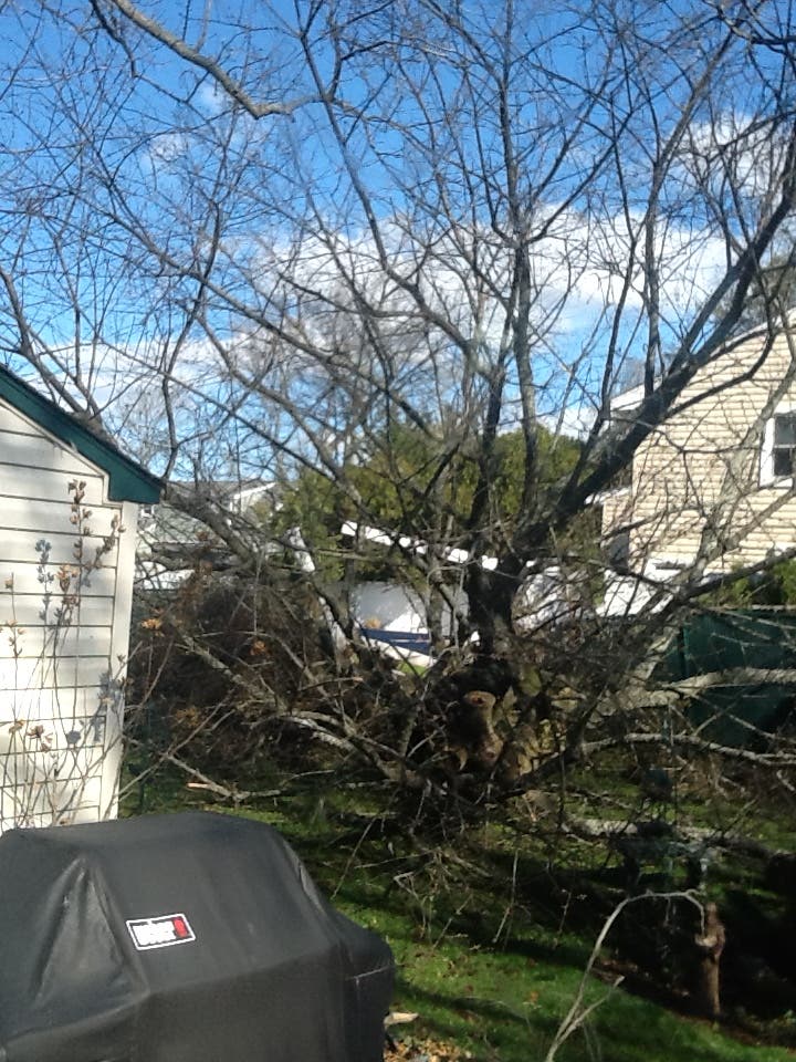
- A tree snapped and brought down power lines that sparked a house fire in Levittown
- A downed tree blocked Evergreen Avenue in East Moriches
- A tree fell onto a car in Farmingdale
- A tree and power lines came down on Udall and Jean roads in West Islip
- A tree took down wires and then landed on cars on Patricia Avenue in Islip
Power lines on fire in #Bellmore #LongIsland after fierce wind gusts pic.twitter.com/mDXXOa21OQ
— ilana gold (@ilanagoldTV) April 3, 2016
Winds causing damage and power outages around the region. This is Franklin Square, Long IslandPhoto: Chris Banwell
Posted by Tri-State Weather on Sunday, April 3, 2016
A freeze warning will be in effect on Long Island from 8 p.m. Sunday until 10 a.m. Monday and then again from 8 p.m. Monday until 10 a.m. Tuesday. Temperatures are expected to fall below freezing on Sunday, Monday and Tuesday nights.
"Freezing and below temperatures will kill sensitive plants if not protected or brought indoors," the National Weather Service says.
Precipitation on Monday will be mostly in the form of rain, but snow and sleet may mix with rain early in the morning.
Here's the full forecast:
Sunday Night- A slight chance of rain, snow, and sleet after 2am. Increasing clouds, with a low around 31. Wind chill values between 25 and 30. Blustery, with a northwest wind 15 to 20 mph becoming southeast 7 to 12 mph in the evening. Winds could gust as high as 31 mph. Chance of precipitation is 20%.
Monday- A chance of rain, snow, and sleet before 8am, then rain. High near 51. Wind chill values between 30 and 40 early. South wind 9 to 16 mph becoming west in the afternoon. Chance of precipitation is 80%. Little or no snow and sleet accumulation expected.
Monday Night- Rain likely, mainly before 8pm. Cloudy, then gradually becoming partly cloudy, with a low around 26. Wind chill values between 15 and 25. North wind around 16 mph. Chance of precipitation is 60%. New precipitation amounts between a tenth and quarter of an inch possible.
Tuesday- Sunny, with a high near 38. Wind chill values between 15 and 25. North wind 15 to 18 mph.Tuesday NightMostly clear, with a low around 23. North wind 8 to 11 mph.
Wednesday- Increasing clouds, with a high near 46.
Wednesday Night- A chance of showers after midnight. Cloudy, with a low around 43. Chance of precipitation is 40%.
Photo courtesy of Lorraine Conlin/Wantagh
Get more local news delivered straight to your inbox. Sign up for free Patch newsletters and alerts.