Weather
Long Island Weather: Major Coastal Storm Threats Increasing, Near Hurricane-Force Winds Likely
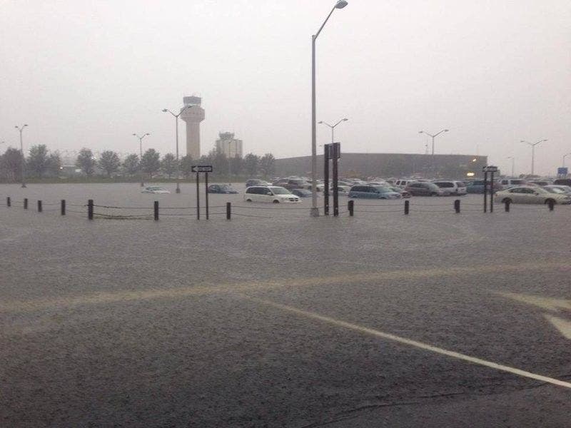
BREAKING: Flooding could cause numerous road closures and widespread power outages are expected.

During a time of the year Long Islanders expect snowstorms, it's going to feel more like hurricane season on the island Monday. An approaching "major coastal storm" is no joke and the National Weather Service has outlined some potentially severe impacts to the region.
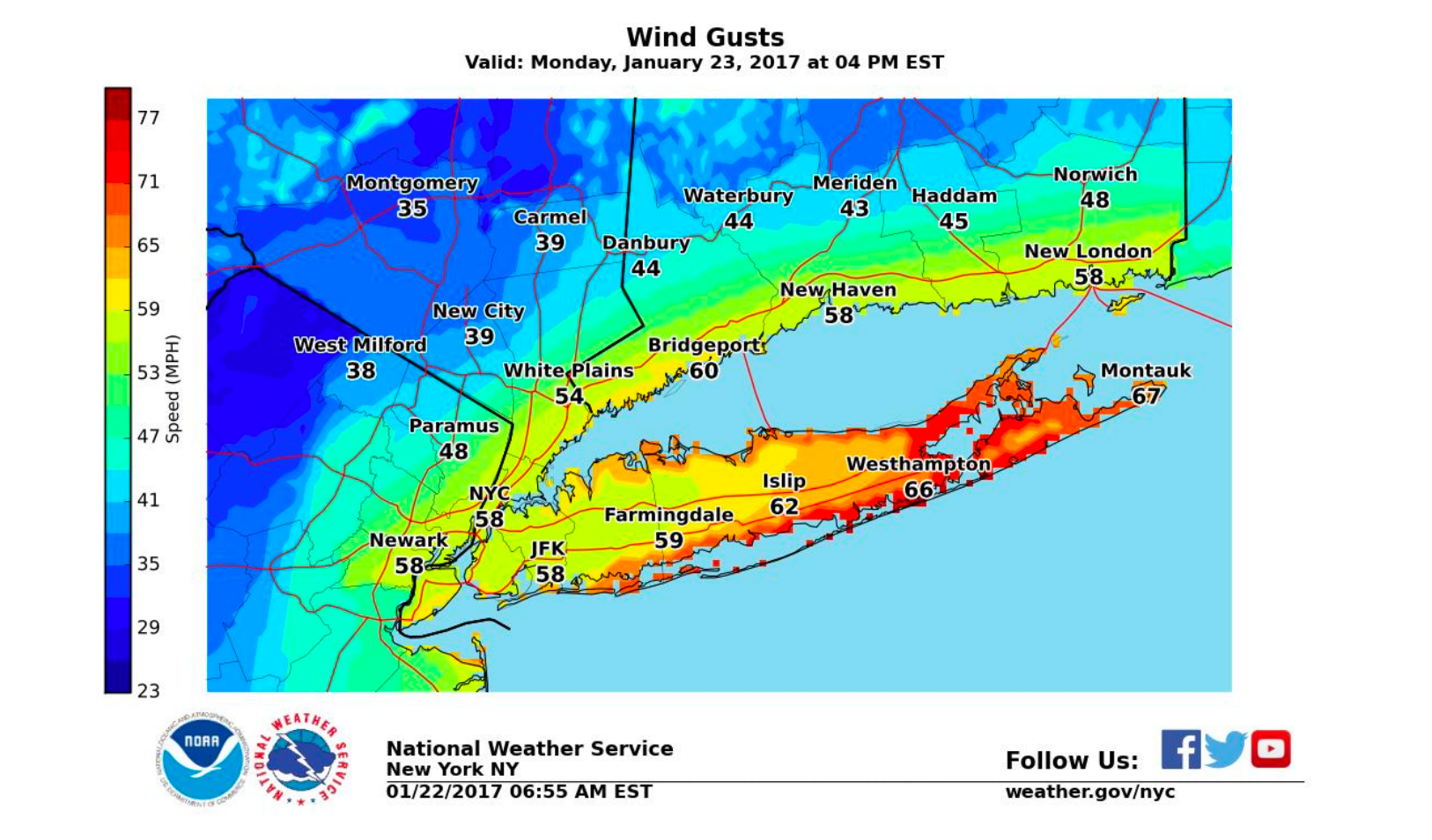
A high wind warning will be in effect for the island from 1 a.m. Monday until 1 a.m. Tuesday. Sustained winds of 30-40 mph are expected, with gusts up to 70 mph, just 4 mph under hurricane-force. The strongest winds are expected along the South Shore and the East End. Winds could begin gusting as high as 45 mph just before daybreak Monday and then increase in strength through the afternoon and evening.
Numerous power outages are expected as the wind knocks down trees and power lines, the National Weather Service says. Travel will also be difficult, especially for high profile vehicles and on elevated roadways and bridges.
Find out what's happening in Massapequafor free with the latest updates from Patch.
Flooding will also be a major concern. A coastal flood advisory will be in effect from 4-8 a.m. Monday when minor flooding will be possible for the South Shore and the North Fork. The real threat will come in the afternoon and evening. A coastal flood watch for the same regions will be in effect from 3-10 p.m. During that period, especially around high tide, moderate flooding is expected, with a "low probability for major flood thresholds to be reached in isolated spots," the NWS says.
Elevated water levels and high surf of 8-12 feet are expected to cause widespread dune erosion and
localized washovers along the Atlantic Ocean beachfront late Sunday night into Tuesday.
Find out what's happening in Massapequafor free with the latest updates from Patch.
There is the potential for widespread flooding of vulnerable shore roads and adjacent properties due to height of storm tide and wave action, the NWS says.
Numerous road closures may be needed and isolated structural damage is possible along the immediate shoreline.
A total of 2-3 inches of rain, with the potential for up to 4 inches, is expected to fall across the island from late Sunday night into Tuesday morning.

The storm that is headed our way.
The full forecast:
Sunday: A 30 percent chance of rain, mainly after 3pm. Areas of dense fog before 9am. Otherwise, cloudy, with a high near 51. Northeast wind 5 to 14 mph.
Sunday Night: A 40 percent chance of rain. Cloudy, with a low around 38. Wind chill values between 30 and 35. Windy, with a northeast wind 18 to 28 mph, with gusts as high as 45 mph.
Monday: Rain, mainly after 10am. The rain could be heavy at times. Steady temperature around 40. Wind chill values between 25 and 30. Windy, with an east wind 34 to 37 mph, with gusts as high as 65 mph. Chance of precipitation is 90%. New precipitation amounts between a half and three quarters of an inch possible.
Monday Night: Rain. Low around 40. Wind chill values between 30 and 35. Windy, with a northeast wind 32 to 37 mph decreasing to 20 to 25 mph after midnight. Winds could gust as high as 55 mph. Chance of precipitation is 90%. New precipitation amounts between 1 and 2 inches possible.
Tuesday: Rain, mainly before 10am. Steady temperature around 43. Northeast wind 14 to 16 mph becoming northwest in the afternoon. Winds could gust as high as 30 mph. Chance of precipitation is 80%. New precipitation amounts between a tenth and quarter of an inch possible.
Tuesday Night: Cloudy, then gradually becoming partly cloudy, with a steady temperature around 41.
Wednesday: Mostly sunny, with a high near 48.
Read the National Weather Service's latest storm briefing here.
Get more local news delivered straight to your inbox. Sign up for free Patch newsletters and alerts.