Community Corner
Strong Winds, Snow to Follow Arctic Blast
The worst of the cold weather is behind us.

A wind chill advisory for the island has expired and the high will be back in the mid-30s on Friday, but the more seasonal temperatures will be accompanied by gusty winds and snow showers, according to the latest National Weather Service forecast.
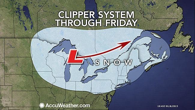
Snow showers are likely, mainly before noon, on Friday with snow accumulation of less than an inch possible across the island. Wind gusts could top 35 mph on Friday, the NWS says.
Things are set to warm up just a bit after wind chill temperatures plunged well below zero Wednesday night into Thursday across a large swath of the country.
Find out what's happening in Medfordfor free with the latest updates from Patch.
“It is possible the weather this week ends up being the coldest of the winter for most areas from the Midwest to the East,” said Paul Pastelok, an AccuWeather.com long-range forecaster.
The NWS full forecast:
Find out what's happening in Medfordfor free with the latest updates from Patch.
- Tonight- Mostly cloudy, with a temperature rising to around 25 by 5am. Wind chill values between 5 and 10. Southwest wind 9 to 18 mph, with gusts as high as 29 mph.
- Friday- Snow showers likely, mainly before noon. Cloudy, then gradually becoming mostly sunny, with a high near 34. Wind chill values between 10 and 20. Breezy, with a southwest wind 20 to 25 mph, with gusts as high as 36 mph. Chance of precipitation is 60%. New snow accumulation of less than one inch possible.
- Friday Night- Mostly clear, with a low around 15. Wind chill values between 5 and 10. West wind 13 to 16 mph.
- Saturday- Sunny, with a high near 23. Wind chill values between zero and 10. West wind 13 to 17 mph.
- Saturday Night- Mostly clear, with a low around 16. West wind around 8 mph.
Photo: AccuWeather.com
Sign up for your local daily Patch newsletter and breaking news alerts here
More on Patch:
- Police: Southampton Woman on Drugs Crashes Into 2 Cars, a House, Tries to Flee
- Kardashian Friend Opening Burger Place in Lynbrook
- No Injuries in Huntington Station Strip Mall Blaze
- Friendly’s Franchisee Files for Bankruptcy
- Police: Port Jefferson Station Man Killed in Crash Into Tree on Northern State
- Tips For Keeping Pets Safe This Winter
- Police: Sayville Man Hit by Car Seriously Injured
Get more local news delivered straight to your inbox. Sign up for free Patch newsletters and alerts.