Politics & Government
How Walkable, Transit and Bicycle Friendly is Mount Vernon?
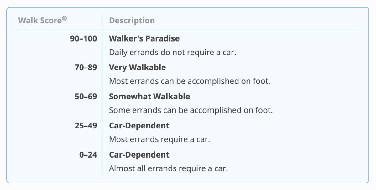
Walkscore.com assessed 3 major attributes people look for when relocating. Heres how Mount Vernon was scored.
(Thursday, March 14, 2019) The City of Mount Vernon is the 2nd most dense city in the state of New York. Due to the compact, dense and walkable nature, all of its approximately 70,000 residents in its 4.4 square mile are within a 10-minute walk of a park or open space.
Roughly every city in the Unites States has a walk, bike and transit score that is determined by a variety of factors within the community being observed.
Here is how Walkscore.com scored Mount Vernon’s walk, transit and bike scores.
Find out what's happening in Mount Vernonfor free with the latest updates from Patch.
According to www.Walkscore.com, the Southside of Mount Vernon walk score is 80 and the Northside is 73. That gives Mount Vernon an overall walk score of 76. A city’s walk score is determined by measuring the walkability of any address using a patented system.
Transit Score is a patented measure of how well a location is served by public transit. Transit Score is based on data released in a standard format by public transit agencies.
Find out what's happening in Mount Vernonfor free with the latest updates from Patch.
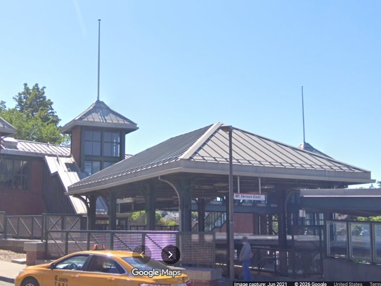
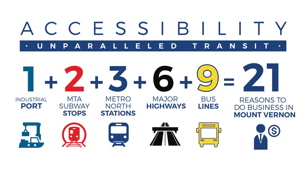
Mount Vernon’s location is unmatched, and our transit system is at the very top of the State of New York. We have instant access to two of New York City’s subway lines and three of Metro-North’s commuter lines – moving more than half of MNR’s ridership through our gateway city. Mount Vernon is adjacent to six (6) major highways and is less than 60 minutes from six (6) different airports, including two (2) that are within a 20-minute drive and four (4) that fly internationally. We have the only active industrial port in the region, servicing 700,000 metric tons of raw materials and millions of gallons of fuel product to heat homes, business, and keep trucks rolling. We provide the real resources for the region to thrive and look forward to Amazon building on our industrial infrastructure, which is uniquely situated between urban and suburban life, with access to the Northeast Corridor, and every corner of the earth.
Walkscore.com scores Mount Vernon’s Southside transit score at a 58 and the Northside at 54. That gives Mount Vernon an overall Transit Score of 56.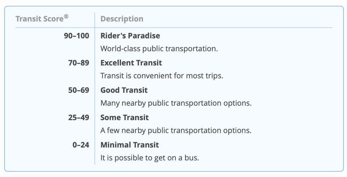
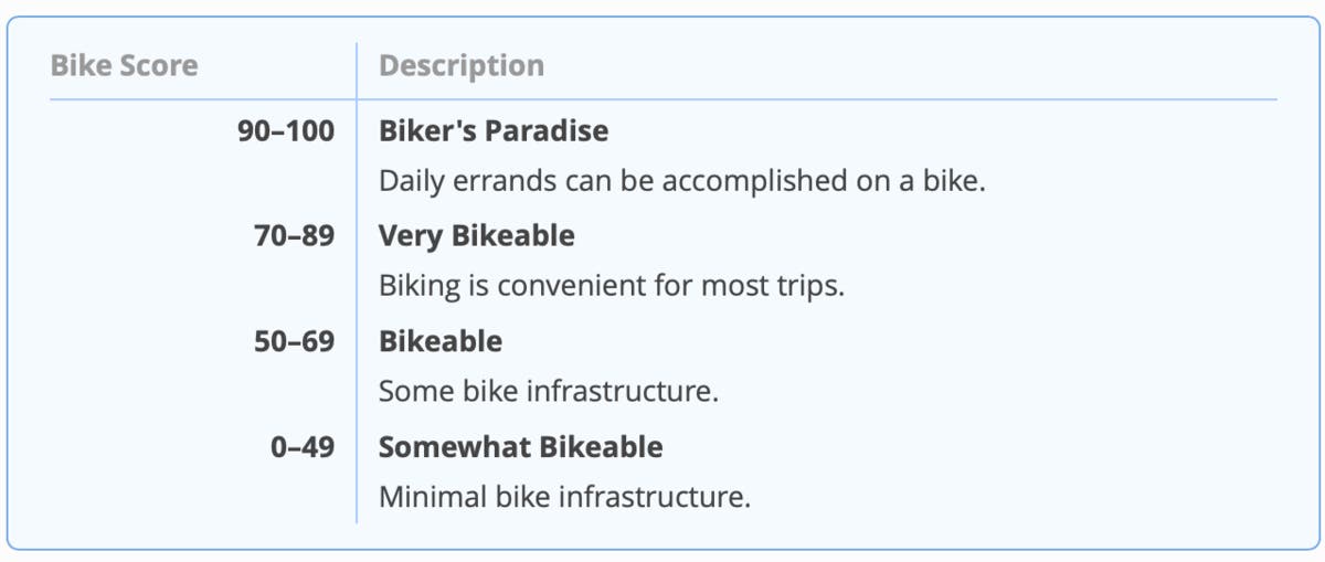
Bike Score measures whether an area is good for biking. For a given location, a Bike Score is calculated by measuring bike infrastructure (lanes, trails, etc.), hills, destinations and road connectivity, and the number of bike commuters.
Walkscore.com scores Mount Vernon’s Southside bike score at a 46 and the Northside at a 43. That gives Mount Vernon an overall Bike score of 45.
Under the leadership of Mayor Thomas, a series of citywide public meetings were held which identified action items that should be implemented through the comprehensive plan.

One of those items was to develop a trail way plan to provide connections to trail networks outside the City borders; identify trail/bikeway trail way networks North/South and East/West within the City.
Mount Vernon has all the potential to become a bicycle friendly city and took steps to illuminate the need for an investment in bicycle infrastructure.