Home & Garden
How Snow Could Slow the Evening Commute
The timing could be more important than the amount around Nanuet.

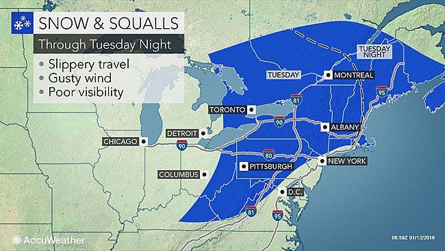
Snow is on the Tuesday menu for Rockland County, according to the National Weather Service.
Some is possible this morning, likely this afternoon, possible overnight and we could see some flurries on Wednesday.
Want hour to hour info: Click here for Nanuet’s in-depth weather forecast.
Find out what's happening in Nanuetfor free with the latest updates from Patch.
“Temperatures should be near or above freezing at the onset of the snow… but temps should fall once the flakes begin to fly,” says Bill Potter of Hudson Valley Weather. “ The snow should start out rather light, but could become a rather steady to heavy burst of snow right around the evening commute… as the storm begins to strengthen. The timing on this could be especially problematic for travel… with reduced visibilities due to falling snow, and snow/ice covered roads in areas of steadier snow. Something to keep in mind for your Tuesday PM.”
Still, it won’t amount to much. Accumulation in Rockland County could be up to 1 inch, according to the National Weather Service.
Find out what's happening in Nanuetfor free with the latest updates from Patch.
The snow will be lighter the further south you are. AccuWeather says conditions along I-95 in the mid-Atlantic are likely to range from dry to perhaps briefly slippery.
“Most areas from New York City to Philadelphia and Washington, D.C., are unlikely to receive more than a light coating of snow and may only have non-accumulating flurries,” according to AccuWeather Senior Meteorologist Alex Sosnowski.
“However, as with any snow shower, there is the risk that some roads could turn slippery in a hurry and catch motorists off guard from late Tuesday afternoon into Tuesday evening.”
Get more local news delivered straight to your inbox. Sign up for free Patch newsletters and alerts.
