Weather
Hudson Valley Forecast: Flood Watch Added To Heat, Bad Air Alerts
The good news is what happens next.

HUDSON VALLEY, NY — A flood watch goes into effect at 2 p.m. for Rockland and Westchester counties.
It overlaps the heat advisory and air quality alert, which are in effect until 8 p.m. Friday for those two counties plus Putnam and Orange.
Through late Saturday night, a moist environment could result in heavy rain producing thunderstorms. With recent heavy rainfall, it will not take much additional rain to result in flash flooding, the National Weather Service said. SEE: 'Counting Blessings': Mamaroneck Neighborhood's Tense Night
Find out what's happening in New Cityfor free with the latest updates from Patch.
The greatest risk looks to be Friday afternoon through Saturday afternoon.
Rainfall rates of 1 to 2 inches per hour could result in flash flooding, especially in low-lying and poor drainage areas such as highway underpasses.
Find out what's happening in New Cityfor free with the latest updates from Patch.
Speaking of flooding, Saturday is the 10th anniversary of Tropical Storm Irene, which hit the Hudson Valley hard.
The good news is what happens after the rain rolls through — two days of cooler temps before we return to August 80s:
- Saturday - Mostly cloudy with a chance of showers and thunderstorms. Highs in the mid 70s. East winds 5 to 10 mph. Chance of rain 40 percent.
- Saturday Night - Mostly cloudy. Lows in the mid 60s. East winds 5 to 10 mph.
- Sunday - Mostly cloudy in the morning, then becoming partly sunny. Highs in the upper 70s. Southeast winds around 5 mph.
- Sunday Night - Mostly cloudy. Lows in the upper 60s.
- Monday - Partly sunny. Showers likely with a chance of thunderstorms in the afternoon. Highs in the mid 80s. Chance of rain 60 percent.
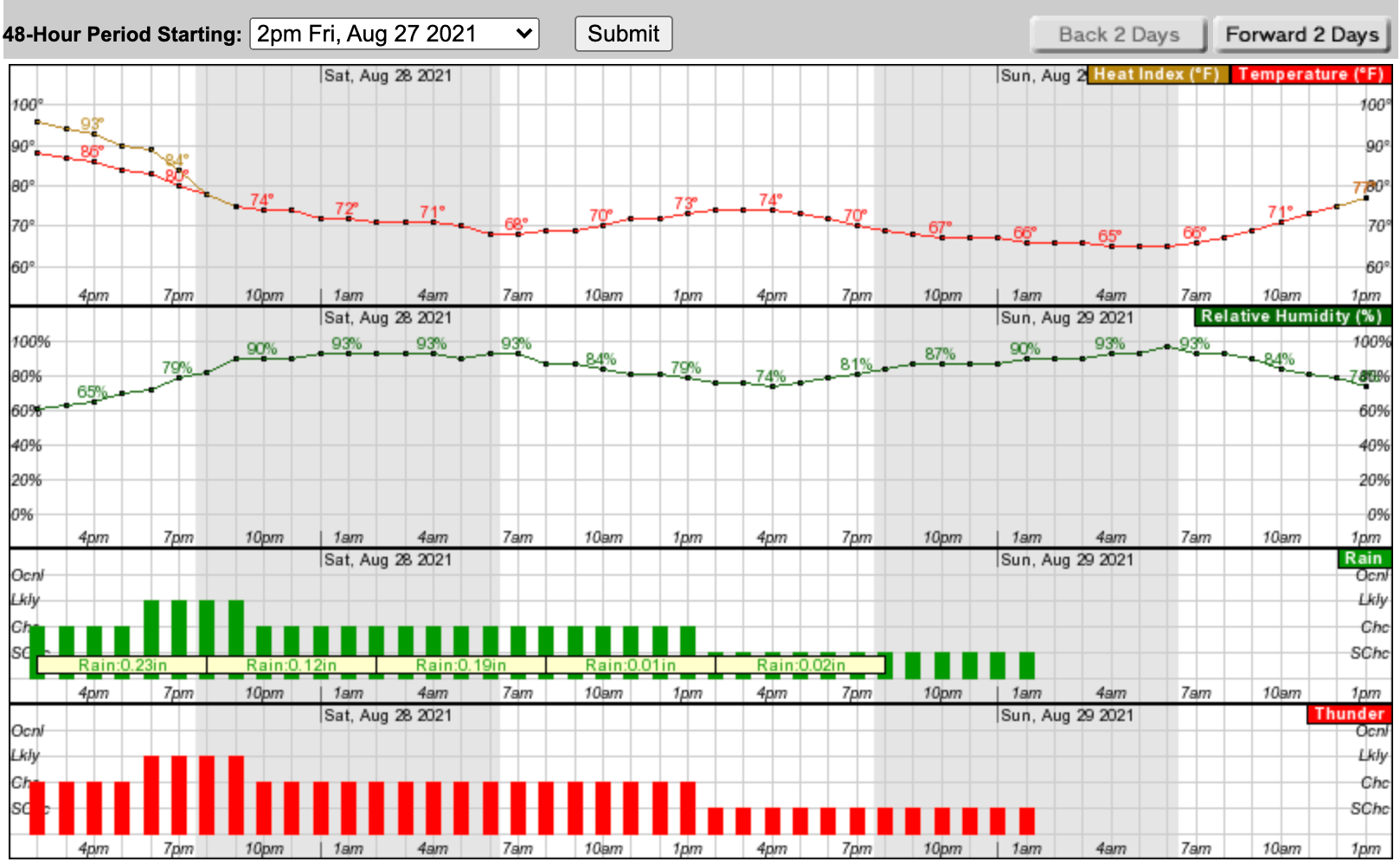
Here's a look at the next 48 hours based on New City:
Get more local news delivered straight to your inbox. Sign up for free Patch newsletters and alerts.


