Weather
Snow Estimates Rise, Hazardous Outlook Issued For Hudson Valley
The further south, the more likely it'll be more than just a coating on Super Bowl Sunday.


HUDSON VALLEY, NY — As temperatures plummet, the National Weather has issued a hazardous outlook for the southern end of the region.
For Orange, Putnam, Rockland and Westchester counties: 1 to 2 inches of snow is expected on Sunday. This may result in some icy spots on area roadways, specially in the morning.
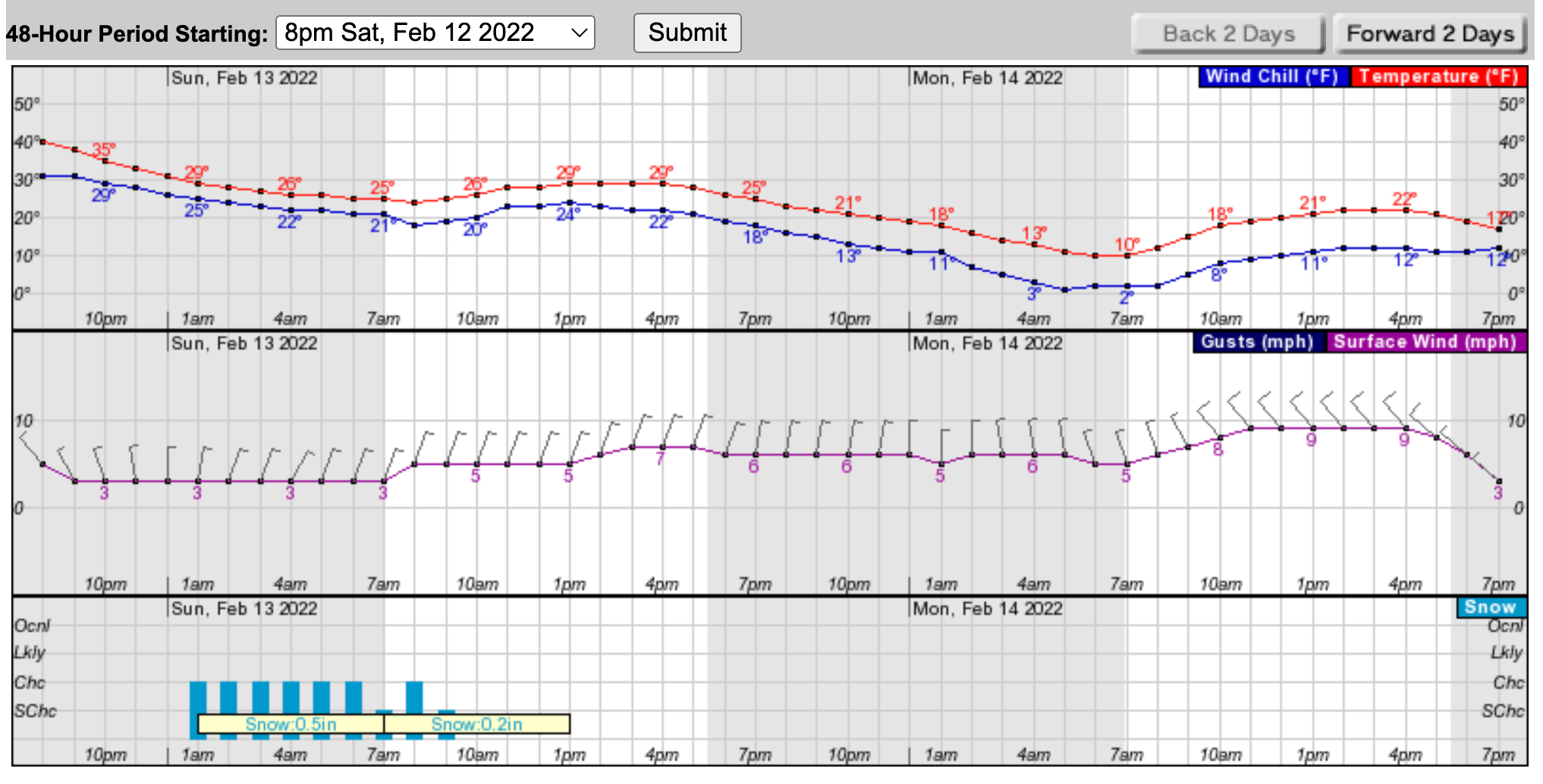
In Ulster and Dutchess, snow is possible, but the main thing is the Arctic blast. Winds shifted to the north-northwest and temperatures plunged Saturday afternoon. Over the next 48 hours, it's just going to keep getting colder.
Find out what's happening in New Cityfor free with the latest updates from Patch.
"Snowfall looks to struggle to extend into northern and northwestern parts of the region," Hudson Valley Weather said on Facebook. "From about Saugerties and points SE a coating to 2” is possible with the highest probability of exceeding an inch being just south of the i84 corridor."
Here's the hourly forecast based on Ulster County:
Find out what's happening in New Cityfor free with the latest updates from Patch.
SEE ALSO: NYSP To Crack Down On Impaired Driving During Super Bowl Weekend
Get more local news delivered straight to your inbox. Sign up for free Patch newsletters and alerts.