Weather
Flash Flood Warning, Thunderstorms, Tornadoes Possible In Region
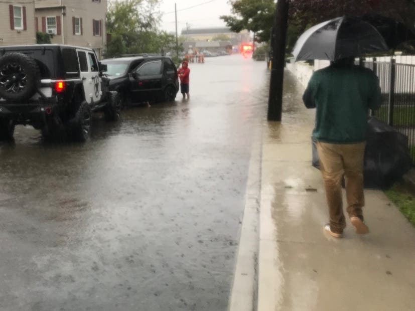
Flash flooding is possible through the Hudson Valley and a heat advisory also remains in effect for much of Southern Westchester County.

HUDSON VALLEY, NY — The National Weather Service has issued warnings and advisories about potentially dangerous weather conditions expected in the region.
The NWS is predicting a number of weather hazards on July 17.
A Flash Flood Watch is in effect from 2 p.m. Saturday afternoon until 6 a.m. Sunday for Orange, Putnam, Rockland and Westchester counties. Showers and thunderstorms will occur across areas already sodden by the recent heavy rains. This will lead to an increased potential for flash flooding, according to forecasters.
Find out what's happening in New Rochellefor free with the latest updates from Patch.
Continued potentially dangerous heat and humidity remain a concern on Saturday. A heat advisory remains in effect for Southern Westchester County until 8 p.m. Max heat index values in the upper 90s are expected.
Isolated to scattered severe thunderstorms are also expected Saturday afternoon and evening. The NOAA NWS Storm Prediction Center says areas along and west of the Hudson River corridor are at a slight risk of dangerous storms. The main threat is damaging winds, but an isolated tornado cannot be ruled out, according to the National Weather Service Hazardous Weather Outlook issued for Southern Westchester from 2 p.m. until late tonight.
Find out what's happening in New Rochellefor free with the latest updates from Patch.

A heat advisory remains in effect for Westchester County (National Weather Service)
Get more local news delivered straight to your inbox. Sign up for free Patch newsletters and alerts.