So the Hudson Valley could see a little snow Tuesday morning as winter refuses to go away despite what the calendar says. No accumulation is expected, but highest chance of snow will come during the morning commute.
The map below shows the odds of more than an inch of snow on various parts of the region. 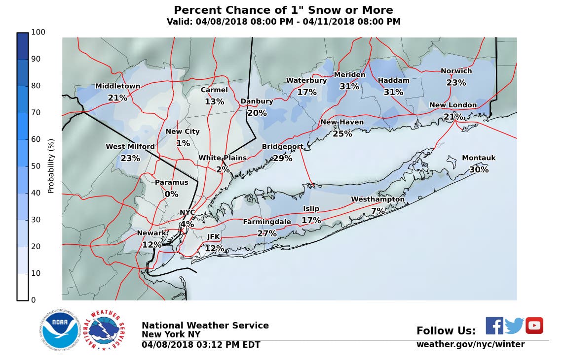
Well, as you can see from the maps, there's not that much of a chance for snow, but there it is.
Find out what's happening in New Rochellefor free with the latest updates from Patch.
By the end of the work week, we may finally get some spring-like weather as temperatures get to around 60 degrees.
Here's the full forecast from the National Weather Service for the lower Hudson Valley:
Find out what's happening in New Rochellefor free with the latest updates from Patch.
- Monday: Increasing clouds, with a high near 46. Wind chill values between 20 and 30 early. Northwest wind around 6 mph becoming southwest in the afternoon.
- Monday Night: A 20 percent chance of light snow after midnight. Cloudy, with a low around 33. South wind 5 to 8 mph becoming calm after midnight.
- Tuesday: A chance of rain and snow before 10am, then a chance of rain. Mostly cloudy, with a high near 47. South wind 5 to 7 mph. Chance of precipitation is 40%.
- Tuesday Night: Partly cloudy, with a low around 34. Northeast wind around 7 mph becoming north after midnight.
- Wednesday: Mostly sunny, with a high near 53.
- Wednesday Night: Partly cloudy, with a low around 36.
- Thursday: A 30 percent chance of showers. Mostly cloudy, with a high near 56.
- Thursday Night: A 30 percent chance of showers before 9pm. Mostly cloudy, with a low around 43.
- Friday: Mostly sunny, with a high near 62.
- Friday Night: Partly cloudy, with a low around 43.
Get more local news delivered straight to your inbox. Sign up for free Patch newsletters and alerts.