Weather
LI Snowstorms Possible Into Spring, New Forecast Says
Contrary to a famous groundhog's recent prediction, winter weather will continue on Long Island forecasters say.

NEW YORK — Despite Punxsutawney Phil’s latest prediction of an early spring, AccuWeather meteorologists predict fierce winter weather through March in its spring 2024 forecast.
Snow lovers will be happy to know the chance for snowstorms in the northeast will remain through the first half of March, with a springtime warmup to follow in late March and April, AccuWeather meteorologists said.
That means winter weather could last into meteorological spring in New York, which is recognized as March 1 based on annual temperature cycles.
Find out what's happening in North Forkfor free with the latest updates from Patch.
March could "come in like a lion in the East," AccuWeather Veteran Meteorologist and Long-Range Forecaster Paul Pastelok said, adding “we may have a pretty stormy pattern from late February to the start of March.”
This tracks with the National Weather Service’s predictions for colder temperatures and possible snowfall in February after above-average temperatures.
Find out what's happening in North Forkfor free with the latest updates from Patch.
Just six days into February, the mercury has already risen to an average of 40s during the day and 30s at night.
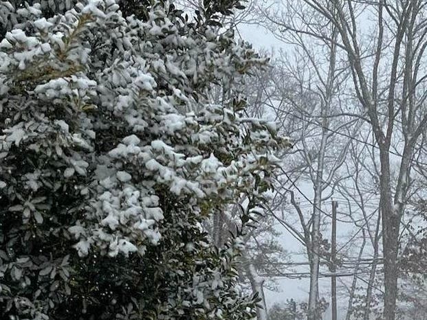
Historically, February gets the most snow out of any month in the year in New York, with monthly snowfall totals averaging about 10.1 inches of snowfall in Central Park, according to the National Weather Service. That’s compared to 8.8 inches in January and 5.0 inches in March, the NWS said.
Although snow is possible, accumulation may not be an issue, the NWS said. "We're not seeing anything significant in the next few days through mid-February," a representative at the National Weather Service Office in Upton said.
According to the NWS's climate and precipitation prediction maps, the third and fourth week of February through March 4 could bring temperatures at, or slightly below normal, with precipitation right at, or below, normal — and an overall cooler and drier outlook.
However, the NWS said, if you look at a three-month forecast, for February, March and April, temperatures slightly above normal are expected, with slightly above normal precipitation.
"That does not mean we can't get a significant snowstorm — these averages are over a long period — so we're going to have to keep an eye on things," the NWS said.
A period of colder weather is approaching, with a big snowstorm still possible, the NWS said.
While this year has seen far below the average snow totals so far, the ongoing El Nino climate pattern associated with coastal storms, temperature swings and snowier late winters in New Yorkmay shake things up later this season.
Read more: Strong El Niño Signals Snowy Winter Ahead In NY: See Forecast
"The window for snow-producing nor'easters will open in late January through February which could dish out hefty snowfall amounts to Boston, New York City, Philadelphia and beyond," AccuWeather predicted in its 2023-24 winter outlook, noting "a strengthening El Niño will make this winter different than last year."
Get more local news delivered straight to your inbox. Sign up for free Patch newsletters and alerts.