Weather
Hudson Valley Hazardous Outlook: Heavy Rain, High Wind
An "energetic" storm pushing through the region could lead to minor flooding, severe thunderstorms or even a brief tornado, the NWS said.

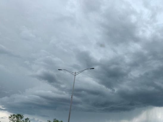
HUDSON VALLEY, NY — The National Weather Service issued hazardous outlooks for the region Friday morning.
For Dutchess and Ulster counties, the NWS warned of heavy rain into the afternoon with ponding of water on roadways expected and some flooding of lying lowing and poor drainage areas possible. Wind gusts of 35 to 45 mph are possible across portions of the southern Green Mountains, Berkshires and Taconics which could bring down small branches and blow around unsecured objects.
In addition, there is a marginal risk for severe thunderstorms across the southeastern Catskills and mid-Hudson Valley. The main threat is isolated damaging wind gusts.
Find out what's happening in Nyack-Piermontfor free with the latest updates from Patch.
For Orange, Putnam, Rockland and Westchester counties, the NWS said the storm system could bring an inch to an inch and a half of rain between Friday morning and early to mid-afternoon
"Although widespread flooding is not expected, minor flooding of urban areas, small streams, and poor drainage areas is possible," the NWS said. "With most of the rain falling in a 3-6 hour window, the local area has been placed in a marginal risk of excessive rainfall."
Find out what's happening in Nyack-Piermontfor free with the latest updates from Patch.
The Storm Prediction Center has classified the entire area as at marginal risk for severe thunderstorms —with the primary threat being strong wind gusts up to 60 mph. In addition, a brief tornado can not be ruled out.
The front is bringing chilly weather. Here's the weekend forecast:
- Friday - Rain with a slight chance of thunderstorms late this morning, then rain this afternoon. Some thunderstorms may produce gusty winds and heavy rainfall late this morning. Highs in the mid 60s. South winds 15 to 20 mph, becoming west 10 to 15 mph this afternoon. Gusts up to 30 mph. Chance of rain near 100 percent.
- Friday night - Mostly clear. Lows in the upper 30s. West winds around 5 mph, becoming southeast after midnight.
- Saturday - Partly sunny with a slight chance of showers in the morning, then mostly cloudy with showers likely in the afternoon. Highs in the mid 50s. Southeast winds 5 to 10 mph, becoming southwest in the afternoon. Gusts up to 25 mph. Chance of rain 60 percent.
- Saturday Night - Mostly cloudy in the evening, then clearing. Lows in the mid 30s. West winds 5 to 10 mph with gusts up to 20 mph.
- Sunday - Sunny in the morning, then becoming partly sunny. Highs in the upper 40s. West winds 5 to 10 mph.
- Sunday Night - Mostly cloudy. Lows in the mid 30s.
- Monday - Partly sunny. A chance of rain showers. Highs in the upper 40s. Chance of rain 30 percent.
- Monday Night. - Partly cloudy with a chance of rain showers in the evening, then mostly clear after midnight. Lows in the lower 30s. Chance of rain 30 percent.
- Tuesday - Mostly sunny. Highs in the mid 40s.
- Tuesday Night - Mostly clear. Lows in the lower 30s.
Get more local news delivered straight to your inbox. Sign up for free Patch newsletters and alerts.