Weather
Massive Storm Bringing Wintry Mix, Flooding To Hudson Valley Weekend
Heavy rain and gusty winds along with some snow and sleet will lash the region for hours. Here's the latest.

HUDSON VALLEY, NY — A potent storm will lash the region Friday into Saturday mostly with rain and gusty winds, though some snow and freezing rain are possible.
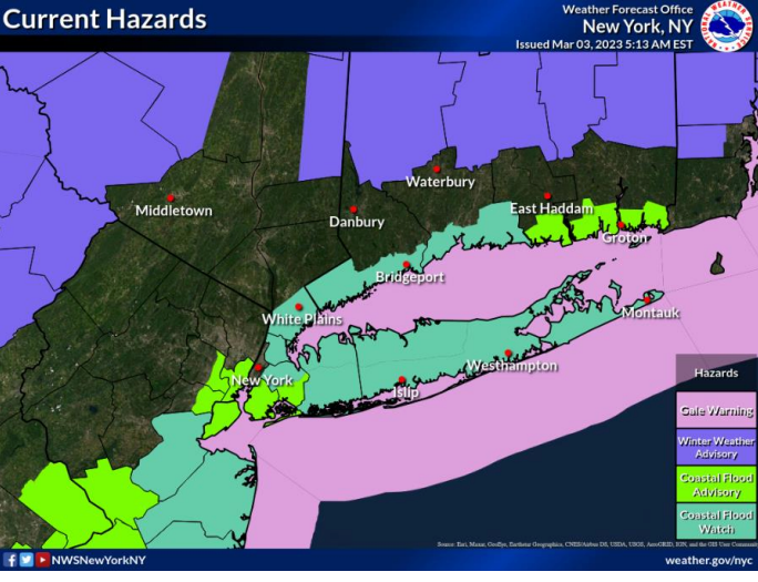
The National Weather Service has issued a hazardous outlook, gale warnings and a coastal flood watch for various parts of the Hudson Valley.
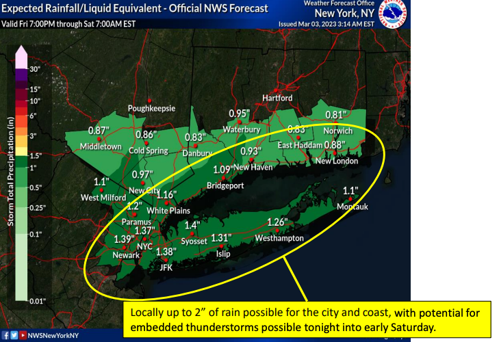
With 1 to 1.5 inches of total rainfall likely — 2 inches possible along the coast — the NWS predicts that flooding is likely in low-lying urban areas and along quick-responding small streams. This could be exacerbated across shoreline and tidally affected riverine communities during the time of high tide Saturday morning.
Find out what's happening in Ossining-Croton-On-Hudsonfor free with the latest updates from Patch.
The NWS also predicts the most vulnerable coastal communities in Westchester could see 1.5 to 2.5 feet of water above ground, as could the Bronx, Long Island, much of coastal Connecticut and northern Queens.
Easterly winds with gusts 35-45 mph will lash the coast until Saturday morning. A few gusts could reach 50 mph. Isolated downed tree branches and power lines are possible.
Find out what's happening in Ossining-Croton-On-Hudsonfor free with the latest updates from Patch.
Guess what we're missing?
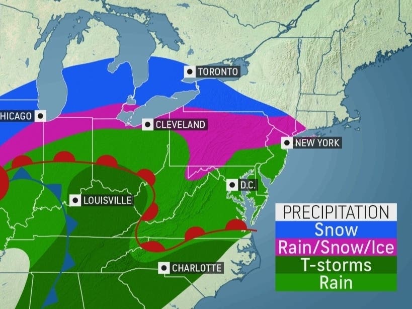
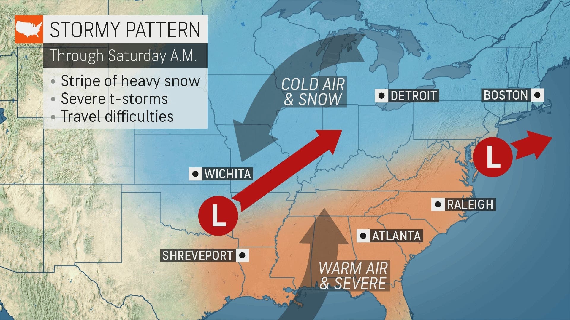
"Snowfall totals of 6-12 inches are expected along a 1,300-mile-long corridor of the United States," said Alex Sosnowski, AccuWeather senior meteorologist. "The heaviest snow will spread across central and northern New York state. Snowfall accumulations will range from a few inches to a foot or more from Friday afternoon to early Saturday."
Here, not so much.
In western Dutchess and eastern Ulster county, the National Weather Service has issued a hazardous outlook. Hudson Valley Weather predicts 2-6 inches of snow at the northern end of the valley, depending on a number of rapidly-changing conditions, and with more snow accumulating on the higher elevations.
For Orange and Putnam counties, snow accumulations forecast are generally 1 to 2 inches, though western Orange could see up to 3 inches in some places. The freezing rain would result in a light ice accumulation in Orange County, northwest of I-84.
"Some of the southernmost parts of Westchester and Rockland may only see a few minutes of sleet or immediately start as rain, while the northern parts of those counties may see a trace," said Alex Marra of Hudson Valley Weather.
The storm will not move fast, probably exiting the area late Saturday.
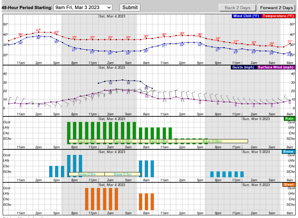
Here's a look at the next 48 hours from the National Weather Service, based on Brewster.
This is part of a mix of storms bringing snow to the north and severe thunderstorms to the southern United States.
Get more local news delivered straight to your inbox. Sign up for free Patch newsletters and alerts.


