Weather
Hudson Valley: Latest Snow, Sleet Timing, Estimates For Storm
A treacherous travel day and night, meteorologists warn.

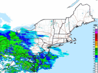
HUDSON VALLEY, NY — Meteorologists are predicting a little more snow and a little later start to the Tuesday-Wednesday storm. It already dropped 3-6 inches across parts of Maryland and Pennsylvania before changing to sleet and rain.
Snow is expected to start from west to east before noon. Schools across the Hudson Valley are closed.
"But the extra inch or so of potential snow is not the real story here," said Alex Marra and Bill Potter of Hudson Valley Weather in their final forecast. "The reality is, that a moderate snowfall will be followed by an extended period of sleet that will end as a mix of sleet and freezing rain... A very treacherous travel day on Tuesday from late morning through the night. Please use extra caution."
Find out what's happening in Ossining-Croton-On-Hudsonfor free with the latest updates from Patch.
Motorists are reminded to check 511NY before traveling.
The winter storm advisory for Rockland and Westchester is in effect and extends until 6 a.m. Wednesday.
Find out what's happening in Ossining-Croton-On-Hudsonfor free with the latest updates from Patch.
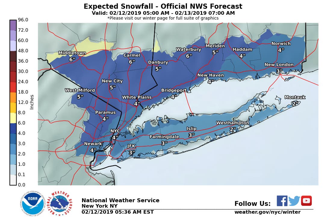
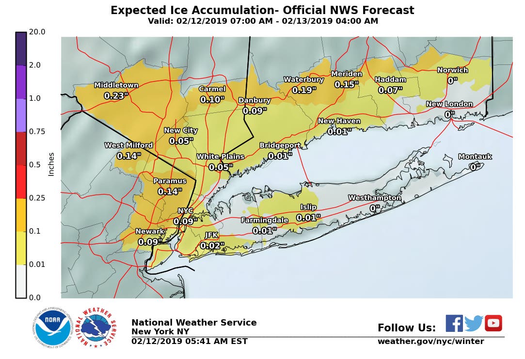
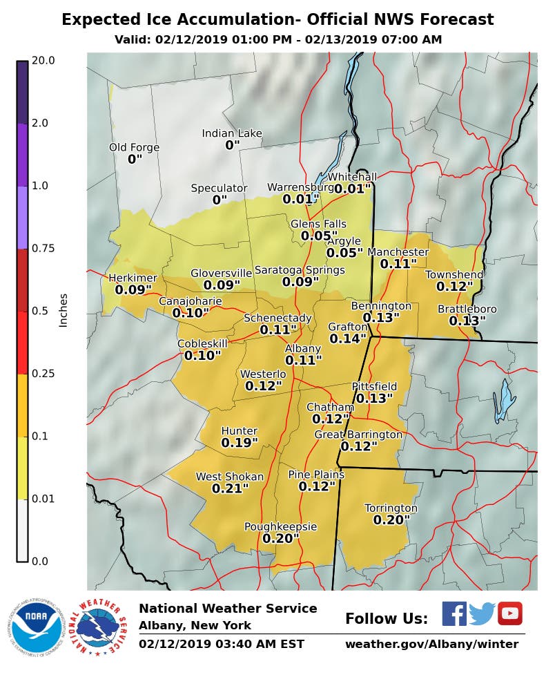
Mixed precipitation expected. Total snow and sleet accumulations of 3 to 5 inches and ice accumulations of one to two tenths of an inch expected. Highest snow, sleet and ice accumulations across interior.
For Orange and Putnam counties:
Heavy mixed precipitation expected. Total snow and sleet accumulations of 5 to 6 inches and ice accumulations of two tenths to three tenths of an inch expected.
For all four counties in the south end of the Hudson Valley:
Plan on slippery road conditions. The hazardous conditions could impact the morning and evening commute.
The winter storm warning for Ulster County starts at 10 a.m. and extends until noon Wednesday. For Dutchess County, the storm warning ends at 6 a.m. Wednesday:
WHAT...Heavy mixed precipitation expected. Total snow and sleet accumulations of 5 to 7 inches across Dutchess County expected. Ice accumulations of a tenth to quarter of an inch are expected.
For Ulster, heavy mixed precipitation expected. Total snow and sleet accumulations of 5 to 11 inches and ice accumulations of a tenth to quarter of an inch expected
ADDITIONAL DETAILS...Travel will be very difficult to dangerous for the evening commute today. Snow will be heavy at times in the afternoon, mixing with and changing to sleet late in the day, with a changeover to freezing rain at night. Snowfall rates around an inch per hour are possible this afternoon.
Get more local news delivered straight to your inbox. Sign up for free Patch newsletters and alerts.


