Home & Garden
WEATHER UPDATE: Flash Flood Watch, Hazardous Weather Outlook Issued
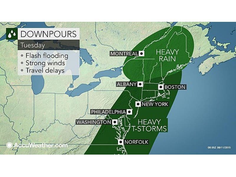
We'll let you know when the stormy weather is likely to end in Pelham, and how much rain you can expect Tuesday.

Written by BRIAN MCCREADY (Patch Staff)
It’s already a wet one out there, and it’s only going to get worse as the day continues on Tuesday.
In fact, rain is forecast up until midnight and before it ends we could see 1-2 inches of rain in Westchester County.
Find out what's happening in Pelhamfor free with the latest updates from Patch.
Besides the rain there could be flooding and severe thunderstorms to contend with.
The National Weather Service has issued a “Flash Flood Watch” until 4 p.m. Tuesday, along with a “Hazardous Weather Outlook.” Storms could continue on and off to about 1 a.m. on Wednesday.
Find out what's happening in Pelhamfor free with the latest updates from Patch.
RAINFALL OF 1 TO 2 INCHES...WITH LOCAL AMOUNTS AS HIGH AS 3 INCHES AND RAINFALL RATES OF UP TO 2 INCHES PER HOUR...ARE EXPECTED. WHILE THE HEAVIEST RAIN IS NOT EXPECTED TO BE WIDESPREAD...URBAN AREAS THAT RECEIVE THE HEAVIEST AMOUNTS COULD EXPERIENCE DISRUPTIVE IMPACTS.
Bill Potter of Hudson Valley Weather writes that Tuesday will remain unsettled throughout, but the heaviest rains will likely be this morning.
“Skies will remain mainly cloudy… and things will remain unsettled. Scattered showers and storms will continue to be a threat thru the afternoon, as the afternoon instability in the atmosphere causes a few showers and storms to flare up.”
Click here for your hyperlocal forecast from Patch.
Patch Editor Alfred Branch contributed to this report.
Map via AccuWeather.com
Get more local news delivered straight to your inbox. Sign up for free Patch newsletters and alerts.