Home & Garden
Hazardous Outlook Issued by National Weather Service
Putnam, Rockland Westchester: dense fog, possible record high temps Sunday, then plan for the Tuesday commute, advises Hudson Valley Weather

The National Weather Service has issued a
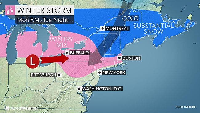
LOW PRESSURE APPROACHING FROM THE SOUTHWEST IS LIKELY TO BRING AN ACCUMULATING WINTRY MIX OF SNOW...SLEET...AND FREEZING RAIN MONDAY NIGHT INTO TUESDAY MORNING BEFORE PRECIPITATION TRANSITIONS TO RAIN. THE FIRST ACCUMULATING WINTRY MIX OF THE SEASON WILL LIKELY CREATE A HAZARDOUS TUESDAY MORNING COMMUTE.
After dense fog dissipates, temperatures on Sunday could again break record highs, before the cold front approaches Monday.
Find out what's happening in Pleasantville-Briarcliff Manorfor free with the latest updates from Patch.
The forecast is a tricky one, says Bill Potter of Hudson Valley Weather. “When we first discussed the potential, a significant snow appeared possible. As we get closer to the event, it appears that sleet and possibly freezing rain will be our biggest concern.
“There will be a substantial layer of cold air at the surface… which should lead to an extended period of sleet prior to sunrise on Tuesday. Temperatures should rise above freezing during the morning on Tuesday… changing any sleet and freezing rain over to a plain cold rain. However… the Tuesday AM commute stands to be a rather treacherous one. We’ll have to monitor this as it gets closer… but this is something worth planning for in advance.”
Find out what's happening in Pleasantville-Briarcliff Manorfor free with the latest updates from Patch.
MAP: AccuWeather.com
Get more local news delivered straight to your inbox. Sign up for free Patch newsletters and alerts.