Weather
Worst Of Storm Yet To Come; What To Expect The Rest Of The Day
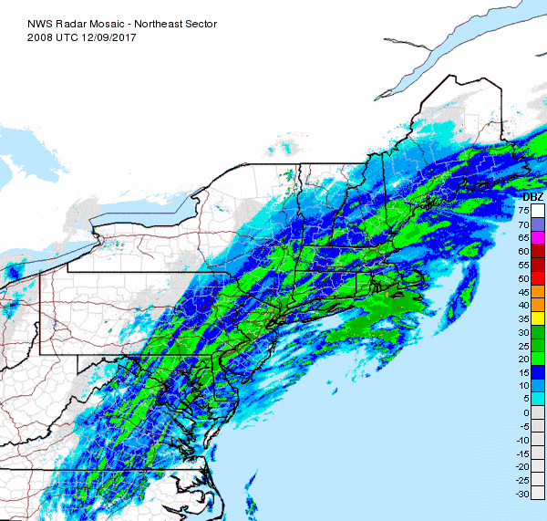
The storm may seem like a bust so far, but there's plenty more snow on the way today as well as early in the work week.

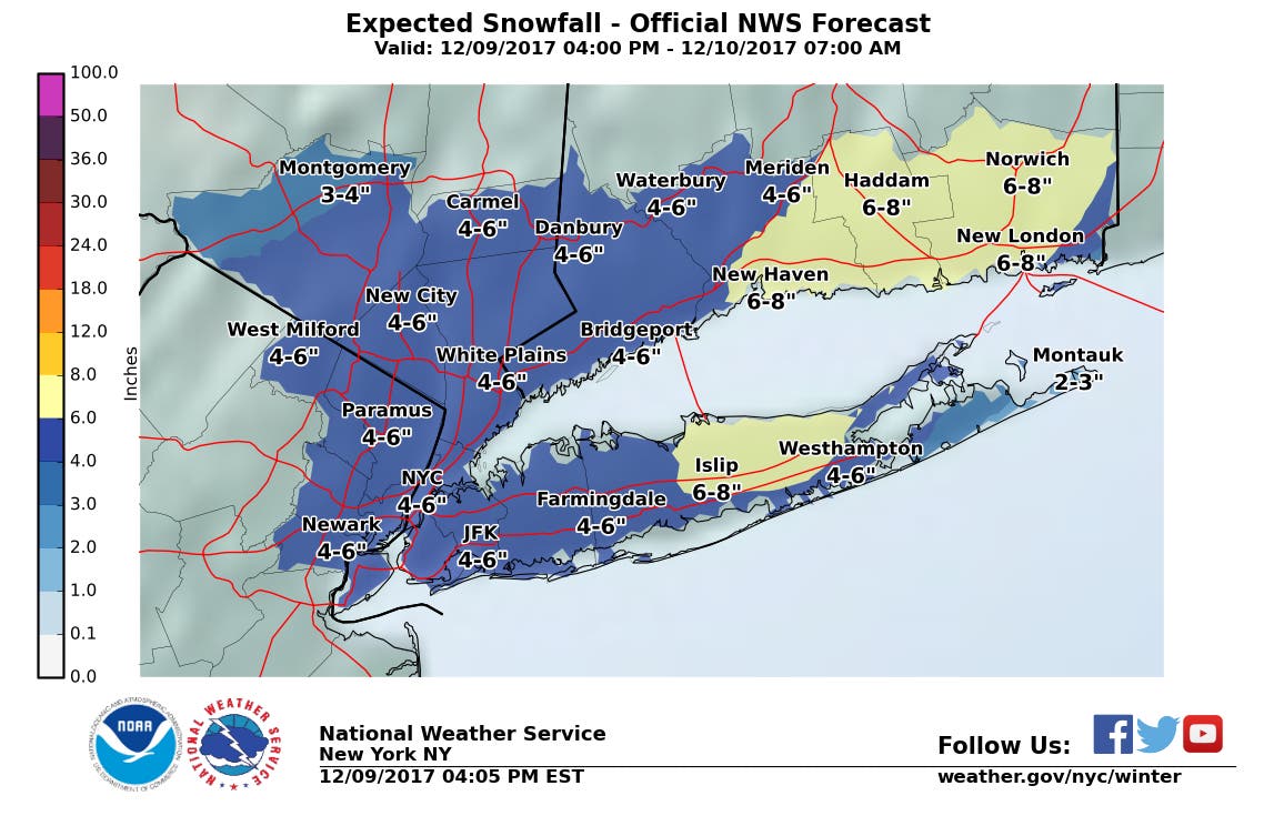
UPDATE: Long Island Snow Totals
Don't put away that shovel. There's plenty more snow on the way, according to the National Weather Service.
Snow was slow to materialize on the island Saturday and just a couple inches of accumulation was reported by mid-afternoon, but the worst is yet to come. In fact, snow total estimates for the region remain unchanged from earlier forecasts.
Find out what's happening in Sachemfor free with the latest updates from Patch.
Suffolk County, with the exception of the South Fork, is under a winter storm warning until 6 a.m. Sunday with a total of 5-7 inches of snow expected. Nassau County and the South Fork are both under a winter weather advisory. The advisory ends in Nassau, where 4-6 inches of snow is likely, at 4 a.m. The advisory ends on the South Fork, where 2-6 inches is expected, at 6 a.m.
Be prepared for snow covered roads and limited visibilities, and use caution while driving, the NWS says.
Find out what's happening in Sachemfor free with the latest updates from Patch.
The snow should end by early Sunday, but there's more of it in the forecast come Monday night.
The full forecast:
This Afternoon- Snow. Steady temperature around 33. Wind chill values between 25 and 30. North wind around 14 mph, with gusts as high as 25 mph. Chance of precipitation is 100%. Total daytime snow accumulation of 2 to 4 inches possible.
Saturday Night- Snow, mainly before 1am. Low around 31. Wind chill values between 25 and 30. North wind 11 to 14 mph, with gusts as high as 25 mph. Chance of precipitation is 100%. New snow accumulation of 2 to 4 inches possible.
Sunday- Mostly sunny, with a high near 39. Wind chill values between 25 and 30. West wind 13 to 18 mph, with gusts as high as 32 mph.
Sunday Night- Mostly cloudy, with a low around 28. Wind chill values between 20 and 25. West wind 11 to 13 mph, with gusts as high as 23 mph.
Monday- A 20 percent chance of snow before noon. Mostly cloudy, then gradually becoming sunny, with a high near 41. West wind 10 to 15 mph.
Monday Night- Snow likely, mainly between 10pm and 4am. Mostly cloudy, with a steady temperature around 35. Chance of precipitation is 70%. New snow accumulation of 1 to 3 inches possible.
Tuesday- A chance of rain and snow before 7am, then a chance of rain between 7am and noon. Mostly cloudy, with a high near 46. Chance of precipitation is 40%.
Tuesday Night- Partly cloudy, with a low around 24. Breezy.
Get more local news delivered straight to your inbox. Sign up for free Patch newsletters and alerts.