Weather
HV Forecast: Polar Vortex Brings Big Freeze, Bit Of Snow
Monday will "be cold by mid-winter standards... let alone late March," said Hudson Valley Weather. Make sure school kids are bundled up.


HUDSON VALLEY, NY — The sudden dip in temperature, the rising wind whipping around the houses — we can tell that winter has snuck back in.
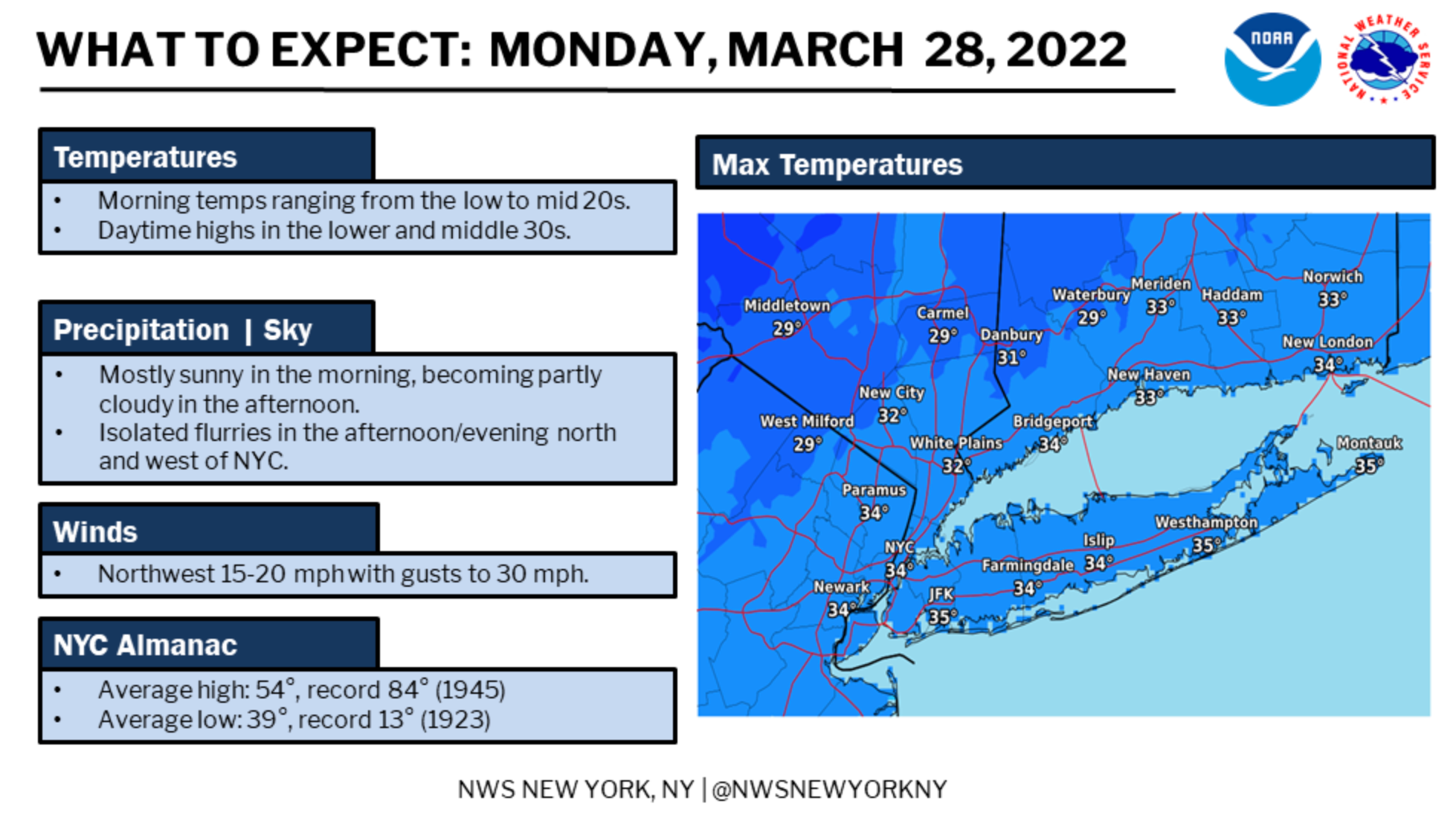
An arctic front pushing across the region Sunday as a finger of the polar vortex dips south will make Monday unseasonably cold. Highs may hit 32 degrees in Rockland and Westchester but don't expect temps to get out of the 20s further up the valley.
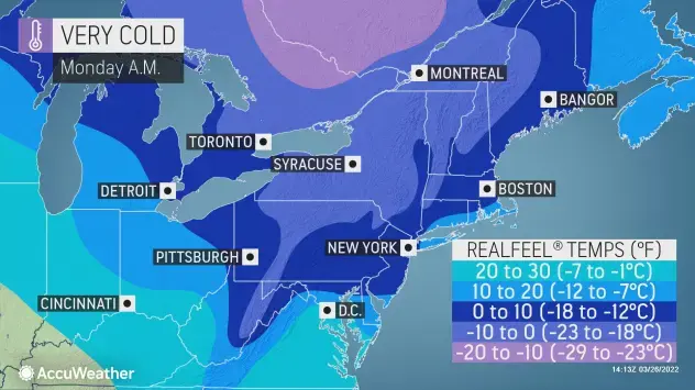
Plus (as if you needed more) the wind will make it feel even colder. We're talking wind chills in the teens, more like the upper teens to lower 20s.
Find out what's happening in Southeast-Brewsterfor free with the latest updates from Patch.
"The below normal temps over the next few days will be aided by a persistent NW flow across the region, winds out of the NW will remain blustery with gusts of 20-40 possible today through Tuesday," the folks at Hudson Valley Weather said on Facebook. "The gusting NW winds will create brutally cold wind chills in the single digits and low teens for Monday afternoon."
A few isolated snow flurries will also be possible, particularly for Dutchess, Orange and Ulster counties.
Find out what's happening in Southeast-Brewsterfor free with the latest updates from Patch.
Even on Tuesday temperatures will stay below normal, "as much as 10 to 20 degrees below normal for late March," said Courtney Travis, AccuWeather senior meteorologist.
Quite a change, eh? "As of March 25, Philadelphia averaged temperatures of 6.5 F degrees above normal, with cities like Buffalo, New York, to Washington, D.C., registering more than 5 degrees above normal," Travis said.
The wave of cold is, in part, thanks to a change in the polar vortex that AccuWeather Long-Range meteorologists called about a week ago.
If you jumped the gun and put in cold-weather plants or bought a pot of pansies, you will need to take steps to protect them as well as yourself.
When we get toward the end of the work week, temperatures will jump and we'll have thunderstorms instead.
Here's a look at the work week forecast based on Rockland County:
- Sunday night - A 30 percent chance of snow showers, mainly before 9pm. Cloudy, then gradually becoming partly cloudy, with a low around 20. Wind chill values between 10 and 15. Northwest wind 13 to 15 mph, with gusts as high as 29 mph.
- Monday - Mostly sunny, with a high near 32. Wind chill values between 5 and 15. Northwest wind 15 to 17 mph, with gusts as high as 30 mph.
- Monday Night - Partly cloudy, with a low around 19. Wind chill values between 10 and 15. Northwest wind 11 to 16 mph.
- Tuesday - Sunny, with a high near 39. Wind chill values between 10 and 20. Northwest wind 8 to 13 mph.
- Tuesday Night - Mostly clear, with a low around 22. Northwest wind 5 to 10 mph, with gusts as high as 20 mph.
- Wednesday - Partly sunny, with a high near 45.
- Wednesday Night - Mostly cloudy, with a low around 34.
- Thursday - Showers likely and possibly a thunderstorm, mainly after 3pm. Cloudy, with a high near 64. Chance of precipitation is 60%.
- Thursday Night - Showers likely and possibly a thunderstorm, then showers after 9pm. Low around 51. Chance of precipitation is 90%.
Get more local news delivered straight to your inbox. Sign up for free Patch newsletters and alerts.


