Weather
Sleet, Snow, Rain And Another Cold Night: Hudson Valley Forecast
Hazardous outlooks are out for Dutchess and Ulster counties; miserable road conditions are in store for the region.


HUDSON VALLEY, NY — A mix of snow, sleet, freezing rain and rain will bring miserable driving conditions to the Hudson Valley from Wednesday afternoon through Thursday morning, and then cold air will again push into the region temporarily.
"Who’s ready for another mixed bag of almost every precipitation type ... again?" said Alex Marra of Hudson Valley Weather.
A hazardous outlook and winter weather advisories have been issued for Dutchess and Ulster counties from 4 p.m. to 10 a.m. The National Weather Service said total snow accumulations there could range from 1 to 4 inches with a light ice glaze on top.
Find out what's happening in Southeast-Brewsterfor free with the latest updates from Patch.
SEE: Some School Dismiss Early, Cancel After-School Activities
Plan on slippery road conditions during both the Wednesday evening and Thursday morning commutes. Especially if you're traveling upstate, heed the weather alerts.
Find out what's happening in Southeast-Brewsterfor free with the latest updates from Patch.
"Most of Upstate New York is preparing for another winter storm that could bring a foot or more of snow in the North Country, and a wintry mix of ice and sleet that will impact travel Wednesday through Thursday," Gov. Kathy Hochul said. "New Yorkers in impacted regions should take action now to prepare for the incoming snow and ice, as power outages and hazardous travel are a concern this week."
Then, Friday night and Saturday will be cold.
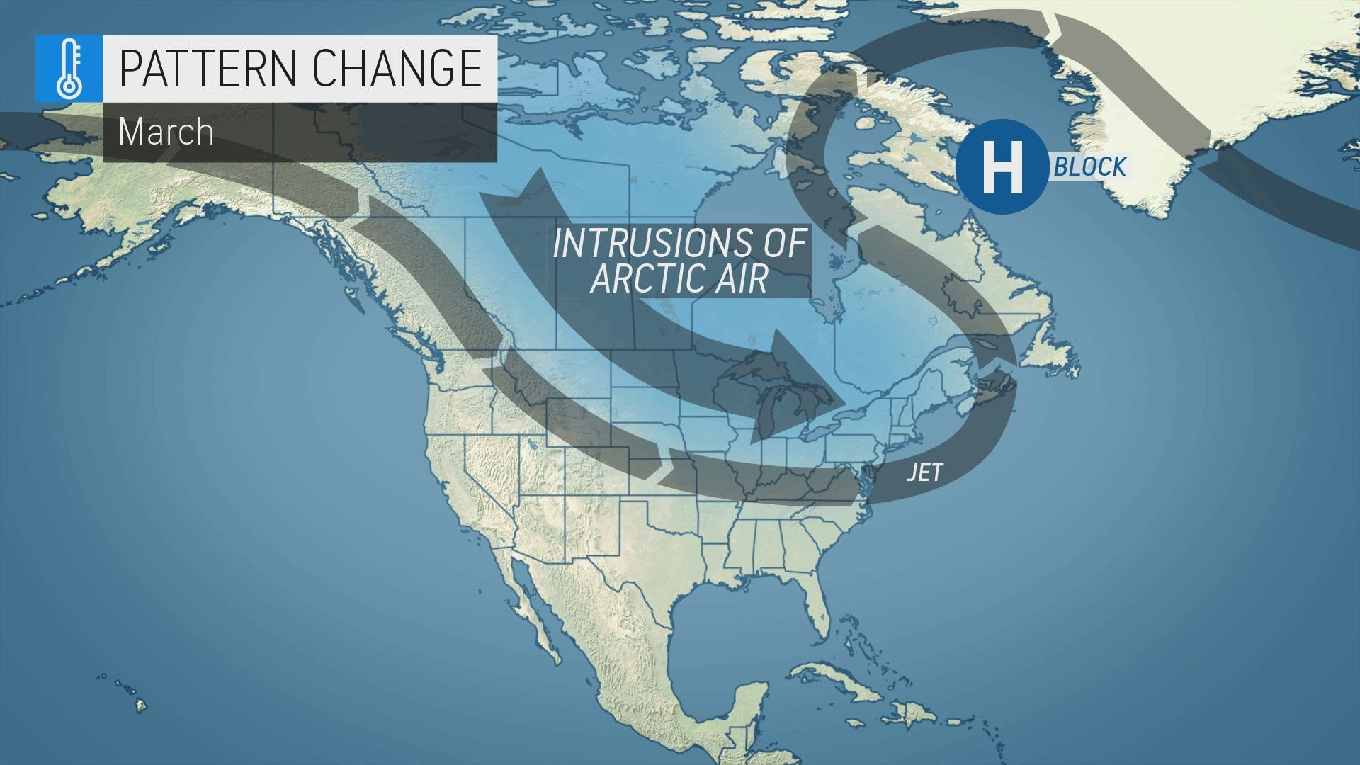
Meanwhile, it's been so mild the cherry trees are beginning to bloom in Washington, D.C. But AccuWeather Senior Meteorologist Paul Pastelok warned that long-range forecasts indicate a chance for colder weather that will stick around longer than any preceding cold spells after March 15.
Here's the NWS's five-day forecast based on Rockland County.
- Wednesday - Mostly cloudy. Rain, sleet with a chance of snow this afternoon. Little or no snow and sleet accumulation. Highs in the lower 40s. North winds around 5 mph, becoming south around 5 mph this afternoon. Chance of precipitation 90 percent.
- Tonight - Rain with a chance of freezing rain. Lows in the lower 30s. East winds around 5 mph. Chance of precipitation 90 percent.
- Thursday - Mostly cloudy with a 50 percent chance of rain showers. Highs around 50. Northeast winds around 5 mph.
- Thursday Night - Mostly cloudy. A chance of rain showers in the evening. Lows in the lower 30s. Southeast winds around 5 mph, increasing to west 10 to 15 mph after midnight. Chance of rain 40 percent.
- Friday - Mostly sunny and breezy. Highs around 40. Northwest winds 15 to 25 mph with gusts up to 35 mph.
- Friday Night- Mostly clear. Cooler with lows 15 to 20.
- Saturday - Partly sunny in the morning, then mostly cloudy with a chance of snow showers in the afternoon. Highs around 30. Chance of snow 30 percent.
- Saturday Night - Mostly cloudy. Lows in the lower 20s.
- Sunday - Mostly cloudy in the morning, then becoming partly sunny. Not as cool with highs in the mid 40s.
- Sunday Night - Partly cloudy in the evening, then clearing. Lows in the mid 20s.
Get more local news delivered straight to your inbox. Sign up for free Patch newsletters and alerts.


