Weather
Snowfall Rate Could Hit 2 Inches An Hour In Part Of Hudson Valley
The wintry mix may vary, but the impact of this storm will be the same. Here's the latest.

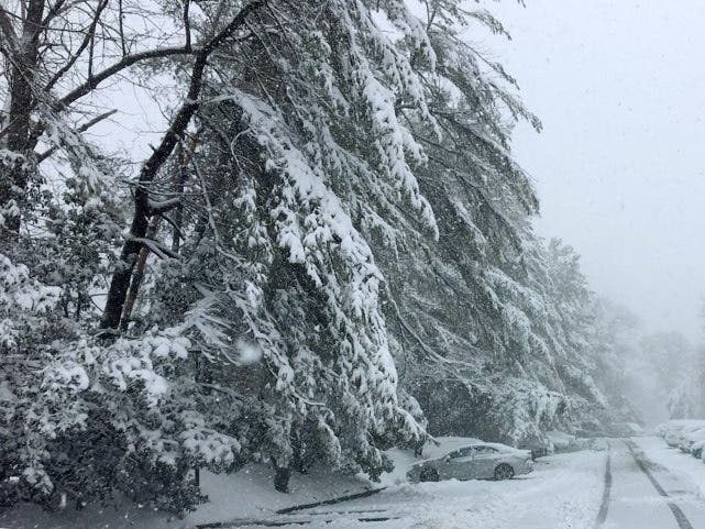
HUDSON VALLEY, NY — With the latest winter storm arriving overnight, the region is looking at another mix of snow and sleet — but this one could dump 2 to 10 inches of snow, up to an inch of sleet, and some ice before it exits Friday.
"The challenge to the forecast, and the reason for the wider than normal snowfall ranges, is due to the uncertainty of the timing of that transition from snow to sleet," said Alex Marra and Bill Potter at Hudson Valley Weather.
"But the net impact to everyone's Friday will be the same, regardless of where you live," they said. "travel will be very hazardous, and clearing the snow/sleet will be equally challenging." They issued their final forecast at 1 p.m. but will be nowcasting throughout the night.
Find out what's happening in Southeast-Brewsterfor free with the latest updates from Patch.
Snow will start out heavy, and there's an increased likelihood that snowfall rates will hit 2 inches per hour overnight in the mid-Hudson and central New York, the National Weather Service said in its 2 p.m. update. In the lower Hudson Valley, rates up to an inch an hour are possible.
The storm is coming from the southwest, so should hit Rockland and Orange counties on the west side of the Hudson River first, after 11 p.m.
Find out what's happening in Southeast-Brewsterfor free with the latest updates from Patch.
While we won't find out until we're in it exactly what the temperatures on the surface and high in the clouds will be, forecasters say the mix of precipitation will gradually change to freezing rain and rain Friday morning at the southern end of the valley.
"However, roads and sidewalks are likely to still be slippery especially over the northern and western suburbs and in parts of central Long Island, where the wintry mix is likely to linger for a time," AccuWeather Senior Meteorologist Alex Sosnowski said Thursday afternoon.
Plus, in the mid-Hudson it could become all snow again before it ends.
Whatever it is, it'll taper off, west to east, around noon. The advisories expire at 1 p.m.
The heaviest snows are expected from along the Pennsylvania/New York State border, across much of New York and much of New England, the National Weather Service said Thursday at 1:42 p.m.
At least the giant storm system won't be bringing us the thunder sleet with which it amazed Oklahoma and Texas.
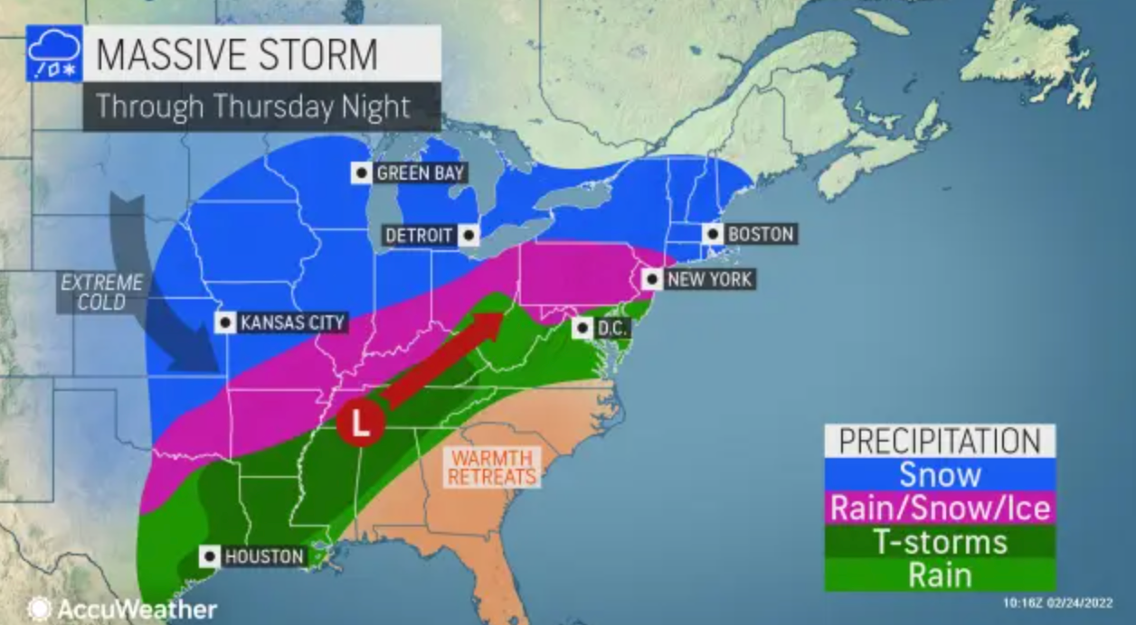
As the storm moves northeastward off the New England coast on Friday, below average temperatures will stretch across much of. the nation. The exception will be across portions of the Southern Mid-Atlantic and Southeast where much above average temperatures are possible, the NWS said.
Get more local news delivered straight to your inbox. Sign up for free Patch newsletters and alerts.


