Home & Garden
Weather Alert: End in Sight to Abnormal Heat
Thursday rain should break Putnam's torrid heat, drought.

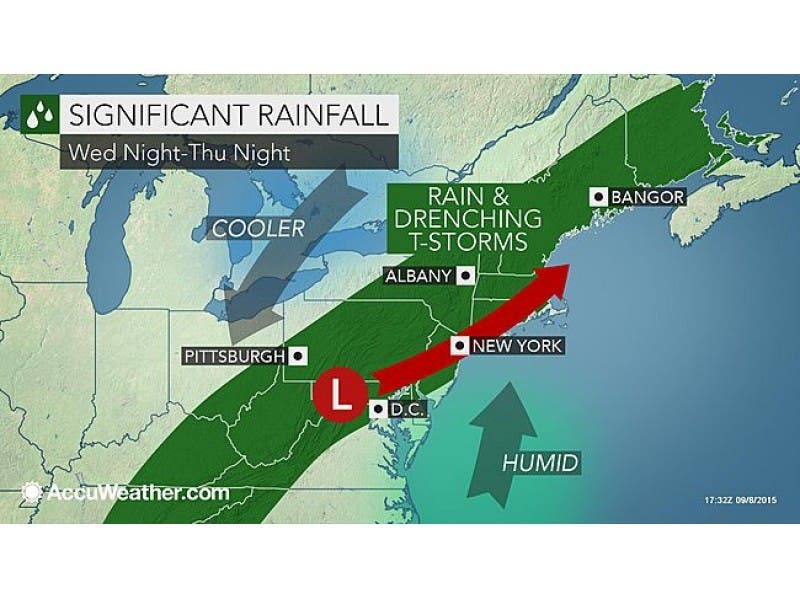
A torrid heat wave that’s capped almost two weeks without rain could end tonight—surely Thursday—as heavy rains are expected to arrive in Putnam County.
“When you have a summer that is very dry, and then you throw a monster Bermuda high pressure over top of us… you have a recipe for some record setting heat,” explains Bill Potter of Hudson Valley Weather. “ That is precisely what we’ve got here. Monday and Tuesday were record hot… and they were forecast to be record hot. But both days surpassed their projected high temperatures and broke records, in part because of how dry it’s been this summer. A dry terrain helps to enhance an already dry air mass… and the drier the air mass… the hotter you can get temperatures to climb, even to record territory.”
Wednesday’s temperatures should continue the trend, at about 10 degrees above normal.
Find out what's happening in Southeast-Brewsterfor free with the latest updates from Patch.
But—all should end soon.
The National Weather Service has issued a Hazardous Weather Outlook for the county, saying showers and possibly some thunderstorms producing heavy rain may lead to flooding in poor drainage and low-lying areas through Thursday.
Find out what's happening in Southeast-Brewsterfor free with the latest updates from Patch.
However, “the development of the rain bands will be unpredictable,” Potter said, “meaning someone could get 0.30″ of rain from this storm… and someone 30 miles away could get 3.00″ from this storm.”
The NWS is forecasting the heaviest rain for late Thursday evening. Most of Thursday is expected to be cloudy with some showers.
Here is the Putnam County forecast through Friday night from the National Weather Service:
- This Afternoon-Mostly sunny, with a high near 89. South wind around 10 mph.
- Tonight-A chance of showers and thunderstorms, mainly after 9pm. Mostly cloudy, with a low around 68. South wind around 6 mph becoming calm in the evening. Chance of precipitation is 40%.
- Thursday-A chance of showers and thunderstorms, then showers likely and possibly a thunderstorm after 10am. Cloudy, with a high near 76. Northeast wind 5 to 7 mph. Chance of precipitation is 60%. New rainfall amounts between a half and three quarters of an inch possible.
- Thursday Night-Showers. The rain could be heavy at times. Steady temperature around 67. North wind around 9 mph. Chance of precipitation is 80%. New precipitation amounts between three quarters and one inch possible.
- Friday-A chance of showers, mainly before noon. Cloudy, then gradually becoming mostly sunny, with a high near 78. North wind around 10 mph. Chance of precipitation is 50%.
- Friday Night-Partly cloudy, with a low around 59.
Map via AccuWeather.com
Get more local news delivered straight to your inbox. Sign up for free Patch newsletters and alerts.