Weather
Heavy Downpours, Gusty Winds Possible In Mooresville: NWS
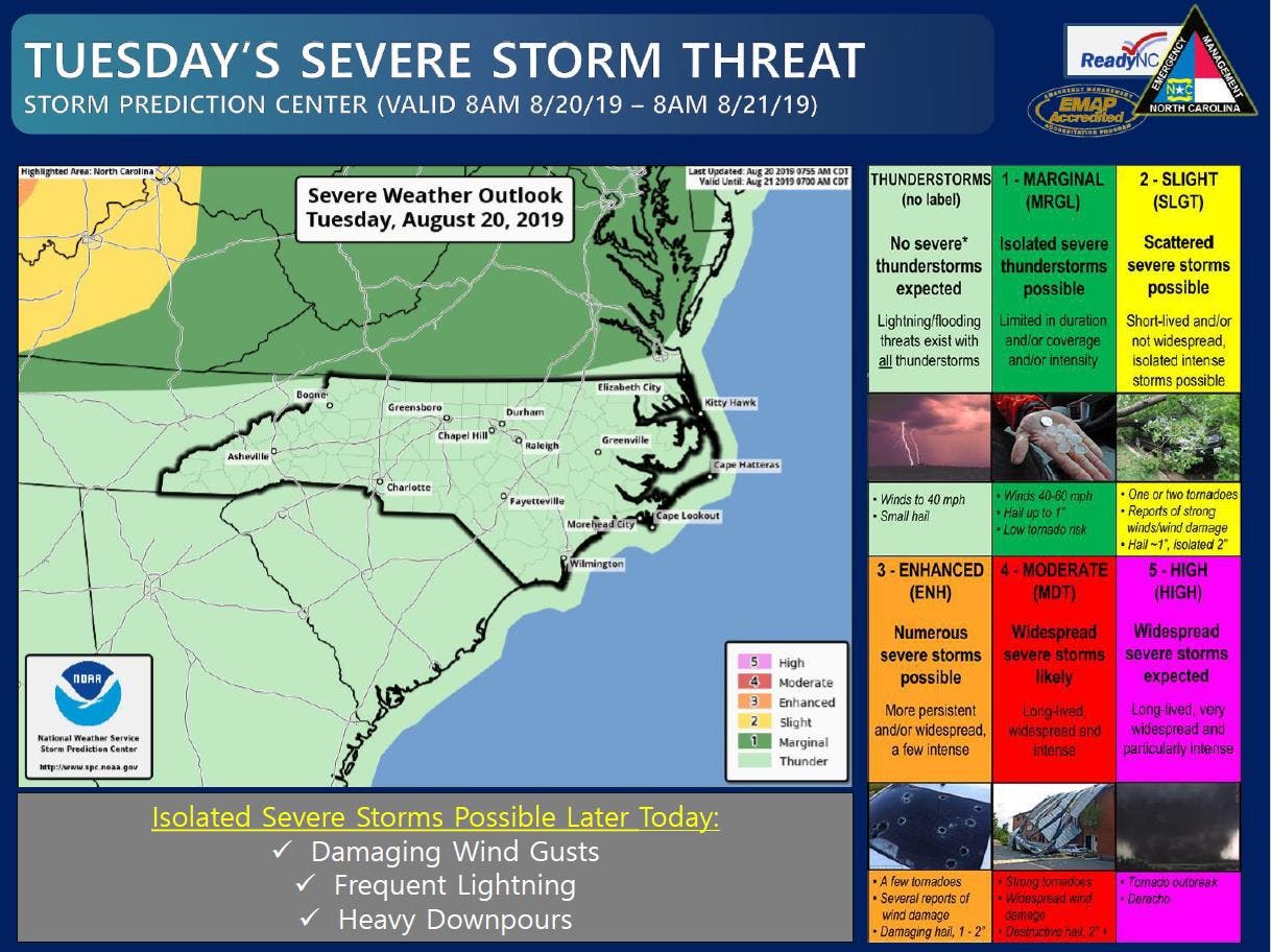
Heavy downpours, high winds and even quarter-sized hail are all possibilities Tuesday afternoon, the National Weather Service warned.

MOORESVILLE, NC — Storms moving into the piedmont of North Carolina Tuesday afternoon could also produce possible heavy downpours, high winds and even quarter-sized hail, the National Weather Service warned.
“Scattered to numerous thunderstorms are expected to develop across the area this afternoon,” the National Weather Service said in a hazardous weather bulletin for the greater Charlotte metro area including Iredell and Mecklenburg counties. “Cloud-to-ground lightning, locally heavy downpours, and brief gusty winds will be the primary threats with these thunderstorms.”
Some of the storms moving through the piedmont of North Carolina Tuesday evening could be strong enough to also lead to isolated flooding in some areas, NWS said.
Find out what's happening in Mooresvillefor free with the latest updates from Patch.
The remainder of the week will also likely be soggy with a greater than 40 percent change of rain every day through the weekend, forecasters said.
Here is the National Weather Service forecast through the weekend:
Today (Aug. 20)
A 40 percent chance of showers and thunderstorms. Mostly cloudy, with a high near 89. South southwest wind 6 to 9 mph. New rainfall amounts between a tenth and quarter of an inch, except higher amounts possible in thunderstorms.
Tonight
A chance of showers and thunderstorms. Patchy fog between midnight and 2am. Otherwise, mostly cloudy, with a low around 72. South southwest wind around 6 mph. Chance of precipitation is 50%. New precipitation amounts between a half and three quarters of an inch possible.
Wednesday (Aug. 21)
A 40 percent chance of showers and thunderstorms, mainly after 10am. Partly sunny, with a high near 90. Southwest wind around 7 mph. New rainfall amounts of less than a tenth of an inch, except higher amounts possible in thunderstorms.
Wednesday Night
A 40 percent chance of showers and thunderstorms, mainly before 10pm. Mostly cloudy, with a low around 72. Southwest wind 3 to 6 mph. New rainfall amounts of less than a tenth of an inch, except higher amounts possible in thunderstorms.
Thursday (Aug. 22)
A slight chance of showers, then a chance of showers and thunderstorms after 9am. Partly sunny, with a high near 91. Southwest wind around 6 mph. Chance of precipitation is 40%.
Thursday Night
A 40 percent chance of showers and thunderstorms. Mostly cloudy, with a low around 72.
Friday (Aug. 23)
Showers and thunderstorms likely, mainly after 10am. Partly sunny, with a high near 88. Chance of precipitation is 70%.
Friday Night
Showers likely, mainly before 1am. Mostly cloudy, with a low around 70. Chance of precipitation is 60%.
Saturday (Aug. 24)
A 50 percent chance of showers. Mostly cloudy, with a high near 82.
Saturday Night
A 50 percent chance of showers. Mostly cloudy, with a low around 67.
Sunday (Aug. 25)
A 40 percent chance of showers. Mostly cloudy, with a high near 80.
Sunday Night
A 40 percent chance of showers. Mostly cloudy, with a low around 67.
Find out what's happening in Mooresvillefor free with the latest updates from Patch.
Get more local news delivered straight to your inbox. Sign up for free Patch newsletters and alerts.