Weather
Confidence Grows In Major Snowstorm Targeting Philly Area: Latest Forecast
The huge weather event impacting much of the country only appears stronger, and more likely, in the latest forecasts.

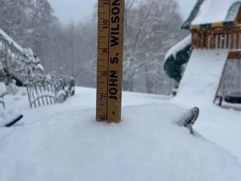
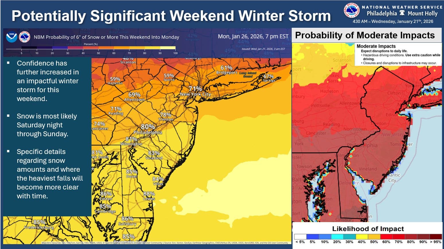
Confidence has further increased that a major snow event will strike the greater Philadelphia area this weekend, forecasters said, with an 80 to 90 percent chance for at least six inches of snow in parts of the region.
That's a higher minimum total and a higher likelihood than yesterday, as the storm draws nearer and forecasters begin to gain a clearer picture of what looks to be the most significant weather of the winter thus far.
"The potential for a significant storm to impact the area this weekend continues to increase," the National Weather Service's Mt. Holly, New Jersey branch shared in a statement.
Find out what's happening in Across Pennsylvaniafor free with the latest updates from Patch.
And much more than 6 inches is possible, with Accuweather forecasting up to 12 inches in many parts of the mid-Atlantic.
The storm will arrive Saturday afternoon and could continue through early Monday morning, though snow is most likely to fall late Saturday night through the day Sunday. More precise timing and location details "will become more clear with time," the National Weather Service said, as they continue to monitor the front.
Find out what's happening in Across Pennsylvaniafor free with the latest updates from Patch.
The agency expects "moderate" impacts, which include school and business closures, road closures, flight delays or cancellations, and general disruptions to infrastructure.
The storm will have heavy impacts on large regions of the country, Accuweather says.
"Potentially hundreds of thousands of people may go without electricity and heat for days,” Accuweather Chief Meteorologist Jonathan Porter said.
The high temperature Saturday, when the storm first arrives, will only be 18 degrees. Lows will be in the low teens on both Saturday and Sunday night, and will drop to 8 on Monday, meaning that everything will freeze. Ice may compound whatever issues are caused by snow.
"In areas where a thick glaze of ice forms, scores of trees and power lines may come down, and removing ice from streets, highways, parking lots and sidewalks may be difficult or impossible, especially where ice-melting supplies are limited," Accuweather adds. "Utility crews could be overwhelmed by the scope of the storm."
Here's the full forecast, according to the National Weather Service:
Today
Mostly sunny, with a high near 36. Light south wind increasing to 5 to 10 mph in the morning.
Tonight
Cloudy during the early evening, then gradual clearing, with a low around 32. Southwest wind around 10 mph.
Thursday
Mostly sunny, with a high near 45. Southwest wind 5 to 15 mph, with gusts as high as 25 mph.
Thursday Night
Partly cloudy, with a low around 26. West wind around 5 mph.
Friday
Partly sunny, with a high near 35. West wind 5 to 10 mph, with gusts as high as 20 mph.
Friday Night
Mostly cloudy, with a low around 11.
Saturday
Mostly cloudy, with a high near 18.
Saturday Night
Snow likely, mainly after 1 a.m. Mostly cloudy, with a low around 13. Chance of precipitation is 70 percent.
Sunday
Snow. High near 20. Chance of precipitation is 80 percent.
Sunday Night
Snow likely, mainly before 1 a.m. Mostly cloudy, with a low around 14. Chance of precipitation is 60 percent.
Monday
A chance of snow. Partly sunny, with a high near 24. Chance of precipitation is 30 percent.
Monday Night
Mostly clear, with a low around 8.
Tuesday
Sunny, with a high near 24.
Get more local news delivered straight to your inbox. Sign up for free Patch newsletters and alerts.