Weather
Latest Eastern PA Winter Storm Timeline: When To Expect Rain, Snow
Here's where things stand for the Philly area with around 24 hours to go before the first precipitation.

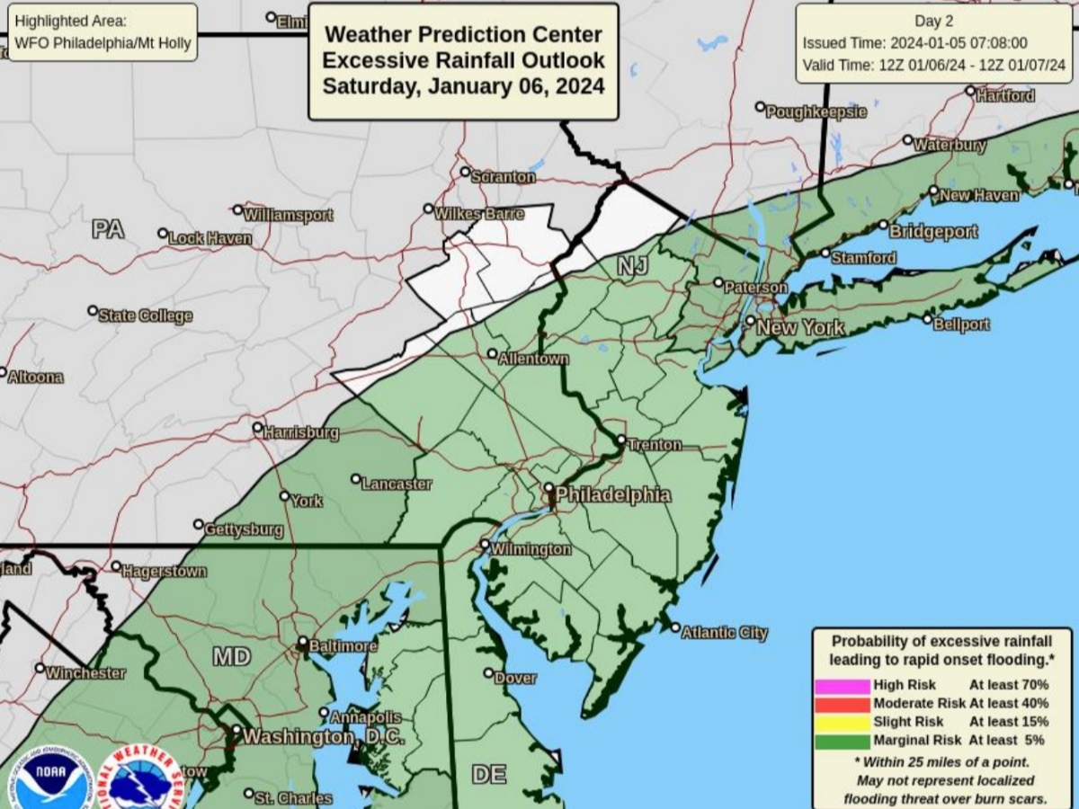
EASTERN PA — The approaching winter storm is very likely going to be considered a near miss for Philadelphia and most of the five county suburban area, according to the latest update from forecasters.
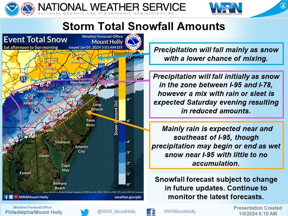
A slight change in the track of the storm would have meant an end to a more than two-year drought of significant snowfall in the region. And while other cities in the northeast like New York will see their drought snap, and while parts of northern New Jersey and the Poconos are slated to receive up to eight inches of snow, this isn't the storm for Philly.
"Philly snow lovers will be disappointed by this weekend's system," the National Weather Service's Mt. Holly, New Jersey branch said in a statement Friday morning. "Our latest forecast has only a 3 percent chance of seeing 1" or more of snowfall. So the snow drought should continue. There will be some wet snow to start, but not enough for an inch."
Find out what's happening in Across Pennsylvaniafor free with the latest updates from Patch.
Significant rainfall is still expected, and here's what the weather timeline for the next few days looks like:
Friday and Friday night will be calm and cold, with the low dipping into the mid-20s throughout the area overnight.
Find out what's happening in Across Pennsylvaniafor free with the latest updates from Patch.
The storm could still begin as snow in the Philly area on Saturday, with precipitation most likely to begin after 1 p.m. As the temperature rises to the daily high of 39, most areas to the south and west of I-95 will receive more and more rain, forecasters said. Less than half an inch of snow is expected to fall during the day.
A wintry mix will continue into the evening, with the potential for another half an inch accumulating before the precipitation shifts to only rain by 10 p.m. Rain will hammer the region overnight until around 1 p.m. on Sunday afternoon.
Traffic impacts are expected to be significant, particularly as anyone traveling more than a half an hour or so north and west from the Philadelphia region will run into serious snow.
"Motorists are urged to check their local forecast and stay aware of changing weather conditions before taking to the roads, especially any college students returning to campus since winter break comes to an end this week for some universities," Accuweather adds.
Here's the full forecast, according to the National Weather Service:
Friday
Sunny, with a high near 38. West wind 5 to 10 mph.
Friday night
Increasing clouds, with a low around 27. Southwest wind around 5 mph becoming calm.
Saturday
Rain, possibly mixed with snow, mainly after 1 p.m. High near 39. Light east wind increasing to 5 to 10 mph in the morning. Chance of precipitation is 90 percent. New snow accumulation of less than a half inch possible.
Saturday night
Rain, possibly mixed with snow, becoming all rain after 10pm. Low around 34. Northeast wind around 15 mph, with gusts as high as 25 mph. Chance of precipitation is 100 percent. New snow accumulation of less than a half inch possible.
Sunday
A chance of rain, mainly before 1 p.m. Cloudy, with a high near 40. North wind around 10 mph becoming west in the afternoon. Chance of precipitation is 50 percent. New precipitation amounts of less than a tenth of an inch possible.
Sunday night
Partly cloudy, with a low around 33.
Get more local news delivered straight to your inbox. Sign up for free Patch newsletters and alerts.