Weather
Incoming Cold Front To Bring High Winds To Eastern PA Friday
Spring is officially here, but lingering winter-like weather is knocking on the door in the greater Philadelphia area.

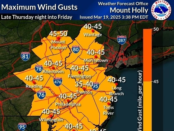
EASTERN PA — Powerful wind gusts that could reach up to 50 miles an hour will blow into the greater Philadelphia area overnight into Friday, potentially causing trees and electrical lines to come down and knocking out power. It will bring a blast of lingering winter, with the cold air ending several days of balmy temperatures just as spring officially begins.
The cold front which will see temperatures drop from their Thursday high all the way down to 37 overnight, according to forecasters.
Highs will still reach the mid-50s in the suburban region on Friday, but will drop again to 40 overnight, and the wind will make everything feel notably colder, the National Weather Service said.
Find out what's happening in Across Pennsylvaniafor free with the latest updates from Patch.
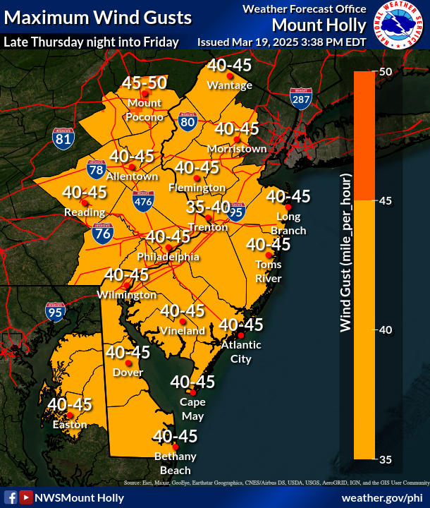
Wind will kick up later Thursday, and will become strong on Friday, with sustained 15 to 20 mile per hour northwest winds punctuated by gusts ranging from 30 to 50 miles per hour, depending on the precise location.
Residents shouldn't expect an immediate return to classic spring weather, either. Accuweather warns that a shift in the polar vortex means that more cooler temperatures are likely on the way in March and April.
Find out what's happening in Across Pennsylvaniafor free with the latest updates from Patch.
"(The vortex) will likely result in more days with temperatures near or even below the historical average rather than above from the midwest to the northeast in the coming weeks," Accuweather notes. "This will lead to hard freezes in the midwest and northeast, so gardeners should not be tempted by the recent retreat of wintry conditions."
A band of snow and slush will sweep over the northern states over the coming days, but it's expected to swing above even far northern Pennsylvania, forecasters said.
Here's the full forecast:
Thursday: A chance of rain after 5 p.m. Mostly cloudy, with a high near 67. Southeast wind around 15 mph. Chance of precipitation is 30 percent. New precipitation amounts of less than a tenth of an inch possible.
Thursday night: Rain, mainly before midnight. Low around 37. Southwest wind 10 to 15 mph becoming northwest in the evening. Winds could gust as high as 30 mph. Chance of precipitation is 90 percent. New precipitation amounts between a quarter and half of an inch possible.
Friday: Partly sunny, then gradually becoming sunny, with a high near 55. Breezy, with a northwest wind 20 to 25 mph, with gusts as high as 35 mph.
Friday night: Mostly clear, with a low around 40. Northwest wind 5 to 10 mph.
Saturday: Partly sunny, with a high near 61. Southwest wind 5 to 15 mph.
Saturday night: Mostly clear, with a low around 31.
Sunday: Mostly sunny, with a high near 52.
Sunday night: Showers likely after 2 a.m. Mostly cloudy, with a low around 40. Chance of precipitation is 60 percent.
Monday: Showers. High near 64. Chance of precipitation is 80 percent.
Monday Night: Showers likely, mainly before 8 p.m. Mostly cloudy, with a low around 43. Chance of precipitation is 60 percent.
Tuesday: Mostly sunny, with a high near 57.
Tuesday Night: Partly cloudy, with a low around 37.
Get more local news delivered straight to your inbox. Sign up for free Patch newsletters and alerts.


