Weather
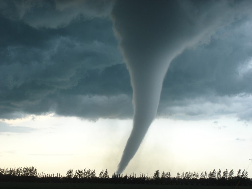
Another Round Of Severe Storms Possible Thursday In Eastern PA
The latest forecast for the Philadelphia area calls for damaging winds, quarter inch hail, and downpours.

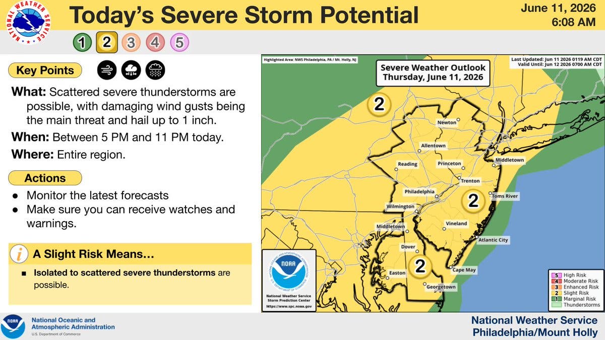
There is an increased chance of severe weather in the Philadelphia region on Thursday, according to the latest update to the forecast for the region.
The National Weather Service now puts the five-county suburban area, and much of eastern Pennsylvania, within its level 2 risk zone, indicating "slight risk." The forecast for Thursday had sat in level 1 most of the week.
Damaging wind gusts, heavy downpours, and quarter-size hail are all possible, forecasters said.
Find out what's happening in Across Pennsylvaniafor free with the latest updates from Patch.
The storm's greatest impacts will be between 5 p.m. and 11 p.m.
"In most situations, the main impact from the storms will be torrential downpours that can lead to flash urban flooding," Accuweather said. "In some of the most severe storms, strong wind gusts during microbursts can lead to downed trees and power outages. Where these more gusty storms approach the major cities, airline delays will increase due to potentially hazardous conditions for aircraft."
Find out what's happening in Across Pennsylvaniafor free with the latest updates from Patch.
Residents should monitor for watches and warnings during those hours, as notice may be given for an imminent severe thunderstorm.
Dangerously high humidity will return on Friday, with the highest heat index yet this year of 104.
Afternoon showers are likely Friday, and there will be another chance for thunderstorms before the weather clears Saturday.
Here's the latest forecast for the coming week, according to the National Weather Service:
Thursday
Mostly sunny, with a high near 95. Heat index values as high as 102. West wind around 10 mph.
Thursday Night
Showers and thunderstorms likely, mainly before 1 a.m. Some of the storms could be severe. Mostly cloudy, with a low around 74. West wind around 5 mph. Chance of precipitation is 60 percent. New rainfall amounts of less than a tenth of an inch, except higher amounts possible in thunderstorms.
Friday
A chance of showers and thunderstorms between 3 p.m. and 5 p.m., then showers likely and possibly a thunderstorm after 5 p.m. Increasing clouds, with a high near 96. Heat index values as high as 104. West wind 5 to 10 mph. Chance of precipitation is 60 percent. New rainfall amounts of less than a tenth of an inch, except higher amounts possible in thunderstorms.
Friday Night
Showers likely and possibly a thunderstorm before 8 p.m., then a chance of showers and thunderstorms between 8 p.m. and 2 a.m. Mostly cloudy, then gradually becoming mostly clear, with a low around 71. Northwest wind around 5 mph. Chance of precipitation is 60 percent. New rainfall amounts of less than a tenth of an inch, except higher amounts possible in thunderstorms.
Saturday
Sunny, with a high near 90. Northwest wind 5 to 10 mph.
Saturday Night
Mostly clear, with a low around 69.
Sunday
A chance of showers and thunderstorms after 2 p.m. Mostly sunny, with a high near 92. Chance of precipitation is 30 percent.
Sunday Night
A chance of showers and thunderstorms before 8 p.m., then showers likely between 8 p.m. and 2 a.m. Mostly cloudy, with a low around 67. Chance of precipitation is 60 percent.
Monday
Mostly sunny, with a high near 84.
Monday Night
Partly cloudy, with a low around 64.
Tuesday
A chance of showers. Partly sunny, with a high near 81. Chance of precipitation is 40 percent.
Tuesday Night
Mostly cloudy, with a low around 63.
Wednesday
Mostly sunny, with a high near 84.
Get more local news delivered straight to your inbox. Sign up for free Patch newsletters and alerts.