Weather
Strong Storms, 50 MPH Winds To Slam PA: Latest Forecast, Timing
Damaging winds could cause widespread power outages, while severe thunderstorms, flash flooding, and even a tornado are possible.

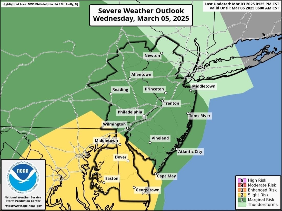
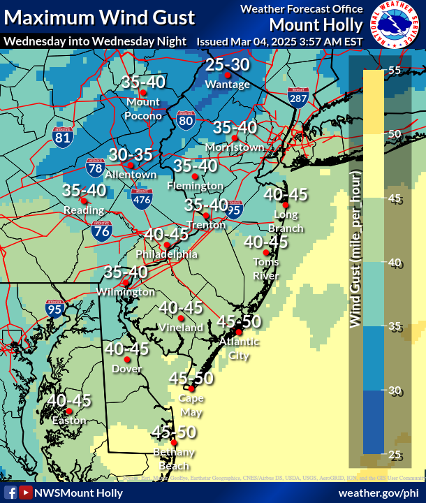
EASTERN PA — Wind gusts soaring near 50 miles per hour, along with heavy thunderstorms, rain, and possible tornadoes, will slam into the greater Philadelphia area this week in what will represent perhaps the most severe storm this year thus far.
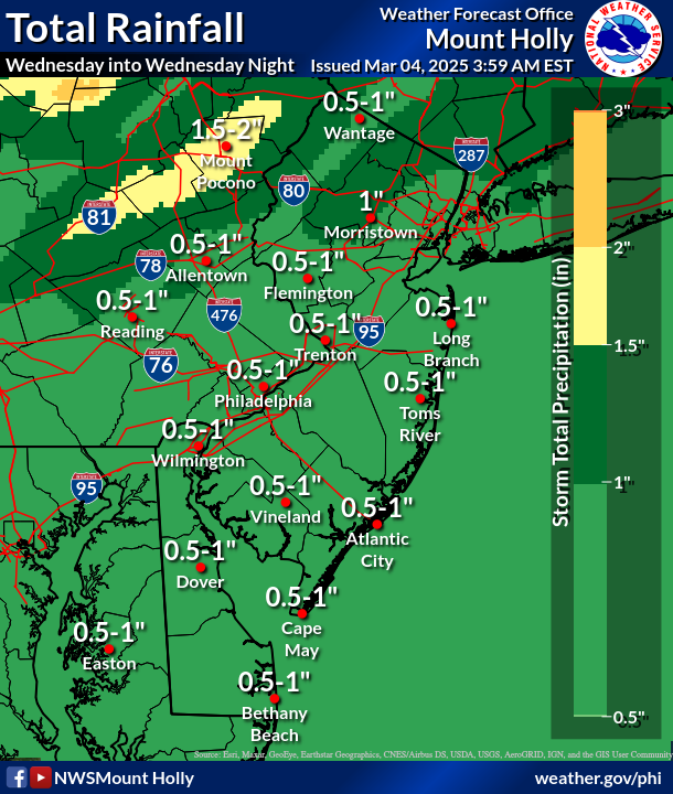
Tuesday will be the calm before the storm arrives Wednesday afternoon. Up to an inch of rain could fall throughout the day, with more possible into the night. Wind gusts are forecasted up to 45 or 50 miles per hour throughout most of the Delaware Valley, meaning trees and electrical wires could come down and cause widespread power outages.
Severe thunderstorms could cause significant damage as well. The National Weather Service said they're most likely to arrive after 4 p.m. Wednesday.
Find out what's happening in Across Pennsylvaniafor free with the latest updates from Patch.
"The line of thunderstorms rolling through the East Coast will be moving very quickly," AccuWeather Meteorologist Alex Duffus said. "Thunderstorms are not expected to last all day, but those that do form could be quite impactful."
Officials advise residents to move indoors and away from windows during severe thunderstorms.
Find out what's happening in Across Pennsylvaniafor free with the latest updates from Patch.
Where severe thunderstorms strike, there is also a risk of more torrential downpours, hail, flash flooding, and even a tornado, the National Weather Service warned, though these impacts are more likely to be localized.
Travel home during the Wednesday evening commute could be hazardous for some, as the storm's severe impacts are slated to ramp up just before rush hour.
Residents can check their power status through PECO, as well as report a status, online here. Officials urge residents not to call 911 if they experience a power outage, but to reserve the line for true emergencies.
Here's the full forecast:
Tuesday
Partly sunny, with a high near 55. South wind around 10 mph.
Tuesday Night
Increasing clouds, with a low around 42. South wind 5 to 10 mph.
Wednesday
Showers, with thunderstorms also possible after 4 p.m. High near 57. Breezy, with a south wind 15 to 25 mph, with gusts as high as 40 mph. Chance of precipitation is 100 percent. New rainfall amounts between a half and three quarters of an inch possible.
Wednesday Night
Showers likely and possibly a thunderstorm before 1 a.m., then a chance of showers between 1am and 4 a.m. Cloudy, with a low around 45. Breezy, with a south wind 15 to 20 mph becoming southwest 10 to 15 mph after midnight. Winds could gust as high as 35 mph. Chance of precipitation is 60 percent. New precipitation amounts between a tenth and quarter of an inch, except higher amounts possible in thunderstorms.
Thursday
Partly sunny, with a high near 51. Breezy, with a west wind 10 to 20 mph, with gusts as high as 35 mph.
Thursday Night
Partly cloudy, with a low around 30. Breezy.
Friday
Mostly sunny, with a high near 49.
Friday Night
Mostly cloudy, with a low around 34.
Get more local news delivered straight to your inbox. Sign up for free Patch newsletters and alerts.