Weather
Weekend Storm Could Dump 3 Inches On Eastern PA: Latest Forecast
Forecasters have a clearer picture of the next multi-day storm impacting the region, which could bring flooding and massive travel delays.

EASTERN PA — Up to three inches of torrential rain could fall on the greater Philadlephia region this week as another major storm front moves into the area.
The latest update from forecasters brings more clarity on the intensity of the storm, which is likely to cause flooding in some areas after last weekend's rainfall left the soil filled with moisture. A hazardous weather outlook has been issued for the region by the National Weather Service.
"Several instances of flooding are possible on Sunday, especially in urban and poor-drainage areas and near particularly vulnerablesmall creeks and streams," the Weather Service said.
Find out what's happening in Across Pennsylvaniafor free with the latest updates from Patch.
Light rain could begin as early as Saturday night in some areas, but the main storm impacts aren't likely until later Sunday morning or early Sunday afternoon, according to the Mt. Holly, New Jersey branch's special forecast discussion Friday morning.
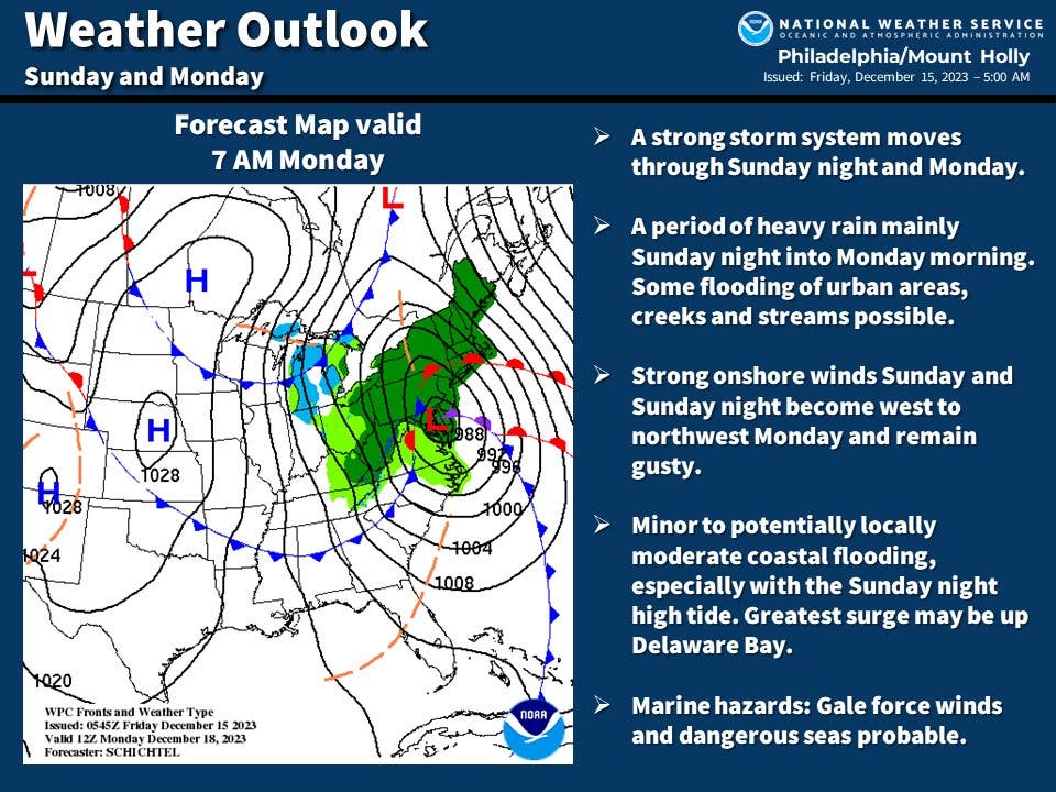
Heavy rain will continue through Monday afternoon. Strong wind gusts are likely, though eastern Pennsylvania is unlikely to see the storm's strongest 4o to 50 mile an hour gusts, which forecasters say will hit the shore.
Find out what's happening in Across Pennsylvaniafor free with the latest updates from Patch.
The storm is likely to significantly hamper travelers who may be on the move for the coming holidays.
"The downpours could dramatically impact commutes on Monday from the Philadelphia and New York Tri-State areas into New England," Accuweather said.
Flight delays are also possible at Philadelphia, Pittsburgh, New York, Atlanta, Boston, Charlotte, and Washington D.C. airports.
Weather is expected to calm down significantly ahead of the holidays, with little turbulence in the forecast leading up to Christmas day.
Here's the full forecast from the National Weather Service:
Friday
Sunny, with a high near 52. West wind 5 to 15 mph.
Friday night
Clear, with a low around 35. West wind around 5 mph.
Saturday
Mostly sunny, with a high near 53. Northwest wind around 5 mph becoming east in the afternoon.
Saturday night
Mostly cloudy, with a low around 40. East wind around 5 mph.
Sunday
Rain, mainly after 1pm. High near 57. East wind 10 to 15 mph. Chance of precipitation is 80%. New precipitation amounts between a tenth and quarter of an inch possible.
Sunday night
Rain. The rain could be heavy at times. Low around 53. Breezy. Chance of precipitation is 100%. New precipitation amounts between 1 and 2 inches possible.
Monday
Rain, mainly before 1pm. The rain could be heavy at times. High near 58. Breezy. Chance of precipitation is 90%.
Monday night
Mostly cloudy, with a low around 32. Breezy.
Get more local news delivered straight to your inbox. Sign up for free Patch newsletters and alerts.


