Weather
PA Weather Forecast: Who Could Get Rain - Or Worse - And Who Won't
Pennsylvania could get its first snowflakes this season, while many areas of the state will actually get something else - or worse.


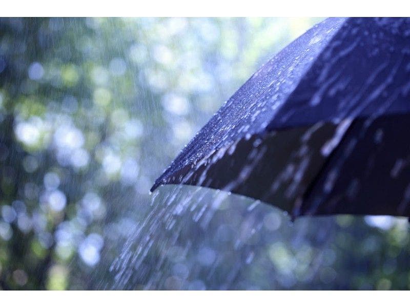
Pennsylvania could get its first snowflakes this season. But many areas of the state could actually get something else - or worse.
A hazardous weather alert remains in effect as most of the eastern part of the state will be dealing with rain on Thursday, while some parts could also get snow, freezing and/or sleet, according to the National Weather Service.
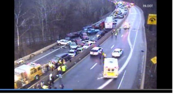
While your area may not be getting snow, you could be dealing with weather conditions that could make Thursday's commute rather slippery. Freezing rain and black ice caused this 38-car pile-up in Bergen County, N.J. last year:
Find out what's happening in Doylestownfor free with the latest updates from Patch.
A storm will slide in from the Midwest to bring another dose of cold rain and accumulating heavy, wet snow to parts of the northeastern United States from Wednesday night into Friday, according to AccuWeather.
Find out what's happening in Doylestownfor free with the latest updates from Patch.
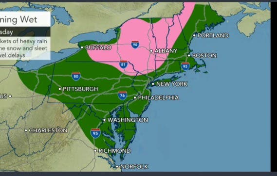
Cold air will hold its ground over much of the northeastern U.S. through this week. One batch of cold air will be replaced by another. The new storm will bring a round or two of rain to Pittsburgh, Washington, D.C., Baltimore, Philadelphia, New York City and Boston.
Lackawanna, Pike, Wayne and Luzerne counties could get some snow - though not enough to accumulate much - as well as sleet and freezing rain, while Monroe County could get some freezing rain, according to the National Weather Service.
Northampton, Lehigh, Berks, Bucks, Montgomery, Chester, Delaware and Philadelphia counties could get rain that's heavy at times.
Yes, there is a little accumulating snow in the forecast. And, yes, I'm having a little trouble typing those words. pic.twitter.com/qPVkXKw2yD
— Gary Szatkowski (@GarySzatkowski) October 24, 2016
Here is the forecast for eastern Pennsylvania:
Wednesday: Sunny, with a high near 49. Northwest wind around 10 mph.
Wednesday night: Increasing clouds, with a low around 31. Light north wind.
Thursday: A chance of rain (snow, freezing rain, and/or sleet, then rain, in Lackawanna, Pike, Wayne, Monroe and Luzerne counties) before 10 a.m. High near 49. Wind chill values between 30 and 40 early. East wind 3 to 8 mph. Chance of precipitation is 100 percent. Little or no ice accumulation expected. Little or no snow and sleet accumulation expected.
Thursday night: Rain and possibly a thunderstorm before midnight, then rain likely. Steady temperature around 48. Southeast wind 5 to 8 mph becoming west after midnight. Chance of precipitation is 80 percent. New precipitation amounts between a half and three quarters of an inch possible.
Friday: Mostly sunny, with a high near 54. Northwest wind 10 to 16 mph, with gusts as high as 29 mph.
Patch file photo
Get more local news delivered straight to your inbox. Sign up for free Patch newsletters and alerts.