Weather
Severe Thunderstorm Watch Issued For Pennsylvania
A "Severe Thunderstorm Watch" was issued for eastern Pennsylvania as heavy rain is also expected, according to the National Weather Service.

A "Severe Thunderstorm Watch" was issued for N.J. as heavy rain and thunderstorms are expected Thursday and Friday and over the weekend, according to the National Weather Service.
The "watch" is in effect until 12 midnight. Here are the counties: Berks, Bucks, Chester, Delawayre, Montgomery and Philadelphia.
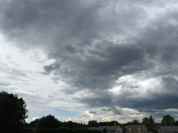
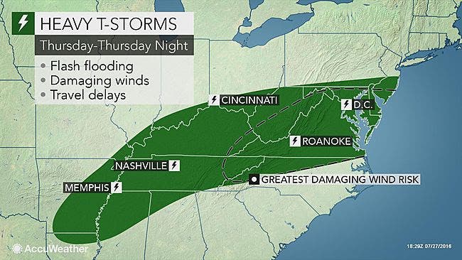
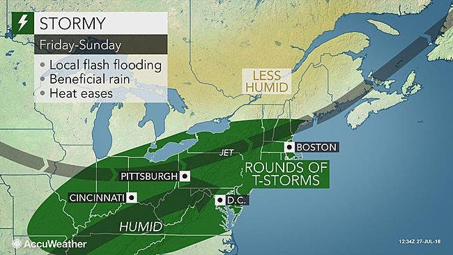
AccuWeather reports the storm system swinging up from the Deep South will bring downpours to the northeastern U.S. and break the back of an extended heat wave.
Find out what's happening in Doylestownfor free with the latest updates from Patch.
Downpours will extend northeastward from the lower Mississippi Valley on Thursday into Thursday night. Locally gusty thunderstorms will erupt along with the drenching downpours from parts of Virginia to Pennsylvania and southern New Jersey during this time, according to an AccuWeather release.
"The exact track of the storm system will be a challenge to predict," according to AccuWeather Senior Meteorologist Brett Anderson.
Find out what's happening in Doylestownfor free with the latest updates from Patch.
Here is what is expected on Thursday:
Here is what is expected on Friday:
Here is the forecast:
Thursday afternoon: Scattered showers and thunderstorms, mainly after 4 p.m. Some of the storms could produce heavy rain. Partly sunny, with a high near 92. Light southwest wind. Chance of precipitation is 30%. New rainfall amounts between a tenth and quarter of an inch, except higher amounts possible in thunderstorms.
Thursday night: Showers and thunderstorms likely, mainly after 1 a.m. Some of the storms could produce heavy rain. Mostly cloudy, with a low around 75. Light south wind. Chance of precipitation is 70%. New rainfall amounts between 1 and 2 inches possible.
Friday: Showers and thunderstorms, mainly before 3 p.m. Some of the storms could produce heavy rain. High near 82. Southeast wind around 10 mph becoming north in the afternoon. Chance of precipitation is 80 percent. New rainfall amounts between 1 and 2 inches possible.
Friday night: A chance of showers and thunderstorms before 8pm. Mostly cloudy, with a low around 67. North wind 5 to 7 mph becoming calm after midnight. Chance of precipitation is 30%. New precipitation amounts of less than a tenth of an inch, except higher amounts possible in thunderstorms.
Saturday: A chance of showers and thunderstorms. Partly sunny, with a high near 85. Calm wind becoming southwest around 5 mph in the afternoon. Chance of precipitation is 30%. New rainfall amounts of less than a tenth of an inch, except higher amounts possible in thunderstorms.
Saturday night: A chance of showers and thunderstorms. Mostly cloudy, with a low around 69. Chance of precipitation is 40 percent. New rainfall amounts between a tenth and quarter of an inch, except higher amounts possible in thunderstorms.
Sunday: A chance of showers and thunderstorms. Cloudy, with a high near 84. Chance of precipitation is 50 percent.
Get more local news delivered straight to your inbox. Sign up for free Patch newsletters and alerts.