Weather
Timeline Of Stormy Weekend Ahead In Eastern PA
Heavy downpours and windy conditions will kick off the first weekend of summer across Eastern Pennsylvania and the Jersey Shore.



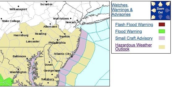
A stormy start to the first weekend of summer is likely across Eastern Pennsylvania and the Jersey Shore, according to forecasters. The National Weather Service has issued a Hazardous Weather Outlook across the Philadelphia region for Saturday, when thunderstorms throughout the afternoon and evening could produce strong winds and torrential downpours.
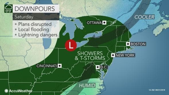
Saturday is likely to be the wettest of the two weekend days, with the steadiest rain extending from central New York state and central Pennsylvania eastward to the upper New Jersey coast, southeastern New York state and western New England, according to AccuWeather.
"June is a popular time for graduations and weddings, but the weather may not cooperate with these plans, other outdoor activities and travel this weekend," AccuWeather Meteorologist Evan Duffey said in a news release.
Find out what's happening in Doylestownfor free with the latest updates from Patch.
The thunderstorms may be heavy at times, and flash flooding is possible, according to AccuWeather.
Here are the alerted areas:
Find out what's happening in Doylestownfor free with the latest updates from Patch.
Here is an AccuWeather map of Saturday's conditions:
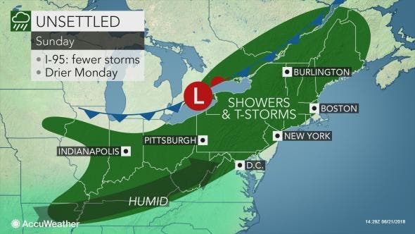
Sunday will be less rainy, with even a chance of sun, AccuWeather predicts. However people should still prepare for "unsettled" conditions.
Here is an AccuWeather map of Sunday's conditions:
And of course, when we all head back to work Monday, the sun comes out.
Here is the forecast:
Today: A chance of showers, mainly after 11am. Cloudy, with a high near 72. East wind around 9 mph. Chance of precipitation is 30%. New precipitation amounts of less than a tenth of an inch possible.
Tonight: Showers likely, mainly after 10pm. Cloudy, with a low around 61. East wind around 9 mph. Chance of precipitation is 60%. New precipitation amounts between a tenth and quarter of an inch possible.
Saturday: A chance of showers before 11am, then showers likely and possibly a thunderstorm between 11am and 2pm, then showers and thunderstorms likely after 2pm. Cloudy, with a high near 82. East wind around 9 mph becoming south in the afternoon. Chance of precipitation is 70%. New rainfall amounts between a quarter and half of an inch possible.
Saturday Night: Showers and thunderstorms likely, mainly before midnight. Patchy fog after 2am. Otherwise, mostly cloudy, with a low around 67. South wind around 6 mph becoming west after midnight. Chance of precipitation is 60%. New rainfall amounts between a tenth and quarter of an inch, except higher amounts possible in thunderstorms.
Sunday: A slight chance of showers between 11am and 2pm, then a chance of showers and thunderstorms after 2pm. Mostly cloudy, with a high near 85. West wind 7 to 14 mph. Chance of precipitation is 50%. New rainfall amounts of less than a tenth of an inch, except higher amounts possible in thunderstorms.
Sunday Night: A chance of showers and thunderstorms before 11pm, then a slight chance of showers. Mostly cloudy, with a low around 65. Chance of precipitation is 30%. New precipitation amounts of less than a tenth of an inch, except higher amounts possible in thunderstorms.
Monday: Sunny, with a high near 82.
Monday Night: Clear, with a low around 57.
Tom Davis photo
Get more local news delivered straight to your inbox. Sign up for free Patch newsletters and alerts.