Weather
Hazardous Weather Outlook in Pennsylvania This Weekend: Is Snow Possible?
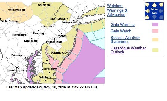
A hazardous weather outlook has been issued in parts of Pennsylvania this weekend, and forecasts have varied. Is snow really possible?


Is snow possible in Pennsylvania this weekend? A hazardous weather outlook has been issued for parts of Pennsylvania this weekend, and forecasts have varied.
But after initially predicting that snow was expected throughout the state on Sunday, the National Weather Service has pulled back from that prediction.
Now, the weather service is saying that as much as 1 inch could fall in the Lehigh Valley and Poconos, and snow could fall elsewhere across the state, including Philadelphia and its suburbs. But much of the southeastern part of the state should escape the kind of snow that would lead to slippery roads and require shoveling.
Find out what's happening in Montgomeryville-Lansdalefor free with the latest updates from Patch.
Here is what is predicted in the western and northern parts of Pennsylvania:
For eastern Pennsylvania, here is what the National Weather Service initially predicted for Sunday night/Monday morning before pulling back its prediction:
Find out what's happening in Montgomeryville-Lansdalefor free with the latest updates from Patch.
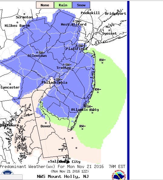
Here is the National Weather Service's modified prediction as of Friday:

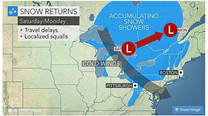
The Northeast as a whole is supposed to get its first major blast of cold air, which will be accompanied by snow and strong winds in some areas, according to an AccuWeather release.
The same storm set to bring the first heavy snow and blizzard conditions of the season to the northern Plains through Friday will turn eastward this weekend.
Cold air wrapping around the storm will slash temperatures by 25-50 degrees Fahrenheit in about 36 hours from the Midwest to the mid-Atlantic states of New Jersey and Pennsylvania. More than half of the temperature plunge can occur in the matter of a few hours, according to AccuWeather.
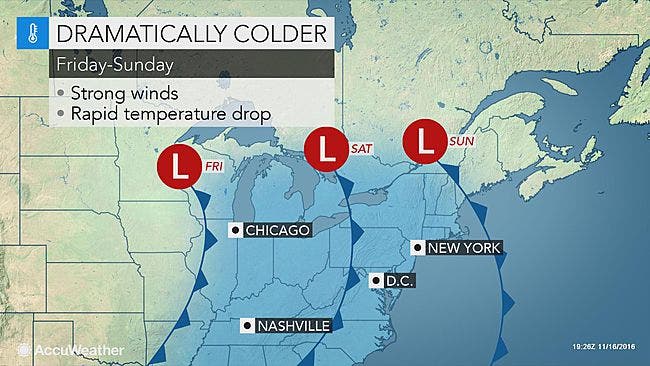
The transition to cold air will be slightly less dramatic along the Interstate 95 corridor of the mid-Atlantic. However, strong winds will mark the approach and passage of the leading edge of the cold air during Saturday evening, according to AccuWeather.
Snow will fall across the Appalachians and eastern Great Lakes as the cold air will catch up with moisture lingering across the area. The snow will begin in some areas as early as Saturday evening, according to AccuWeather.
"While the exact timing of accumulating snow is questionable in situations such as this, we expect snow to develop over West Virginia and expand northward across western Pennsylvania, northeastern Ohio and western New York during Saturday night and Sunday," AccuWeather Senior Meteorologist Brian Wimer said in the release.
Roads will transition from wet to slushy to snow-covered over portions of I-68, I-70, I-80, I-90, the Pennsylvania Turnpike and other highways within and along the western slopes of the Appalachians during the second half of the weekend.
Motorists should be prepared for rapidly changing road conditions and visibility due to the sudden temperature drop, gusty winds and the showery nature of the snow in some locations, according to the release.
Here is the forecast for the region:
- Friday: Sunny, with a high near 65. Calm wind becoming northwest around 5 mph.
- Friday night: Clear, with a low around 43. Calm wind becoming east around 5 mph after midnight.
- Saturday: Sunny, with a high near 64. Light and variable wind becoming south 5 to 10 mph in the morning.
- Saturday night: A chance of showers, mainly between 10pm and 4am. Mostly cloudy, with a low around 38. West wind 11 to 16 mph. Chance of precipitation is 50 percent. New precipitation amounts of less than a tenth of an inch possible.
- Sunday: A chance of showers, mainly after 7am. Partly sunny, with a high near 48. Breezy, with a west wind 16 to 24 mph. Chance of precipitation is 30 percent. New precipitation amounts of less than a tenth of an inch possible.
- Sunday night: A slight chance of rain showers before 1 a.m., then a chance of snow showers. Mostly cloudy, with a low around 31. Chance of precipitation is 20 percent.
Patch file photo
Get more local news delivered straight to your inbox. Sign up for free Patch newsletters and alerts.