Community Corner
Bitter Cold Coming: The Hour-By-Hour Forecast
Forecasters say a harsh arctic outbreak is likely for the holiday weekend.

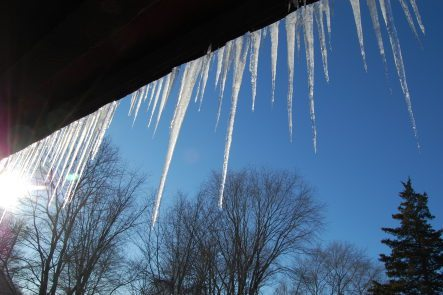
We’re in for some record-breaking cold this holiday weekend, forecasters say.
The last time the Philadelphia region experienced such a stretch of single-digit temperatures in February was in 1996, AccuWeather reports.
See also:
Find out what's happening in Newtownfor free with the latest updates from Patch.
- WEATHER ALERT: Worst Cold In 11 Years Coming to Pennsylvania
- How to Protect Your Pipes as Record-Breaking Cold Approaches
Here are hour-by-hour forecasts for the region, according to the National Weather Service:
Bucks County
Find out what's happening in Newtownfor free with the latest updates from Patch.
- Thursday night: Scattered snow showers, mainly before 7pm. Mostly cloudy, with a low around 8. Wind chill values as low as -8. Blustery, with a northwest wind 17 to 24 mph, with gusts as high as 38 mph. Chance of precipitation is 30%. New snow accumulation of less than a half inch possible.
- Friday: Mostly sunny, with a high near 19. Wind chill values as low as -8. Northwest wind 11 to 18 mph.
- Friday night: Mostly cloudy, with a low around 12. Northwest wind around 5 mph becoming calm in the evening.
- Saturday: Snow showers likely, mainly after noon. Cloudy, with a high near 31. Calm wind becoming southwest 5 to 8 mph in the morning. Chance of precipitation is 60%. New snow accumulation of less than one inch possible.
- Saturday night: Snow showers likely, mainly before midnight. Mostly cloudy, with a low around 7. Blustery. Chance of precipitation is 60%.
- Sunday: Mostly sunny, with a high near 13. Blustery.
- Sunday night: Mostly clear, with a low around 0.
- Monday: Sunny, with a high near 19.
- Monday night: Partly cloudy, with a low around 10.
Montgomery County
- Thursday night: Scattered snow showers before 7pm. Mostly cloudy, with a low around 8. Wind chill values as low as -7. Blustery, with a northwest wind 17 to 24 mph, with gusts as high as 38 mph. Chance of precipitation is 30%. Little or no snow accumulation expected.
- Friday: Mostly sunny, with a high near 19. Wind chill values as low as -8. Northwest wind 13 to 17 mph.
- Friday night: Mostly cloudy, with a low around 12. Northwest wind around 5 mph becoming calm in the evening.
- Saturday: Snow showers likely, mainly after noon. Cloudy, with a high near 31. Calm wind becoming southwest 5 to 8 mph in the morning. Chance of precipitation is 60%. New snow accumulation of less than one inch possible.
- Saturday night: A chance of snow showers. Mostly cloudy, with a low around 7. Blustery. Chance of precipitation is 50%.
- Sunday: Mostly sunny, with a high near 13. Blustery.
- Sunday night: Mostly clear, with a low around 0.
- Monday: Sunny, with a high near 19.
- Monday night: Mostly cloudy, with a low around 11.
Get more local news delivered straight to your inbox. Sign up for free Patch newsletters and alerts.