Community Corner
Heavy Rain, Warm Temps Pose Flooding Threat Wednesday
The National Weather Service has issued a Hazardous Weather Outlook, warning residents of potential flooding Wednesday.

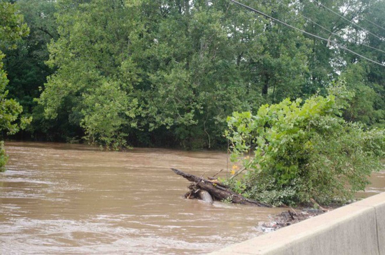
Heavy rain combined with record temperatures could cause flooding throughout the region Wednesday, forecasters are warning.
“The combination of heavy showers and accelerating snowmelt will probably result in scattered minor to possibly moderate small stream flooding and area of poor drainage street flooding Wednesday,” according to a Hazardous Weather Outlook issued Monday morning by the National Weather Service.
Areas along and northwest of I-95 have a “good chance” of getting an inch of rain in six hours on Wednesday.
Find out what's happening in Newtownfor free with the latest updates from Patch.
That, in addition to near record warm temperatures that will melt much of the remaining snow pack, could mean flooding for local creeks and rivers, including the Schuylkill River and the Neshaminy, Perkiomen, Brandywine and Chester creeks.
“If this runoff flooding develops close to the modeled out comes, it could last into late Thursday in a few spots,” the NWS said. However, the primary threat for flooding is Wednesday afternoon and night.
Find out what's happening in Newtownfor free with the latest updates from Patch.
Forecasters say if this “unfolding scenario” continues on the current forecast track, a flood watch will be issued Monday or Tuesday.
Dense fog is also possible Wednesday.
Check back to Patch for updates.
Here is the current forecast:
Today: Showers likely, mainly between 1pm and 2pm. Mostly cloudy, with a high near 54. West wind 7 to 9 mph. Chance of precipitation is 60%. New precipitation amounts between a tenth and quarter of an inch possible.
Tonight: A slight chance of showers before 9pm. Mostly cloudy, with a low around 33. North wind 3 to 5 mph. Chance of precipitation is 20%.
Tuesday: Sunny, with a high near 49. Light and variable wind becoming north around 6 mph in the morning.
Tuesday Night: Showers likely, mainly after 1am. Increasing clouds, with a low around 39. East wind 3 to 6 mph. Chance of precipitation is 60%. New precipitation amounts of less than a tenth of an inch possible.
Wednesday: Showers. The rain could be heavy at times. Areas of fog. High near 62. Southeast wind 9 to 15 mph becoming southwest in the afternoon. Chance of precipitation is 100%. New precipitation amounts between three quarters and one inch possible.
Wednesday Night: A chance of showers, mainly before midnight. Patchy fog before midnight. Otherwise, mostly cloudy, with a low around 40. Chance of precipitation is 40%. New precipitation amounts between a tenth and quarter of an inch possible.
Thursday: Partly sunny, with a high near 46.
Get more local news delivered straight to your inbox. Sign up for free Patch newsletters and alerts.