Politics & Government
Perkiomen Township Among Spots Studied in Groundwater Monitoring Program
Montgomery County Health Department has released its first findings.

The Montgomery County Health Department recently released the first findings from its groundwater-monitoring program.
The program began in the summer of 2005 after a significant drought in the previous year made the health department realize it did not have enough information on groundwater in the county, said Director of Water Quality Management Kyle Schmeck.
“The health department felt we didn’t have enough data, locally, to determine whether we, as a county, were experiencing low water resources,” Schmeck said.
Find out what's happening in Perkiomen Valleyfor free with the latest updates from Patch.
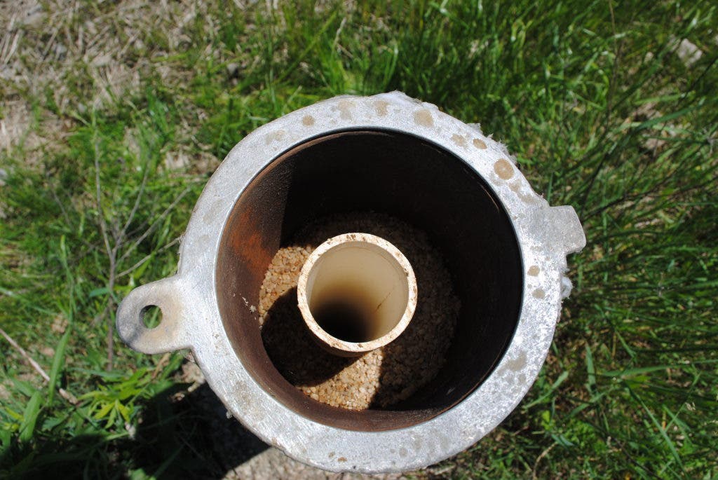
The program now monitors 19 wells in the county, Schmeck said. He said none of the wells are being used and are not influenced by any major withdrawals that could affect the figures.
Some of the towns in the program include Hatfield Borough, Abington Township, Montgomery Township, Whitpain Township, and Perkiomen Township.
Find out what's happening in Perkiomen Valleyfor free with the latest updates from Patch.
Each month, the groundwater is measured in the towns by a probe that is lowered into the well, which buzzes once it touches water, Schmeck said. This allows the county to see how far below the surface the groundwater sits, he said.
By tracking it monthly, the county can get an idea of where the groundwater sits below the surface on average so officials can tell when the water gets lower than normal. That could mean a drought is approaching, Schmeck said.
For example, Schmeck explained that if a well’s average ground water level is 10 feet below the surface, when it drops two feet and is now 12 feet below the surface, the county could issue a drought watch. When it reaches 14 feet, it could be a drought warning, and 16 feet could mean a drought emergency.
Right now, the United States Geological Survey (USGS) has one well in Montgomery County, in Hatfield, to monitor the groundwater levels for the whole county. Schmeck said he hopes this will provide the USGS and the state’s Department of Environmental Protection (DEP) with more information about the groundwater levels throughout the county.
The program has now collected data over the past five years, which is why the information was made public, Schmeck said. Because the sample size is larger, the average is now more accurate than it would have been even a year ago, he said.
“We didn’t want to sit on good information that residents might be interested in,” Schmeck said. “We think the program will be helpful.”
Schmeck said the program is still being worked on and has not made any determinations yet as far as droughts are concerned. He said the Health Department wants to meet with the USGS soon so plans can be drawn and the figures can be analyzed.
For more information and to see the results, visit the program’s website.
Get more local news delivered straight to your inbox. Sign up for free Patch newsletters and alerts.