Neighbor News
A few showers/thunderstorms still in store Wednesday evening, with sunshine Thursday. More showers possible Friday.
A couple of systems will combine to give us showers on Friday, and into the evening. Will it rain on our 4th of July parade and fireworks?

Weather Forecast Discussion for Rhode Island on June 30, 2016
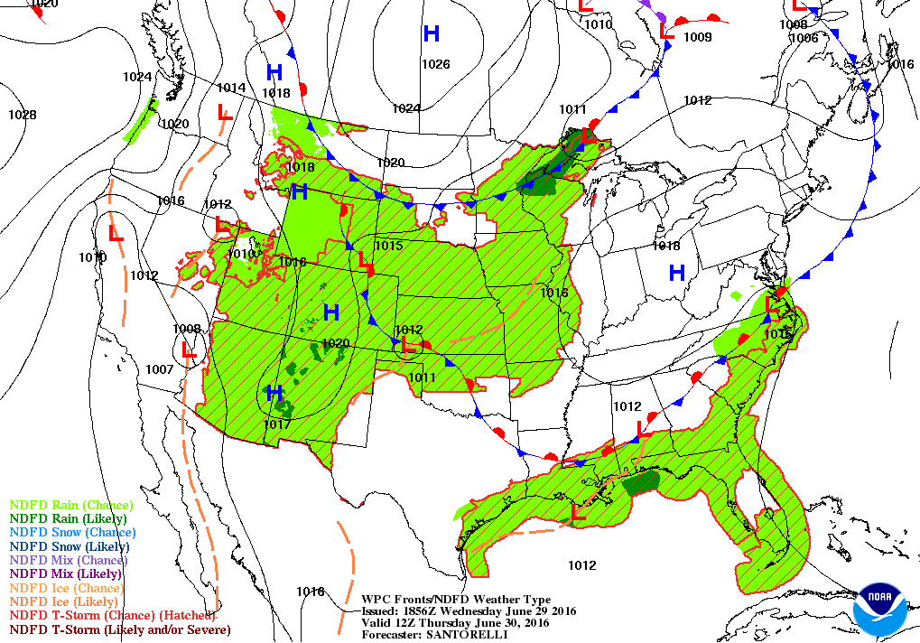
After some morning showers and widely isolated thunderstorms, a cold front still sits over Rhode Island Wednesday afternoon. In fact, the latest radar image shows a few thunderstorms forming just west of Providence, with light rain over Pawtucket as the sun remains out. Also, a few thunderstorms formed over northwest Rhode Island. We will continue to see hit and miss showers and thunderstorms through the rest of the afternoon and early evening.
Once the cold front passes to our east tonight, showers will end by 10 p.m., and skies will become partly cloudy after midnight. We will still see mild temperatures overnight, as lows only fall into the lower to middle 60’s. A large dome of high pressure will move east, giving us drier conditions. It will be sunny and remain warm, as highs reach the middle 80’s. We will continue with partly cloudy skies Thursday night, with lows in the middle 60’s.
Find out what's happening in East Providencefor free with the latest updates from Patch.
By Friday, two different weather systems will come into play. Some moisture from a weak disturbance in the Carolinas will move northward, and be off the Mid-Atlantic coast by Friday morning. Meanwhile, a low pressure system in eastern Canada will sweep a cold front down into the Great Lakes. The two systems will combine forces, giving us partly sunny skies in the morning, with the risk for some showers and thunderstorms by 2 p.m. Friday afternoon. The front arrives by 7 p.m. Friday, increasing our risk for precipitation. Expect highs in the lower 80’s, with lows in the upper 60’s. All precipitation will come to an end by 3 a.m. Saturday morning.
Once we get past early Saturday morning, the weather looks great for the rest of the holiday weekend. We should return to mostly sunny skies by the late morning, with highs in the lower 80’s. A high pressure system will center itself over the Mid-Atlantic by Saturday afternoon, and become quasi-stationary. So, we will keep clear to partly cloudy skies right into Monday night. Daytime highs into the 4th of July will be in the lower to middle 80’s, with lows in the lower 60’s. So, whether it’s the beach, a barbeque, or a fireworks show, all outdoor plans look rather exquisite.
Find out what's happening in East Providencefor free with the latest updates from Patch.
But, what if you have to work this whole weekend? Well, the weather still looks just fine on Tuesday. The American model is being the outcast right now, bringing a low pressure system from Tennessee and moving it straight north. According to the model, we would see showers and thunderstorms. However, the European and United Kingdom models show just a weak low staying south of Southern New England. At this time, I cannot see where the American model even develops this low, much less track it north. So, I will keep Rhode Island dry on Tuesday, with partly to mostly sunny skies and highs in the middle 80’s. Keeping that thought, there might be a chance for a few showers Tuesday night, as the models do seem to agree on a very weak low staying south of Southern New England. We may see mostly cloudy skies with a passing shower for the south coast and Block Island. Lows Tuesday night will be in the middle 60’s. Any lows quickly move out to sea by the mid-morning next Wednesday. We will see increasing sunshine, as drier air moves over us, with highs in the lower to middle 80’s.
First Pitch Forecast (for McCoy stadium, home of the Pawtucket Red Sox):
June 30th vs. Columbus (7:05 p.m.): Partly cloudy, 79.
July 1st vs. Columbus (6:15 p.m.): Mostly cloudy, risk of showers/thunderstorms, 74.
Jim Laurie is a local meteorologist who earned a B.S. in Meteorology at Lyndon State College in Lyndonville, VT. Jim has fifteen years of professional experience, with eight years in the field of marine meteorology.