Weather
RI Weather: Up To 6 Inches Of Snow, Start Times Detailed
The forecast for Thursday night has already worsened.


The first flake hasn't even fallen, but forecasters are already warning of increased snow totals for Thursday night's storm. The first widespread snow of the season will bring up to 6 inches into areas Rhode Island, the National Weather Service shortly after noon. The coastal areas will get 2-3 inches.
Snow is expected to start falling some time around 5 to 6 p.m. See the map below for when to expect it near you. The precipitation will then change overnight into everyone's favorite: A wintry mix of sleet and freezing rain, with some gusty winds to boot.
Rhode Island is expected to get snow down until the coast, lightening up around I-95. The most snow is expected in the northern half of the state, while the southernmost region can expect up to 2 inches of rain. For you commuters, the Greater Boston area is looking at 1-2 inches of snow, with some slush. See the precipitation maps below, courtesy of the National Weather Service.
Find out what's happening in Newportfor free with the latest updates from Patch.
There is the always the possibility of school delays when it gets messy. Stick with Patch throughout the day for the latest announcements.
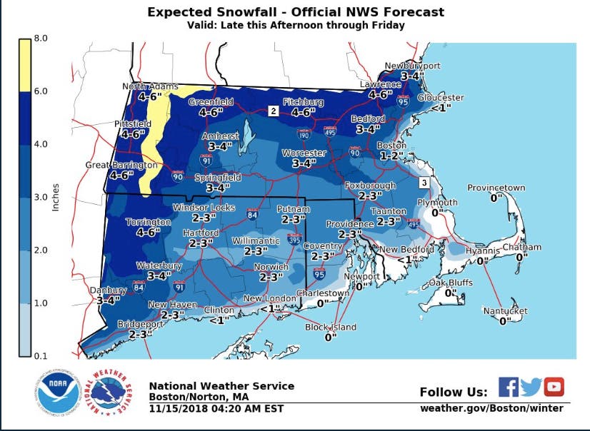

There will be a winter storm warning across across the northern portion of Rhode Island and a winter weather advisory for the rest of the state from 7 p.m. Thursday to 7 p.m. Friday.
Find out what's happening in Newportfor free with the latest updates from Patch.
Thursday started off with a serious winter chill. Temperatures are expected to sit in the 30s all day. The wind won't do any favors, either. The wind gusts south of 95 will get between 30-50 miles per hour, with the worst of that being on Block Island.
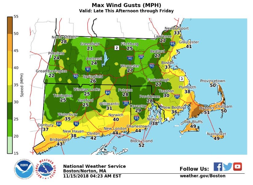
Photo by Jenna Fisher, Patch
Get more local news delivered straight to your inbox. Sign up for free Patch newsletters and alerts.