Weather
RI Weather: Spring Nor'easter On Deck Tonight, Tomorrow
A powerful storm will hit late Thursday night and intensify into early Friday morning, but don't worry - no snow is expected in Rhode Island


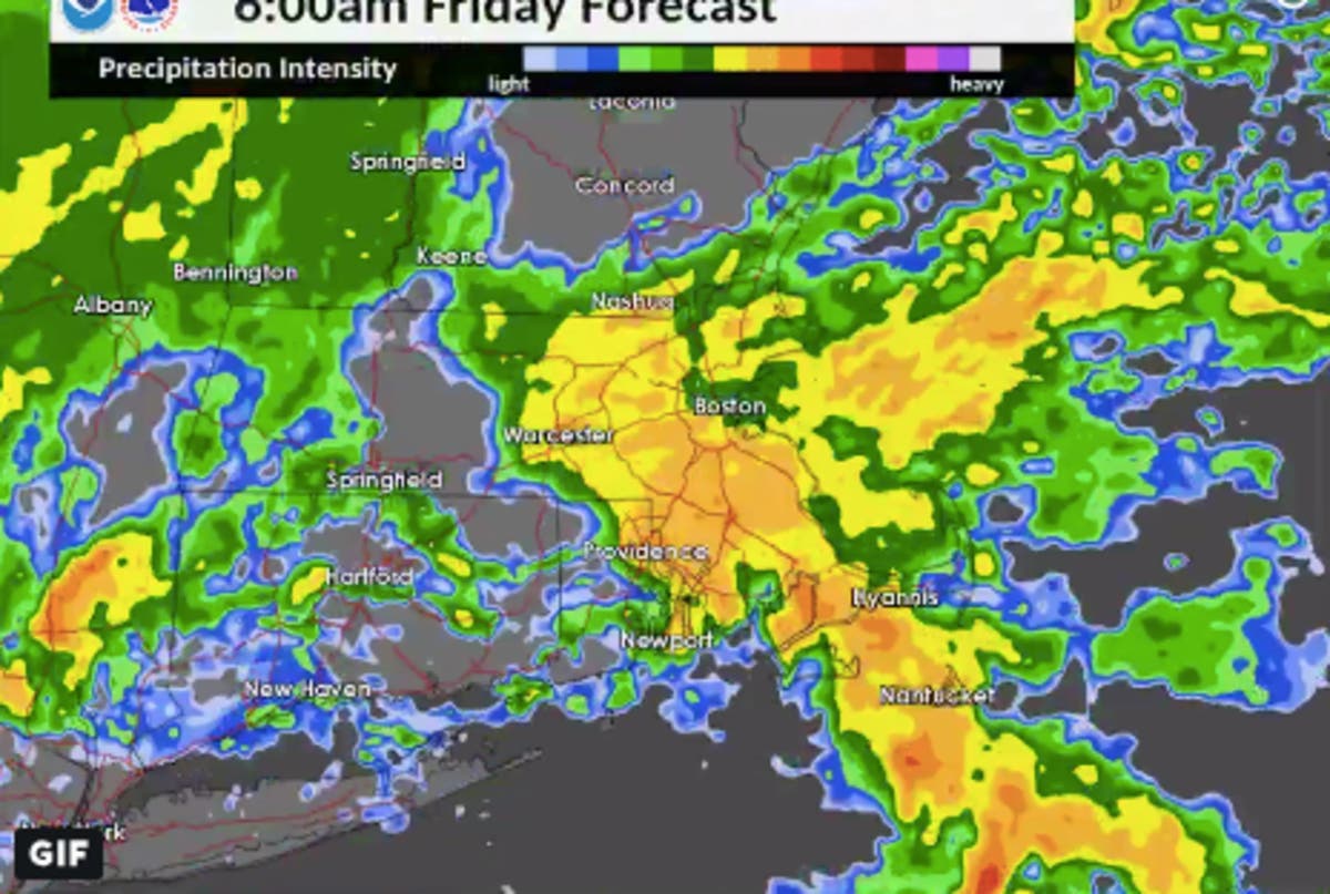
A nor'easter is expected to expected to start late Thursday evening and intensify overnight into late Friday morning. Fans of spring can relax - Rhode Island is looking at just rain - but it will be a powerful storm to kick off the season.
The storm is set to bring heavy rain and strong winds to the region, with some snow in high-elevation areas but likely to be absent in Rhode Island. The area is looking at more than an inch of rain.
"The exact track of the storm, say right along the coast or a bit farther inland, will determine the rain and snow line and where the heaviest accumulations will be over the interior Northeast," AccuWeather senior meteorologist Brian Wimer said.
Find out what's happening in Newportfor free with the latest updates from Patch.
You can see the timing of the storm in the simulated radar below:
Much of the day is dry. Save fore a few light showers mainly across western MA and CT. The bulk of the heavier rain is overnight: pic.twitter.com/AzaTY0bHSE
— NWS Boston (@NWSBoston) March 21, 2019
-1553175740-8204.jpg)
Much of Thursday will be dry until the rain starts in the late evening, though there is a chance of afternoon rain. It will also be mild - about 45-50 degrees.
Find out what's happening in Newportfor free with the latest updates from Patch.
The rain isn't expected to freeze overnight, meaning we've finally got a storm we won't have to be looking at the aftereffects of for days.
Providence-area forecast via NWS Boston
Thursday night - Rain, mainly after 10pm. The rain could be heavy at times. Low around 39. East wind 7 to 9 mph. Chance of precipitation is 100%. New precipitation amounts between 1 and 2 inches possible.
Friday - Rain likely, mainly before 8am, then a chance of showers after 2pm. Patchy fog before noon. Otherwise, cloudy, with a high near 49. Southeast wind 5 to 10 mph becoming west in the afternoon. Winds could gust as high as 24 mph. Chance of precipitation is 60%. New precipitation amounts between a tenth and quarter of an inch possible.
Friday night - A chance of rain showers before 3am, then scattered snow showers. Mostly cloudy, with a low around 33. West wind 10 to 14 mph, with gusts as high as 36 mph. Chance of precipitation is 40%. New snow accumulation of less than a half inch possible.
Saturday - Partly sunny, with a high near 46. Northwest wind 15 to 18 mph, with gusts as high as 38 mph.
Saturday night - Mostly clear, with a low around 29. Northwest wind 8 to 13 mph.
Sunday - Sunny, with a high near 53. West wind 8 to 10 mph.
Sunday night - Partly cloudy, with a low around 37. West wind 5 to 8 mph.
Monday - A chance of rain after 2pm. Partly sunny, with a high near 51. West wind 3 to 8 mph. Chance of precipitation is 30%.
Monday night - A chance of rain before 7pm. Partly cloudy, with a low around 28. West wind around 7 mph, with gusts as high as 20 mph. Chance of precipitation is 30%.
Tuesday - Mostly sunny, with a high near 40. North wind around 7 mph.
Tuesday night - Partly cloudy, with a low around 24. North wind around 6 mph.
Wednesday - Mostly sunny, with a high near 42. North wind around 7 mph.
Get more local news delivered straight to your inbox. Sign up for free Patch newsletters and alerts.


