Community Corner
Bike To The Beach: The Route From Boston & From Woonsocket
A Portsmouth Patch reader wondered about the route through Portsmouth. Patch asked Bike Newport's Bari Freeman, and she provided the lowdown

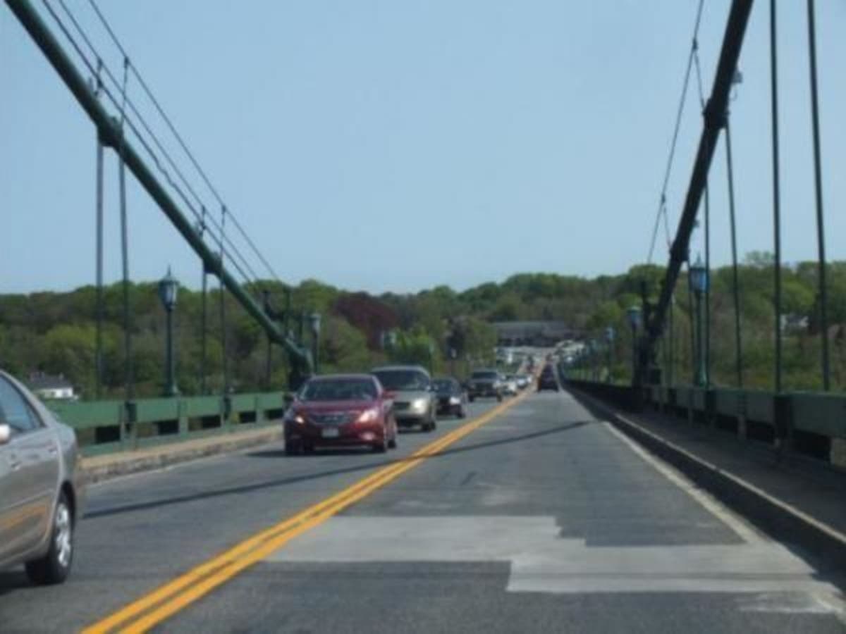
PORTSMOUTH, RI—Saturday's Bike to the Beach event starts either in Boston (The Century Ride) or Woonsocket (The Half Century). On the way to Woonsocket, the route winds through Franklin, Mass., hops on the Blackstone Valley Bikeway to Pawtucket, takes Alfred Stone Road and the Boulevard through the East Side to Gano Street, which turns into Tockwotton Street, picks up the East Bay Bike Path to Hope Street in Bristol and then spins over the Mount Hope Bridge.
Portsmouth police expect the first bikers to arrive on Aquidneck Island around 11:30 a.m.
After Middletown police came up with a traffic alert showing the route, approximate times, and telling motorists to avoid the Middletown leg of the trip between noon and 3 p.m., a Portsmouth reader wanted to know how to avoid the route in Portsmouth. We asked Bari Freeman of Bike Newport, and she came up with the information. The riders will have a police escort when they come off the Mount Hope Bridge. They're going through Portsmouth, Middletown and part of Newport to Hibernian Hall on Wellington Avenue, and they'll follow these directions:
Find out what's happening in Portsmouthfor free with the latest updates from Patch.
| Left | Slight left onto Boyds Ln |
Find out what's happening in Portsmouthfor free with the latest updates from Patch.
Right
Turn right onto Park Ave
Left
Turn left onto Aquidneck Ave
Left
Turn left onto Atlantic Ave
Right
Atlantic Ave turns right and becomes Water St
Right
Slight right onto Church Ln
Left
Slight left onto RI-138 S
Right
Turn right onto Middle Rd
Left
Turn left onto Union St
Right
Turn right onto RI-138
Left
Turn left onto Sandy Point Ave
Right
Turn right onto Wapping Rd
Left
Turn left onto Old Mill Ln
Right
Turn right onto Indian Ave
Straight
Continue onto Hanging Rock Rd
Straight
Continue onto Paradise Ave
Left
Turn left onto Tuckerman Ave
Left
Turn left onto Purgatory Rd
Right
Slight right onto Crescent Rd
Left
Turn left to stay on Crescent Rd
Left
Turn left onto Aquidneck Ave
Left
Turn left onto S Rhode Island Ave
Right
Turn right onto Bushy Park Terrace
Left
Turn left onto Annandale Rd
Left
Turn left onto Narragansett Ave
Right
Turn right onto Ochre Point Ave
Right
Turn right onto Ruggles Ave
Left
Turn left onto Bellevue Ave
Right
Turn right onto Coggeshall Ave
Left
Turn left onto Ocean Ave
Straight
Continue onto Castle Hill Ave
Right
Turn right to stay on Castle Hill Ave
Left
Turn left onto Ridge Rd
Left
Turn left onto Harrison Ave
Left
Turn left to stay on Harrison Ave
Right
Turn right to stay on Harrison Ave
Left
Turn left onto Halidon Ave
Straight
Continue onto Wellington Ave
Left
Turn left onto Richmond St
End
End of route (Hibernian Hall)
Of course, everyone hopes people will ride in the event or donate.
The Bike Newport team is donating all the money it raises to help Jayden Rodriguez's family pay his medical bills. Jayden is the 7-year-old Newport boy who was hurt last Friday in a collision with a car while he was riding his bike.
Related Story: Bikers Stick Together For 7-Year-Old Hurt In Newport Accident Friday
Here is the entire route from Boston:
Bike to the Beach NE - 2017 Route
685 Commonwealth Ave., Boston, MA 02215
1 Head south on St. Marys St. toward Commonwealth Ave. 0.1 mi
2 Turn left onto Mountfort St. 256 ft
3 Mountfort St. turns slightly right and becomes Park Dr. 0.3 mi
4 Turn right onto Riverway 1.1 mi
5 Continue onto Jamaicaway 0.5 mi
6 Turn right onto Highland Rd/Willow Pond Rd 46 ft
7 Turn left to stay on Emerald Necklace 0.3 mi
8 Turn left to stay on Emerald Necklace 20 ft
9 Turn right to stay on Emerald Necklace 0.7 mi
10 Turn left onto Francis Parkman Dr. 30 ft
11 Turn right onto Arborway 0.3 mi
12 Turn right toward Centre St. 131 ft
13 Turn left at May St. 105 ft
14 Turn right onto Centre St. 1.0 mi
15 Slight right onto VFW Pkwy. 0.7 mi
16 At the traffic circle, continue straight to stay on VFW Pkwy. 2.7 mi
17 Turn right onto MA-109/Bridge St. 1.0 mi
18 Slight left onto Ames St. 0.7 mi
19 Continue onto Court St. 0.2 mi
20 Turn right onto Highland St. 1.0 mi
21 Turn right onto Washington St. 0.5 mi
22 Turn right onto Gay St. 1.1 mi
23 Turn left onto Milk St. 0.2 mi
24 Turn right onto Clapboardtree St. 1.5 mi
25 Turn left onto Pond St. 0.3 mi
26 Turn left onto Oak St. 1.5 mi
27 Turn right onto Brook St. 0.6 mi
28 Turn left onto North St. 0.3 mi
29 Turn right to stay on North St. 0.5 mi
30 Turn right onto Northwood Dr. 0.3 mi
31 Turn left onto Homeward Ln. 0.6
32 Continue onto High St. 0.6 mi
33 Continue onto Elm St. 0.9 mi
34 Turn left onto South St. 0.3 mi
35 Turn left onto MA-27 S/South St. 0.1 mi
36 Turn right onto South St. 1.6 mi
37 Continue onto Seekonk St. 0.7 mi
38 Turn right onto Cleveland St. 1.0 mi
39 Turn right onto Holbrook St. 0.8 mi
40 Turn right onto MA-115 N 0.1 mi
41 Slight left onto Holbrook St. 0.4 mi
42 Continue onto Turner St. 0.3 mi
43 Turn left onto Dean St. 0.4 mi
44 Continue onto Myrtle St. 0.5 mi
45 Turn right onto Miller St. 1.5 mi
46 Turn right to stay on Miller St. 0.7 mi Franklin, MA
47 Head southwest on Pleasant St. toward Country Way 1.3 mi
48 Turn left onto Hillside Rd. 0.3 mi
49 Turn right onto Emmons St. 0.3 mi
50 Turn left onto Main St. 0.2 mi
51 Turn right onto Cottage St. 0.4 mi
52 Turn left onto Wachusett St. 0.2 mi
53 Turn right onto Arlington St. 0.2 mi
54 Continue onto Washington St. 1.3 mi
55 Turn right onto Washington St. 0.2 mi
56 Turn left onto Hunters Run 0.5 mi
57 Turn left onto Stage Harbor Rd. 453 ft
58 Turn right onto Forest St. 0.9 mi
59 Continue onto Williams St. 0.7 mi
60 Turn right onto West St. 2.5 mi
61 Continue onto Wrentham Rd. 1.6 mi
62 Turn right onto Wrentham St. 404 ft
63 Turn left onto MA-136 S 0.7 mi
64 Slight left onto Bellingham St. (Entering Rhode Island) 0.2 mi
65 Continue onton Wood Ave. 0.7 mi
66 Turn right onto Cass Ave. 292 ft
67 Turn left onto Cumberland St. 0.1 mi
68 Turn right onto Hamlet Ave 0.1 mi
69 Turn left onto Davison Ave 0.1 mi 2-198 Davison Ave, Woonsocket, RI 02895
70 Head south on Davison Ave. 0.1 mi
71 Turn left toward Blackstone River Bikeway 161 ft
72 Turn right toward Blackstone River Bikeway 23 ft
73 Continue onto Blackstone River Bikeway 4.4 mi
74 Slight right to stay on Blackstone River Bikeway 1.5 mi
75 Turn right to stay on Blackstone River Bikeway 433 ft
76 Turn left to stay on Blackstone River Bikeway 0.2 mi
77 Turn left to stay on Blackstone River Bikeway 2.2 mi
78 Turn left to stay on Blackstone River Bikeway 0.5 mi
79 Slight right to stay on Blackstone River Bikeway 0.6 mi
80 Slight right to stay on Blackstone River Bikeway 0.4 mi
81 Turn right onto Silva St. 0.1 mi
82 Turn left onto Titus St. 0.1 mi
83 Turn right onto Chase St. 0.1 mi
84 Turn left onto Meeting St. 338 ft
85 Turn right onto Broad St. 0.1 mi
86 Turn left onto High St. 1.0 mi
87 Turn left onto Charles St. 0.1 mi
88 Turn right onto Roosevelt Ave 0.8 mi
89 Continue onto Roosevelt Ave EXD 0.1 mi
90 Continue onto Taft St. 0.6 mi
91 Turn right onto Bowles Ct. 285 ft
92 Turn left onto Pleasant St. 0.6 mi
93 Continue onto Alfred Stone Rd. 0.4 mi
94 Turn left onto Blackstone Blvd. 1.7 mi
95 Continue onto Butler Ave. 0.3 mi
96 Turn right ont S Angell St. 0.3 mi
97 Turn left onto Gano St. 0.8 mi
98 Gano St. turns right and becomes Tockwotton St. 259 ft
99 Turn left to stay on Tockwotton St. 52 ft
100 Turn right onto E Bay Bike Path 0.6 mi
101 Continue onto 1st St. 0.2 mi
102 Slight right onto E Bay Bike Path 7.8 mi
103 Slight right to stay on E Bay Bike Path 2.0 mi
104 Turn right to stay on E Bay Bike Path 0.6 mi
105 Slight left onto E Bay Bike Path 1.2 mi
106 Slight left onto E Bay Bike Path 1.7 mi
107 Turn leftt toward Hope St. 141 ft
108 Turn right onto Hope St. 1.5 mi
109 Continue onto Ferry Rd. 0.9 mi
110 Continue onto RI-114 S/Mt Hope Bridge 1.1 mi
111 Slight left onto Boyds Ln 1.0 mi
112 Turn right onto Norseman Dr. 0.3 mi
113 Turn left onto Park Ave. 167 ft
114 Turn right onto Aquidneck Ave. 0.2 mi
115 Turn left onto Atlantic Ave. 0.2 mi
116 Atlantic Ave. turns right and becomes Water St. 1.0 mi
117 Turn left onto Emmanuel Dr. 0.1 mi
118 Turn right onto Peggy Ln. 0.1 mi
119 Turn right onto Immokolee Dr. 0.3 mi
120 Turn left onto RI-138 S 0.6 mi
121 Turn right onto Middle Rd. 2.3 mi
122 Turn left onto Union St. 0.1 mi
123 Turn right onto RI-138 0.3 mi
124 Turn left onto Linden Ln. 0.7 mi
125 Turn right onto Glen Farm Rd. 0.3 mi
126 Turn right onto Sandy Point Ave. 0.2 mi
127 Turn left onto Wapping Rd. 1.9 mi
128 Turn left onto Old Mill Ln. 0.7 mi
129 Turn right onto Indian Ave. 1.9 mi
130 Continue onto Hanging Rock Rd. 1.2 mi
131 Continue Paradise Ave. 0.1 mi
132 Continue onto Purgatory Rd. 0.8 mi
133 Turn left onto Ri-138A W 1.4 mi
134 Turn left onto Bellevue Ave. 2.2 mi
135 Turn right onto Coggeshall Ave. 344 ft
136 Turn left onto Ocean Ave. 3.7 mi
137 Continue onto Castle Hill Ave. 285 ft
138 Turn right to stay on Castle Hill Ave. 0.4 mi
139 Turn left onto Harrison Ave. 1.3 mi
140 Continue onto Beacon Hill Rd. 0.2 mi
141 Continue onto Brenton Rd. 0.2 mi
142 Continue onto Halidon Ave. 0.3 mi
143 Continue onto Wellington Ave. 0.5 mi
End at Hibernian Hall.
Get more local news delivered straight to your inbox. Sign up for free Patch newsletters and alerts.