Health & Fitness
In Their Own Words: Setting Boundries
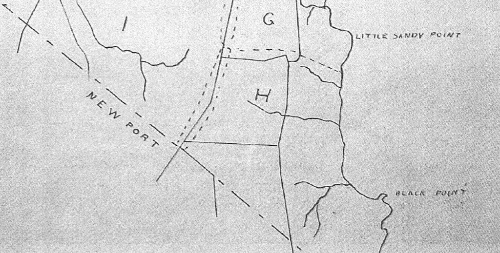
Setting the line between Newport and Portsmouth was important to the early settlers. An early document from the Portsmouth Historical Society collections shed light on how the marking was done.
Do you know where the boundary between Portsmouth and Newport is today? Trick question. There hasn’t been a Newport/Portsmouth boundary since 1743. Aquidneck Island was divided about in half between Newport and Portsmouth after Newport’s founding in 1639. Middletown was carved out of Newport’s half of the island and became a town on its own in 1743.
One of the documents in the collection of the Portsmouth Historical Society is an account of how the boundary between Portsmouth and Newport was marked again in 1666. Like a number of our documents, it is a “true copy” of an earlier recorded document. The document includes a note saying that it is a “true copy extracted out of these records belonging to the Town of Portsmouth and compared". Mr. John Anthony signed the document and he was Clerk in the 1680s so this particular copy dates from that time.
According to the document, John Albro (for Portsmouth) and William Dyer (for Newport) were appointed to lay a line of division between the towns. They started in the northeastern corner and marked the boundaries by labeling trees with N on the Newport side and P for the Portsmouth side.
Find out what's happening in Portsmouthfor free with the latest updates from Patch.
I believe that the 1666 boundary marking is a remarking of the border. Digging into old Aquidneck Island histories *, it is clear that there was a delegation from each of the two towns (Easton and Porter from Newport and Jeffreys and Sanford for Portsmouth) to mark the official boundaries by November of 1640. They started at the Sakonnet River south of William Brenton’s land (which was around the Glen area) and marked trees in a straight line toward the “sea” using a brook and a “hunting wigwam” as part of the landmarks.
What can we learn about life for early residents of Portsmouth from this document. Borders, boundaries and property lines were very important to them. Logically the borders needed to be remarked as trees fall and local landmarks change. There may have been many more such boundary markings. Today we may mark town borders at East and West Main Road, but we don’t seem as interested in marking the boundaries across the island.
Find out what's happening in Portsmouthfor free with the latest updates from Patch.
Are you interested in reading the full transcription? The transcriptions will be available on the Portsmouth Historical Society website: www.portsmouthhistorical.com Click on the “transcriptions” heading.
*Bayles History of Newport County,1888.