Weather
Middle Tennessee Weather: 'A Doozy of a Storm System' Rolls Through This Weekend
The National Weather Service says heavy winds and perhaps a wintry mix is in the cards for the Nashville area this weekend.


OLD HICKORY, TN — "A doozy of a storm system" is expected to roll into the Nashville area Friday, bringing storms Saturday and perhaps a wintry mix Sunday morning.
After brutally cold temperatures Thursday — highs aren't expected to get out of the 20s and lows will be in the mid-teens — a front pushes in Friday, bringing showers and south winds, which will push Saturday's highs into the unseasonably warm mid-60s. But with that warm air comes a chance of severe weather.
"We could see a few severe storms (damaging winds main threat) on Saturday afternoon and night, mainly south of I-40 and west of I-65," the National Weather Service office in Nashville posted on Facebook. Winds are currently forecast for 15 to 20 mph with gusts up to 30 mph on Saturday.
Find out what's happening in Nashvillefor free with the latest updates from Patch.
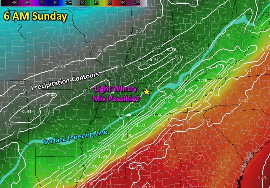
After the front passes, cold air rushes back in, dropping Saturday night's lows down into the upper 20s, nearly 40 degrees below the forecast highs. And, as is typical in the early part of winter in this part of the world, if the cold air arrives while the moisture is still sticking around, there's a chance for some frozen precipitation.
The current forecast calls for rain to change to a rain and snow mix after midnight Saturday with a good chance of flurries throughout the day Sunday, as highs struggle to crack freezing.
Find out what's happening in Nashvillefor free with the latest updates from Patch.
"It's way too early to know specifics on if this will even occur at all, start times, or accumulations. Right now we're just saying the potential exists, and we'll be following it closely for the next several days," the NWS wrote.
Images via National Weather Service
Get more local news delivered straight to your inbox. Sign up for free Patch newsletters and alerts.