Weather
Much Of Texas To Be Hit With African Saharan Dust This Weekend
Particles in the Austin air Friday, Saturday could measure 2.5 micrometers in size, but the dust makes for stunning light-nuanced sunsets.


AUSTIN, TX — Texas residents with respiratory problems may want to limit their time outdoors this weekend as an unusually large plume of dust from Africa's Sahara Desert expected to blow in from across the Atlantic Ocean, potentially wreaking havoc with those suffering from breathing ailments.
Don't believe us? Then check out the NASA composition maps illustrating the massive reach of the approaching dust cloud, shown on Thursday as it stretched from the West African coast to the western Caribbean making its inexorable path for Texas.
The emergence of such desert plumes aren't unusual this time of year in Texas. The Weather Channel said this latest one was located over the Yucatan Peninsula in Mexico on Wednesday morning, and spread to the Texas Gulf Coast on Thursday. By the weekend, it's expected to create hazy conditions late, the t another plume of dust located over Mexico's Yucatan Peninsula on Wednesday morning was expected to spread towards the Texas Gulf Coast by Thursday. This may create more hazy conditions late this week, according to the National Weather Service in Houston.
Find out what's happening in Austinfor free with the latest updates from Patch.
The Texas Commission on Environmental Quality (TCEQ) considers African dust to be a pollutant that will result in decreased air quality. Particles in the air in Austin on Friday and Saturday could measure 2.5 micrometers in size, which according to the Environmental Protection Agency poses a moderate health concern for a very small number of people with respiratory problems, the Weather Channel noted.
People affected with respiratory ailments should limit their time outdoors, officials said.
Find out what's happening in Austinfor free with the latest updates from Patch.
But the news isn't all bad, the Weather Channel reports. Ground-level ozone, which forms when chemical compounds interact with the sun, is lower on days with African dust, since the air masses originate out of the clean Gulf of Mexico and Atlantic Ocean, the channel reported. Chances for tropical cyclone development are also lower because the dry air mass makes it harder for storms to form, officials added.
And then there's the aesthetics created by the plume. The visiting dust makes for a stunning evening sunset, what with the red-orange dust's interplay with the sky's coloration as it emits light from the sun in a manner that can be quite mesmerizing.
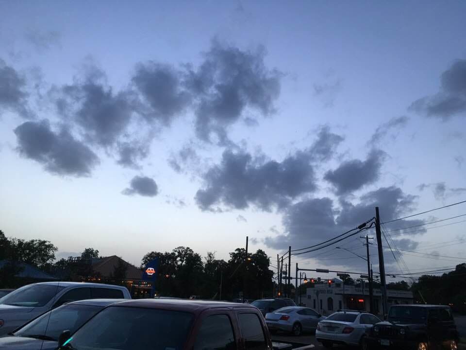
Our vantage point at sunset Friday, June 29, 8:37 p.m., wasn't optimal. But the clouds that evening took on a stark, dark gray coloration even while no rainfall was forecast. This was in the West Campus area.
We found a video on Saharan dust that explains it in greater detail:
Get Patch's Daily Newsletter and Real Time News Alerts. Or, if you have an iPhone, download the free Patch app.
>>> Top photo: Saharan dust blowing off Northwest Africa: This is an image of dust storms taken by NASA's SeaWiFS satellite, taken on Feb. 28, 2000. Credit: NASA. Photos of clouds by Tony Cantú/Patch staff
Get more local news delivered straight to your inbox. Sign up for free Patch newsletters and alerts.