Weather
Storms Lead To Flood Warnings, Rescues Throughout Central Texas
Emergency crews were kept busy early Saturday with rescues, including one involving wedding party of 61 people trapped amid rising water.


CENTRAL TEXAS — The National Weather Service early Saturday allowed flood warnings for Travis and Williamson counties to expire, but heavy overnight rain left precarious conditions on the ground in their wake.
In Pflugerville, portions of two major arteries — the 2700 block of Kelly Lane, 900 block of Old Austin Hutto Road, 1600 East Pecan — were closed amid heavy rain overnight before being reopened. Yet a flood warning remains in effect for the San Gabriel River near Georgetown, which is expected to reach major flood stage by Saturday afternoon, Williamson County Emergency Services officials said, noting the waterway is expected to reach major flood stage.
County officials evacuated residents living along the river not expected to fall below flood stage until Sunday morning, officials said.
Find out what's happening in Austinfor free with the latest updates from Patch.
Williamson County officials closed all roads leading into San Gabriel Park due to the namesake river's flooding. Residents needing to drop off or pick up a dog from the county's Canine Corral shelter were being allowed to enter the park off Chamber Way, urged to then consult with officers stationed at the barricade as to their travel plans.
All roads going into San Gabriel Park are closed due to river flooding. People needing to drop off or pick up a dog from the @wilcopets Canine Corral will be allowed to enter the park off Chamber Way & tell the PD at the barricade you are going to the Canine Corral. pic.twitter.com/HR6V9wq4j6
— Williamson County (@wilcogov) September 22, 2018
Austin wasn't spared from the ravages of nature. Austin Fire Department crews on Saturday morning rescued a woman who was trapped inside her car amid high water along the 10000 block of Gregg Lane in Manor. Steck Avenue was closed after being deluged with high water under MoPac Boulevard (Loop 1) until it was later reopened, officials said.
Find out what's happening in Austinfor free with the latest updates from Patch.
And Austin Fire and Manor Fire have just successfully rescued female driver from high water in the 10000 Blk of Gregg Lane. She is being evaluated by @ATCEMS pic.twitter.com/FkdGgiQsJF
— Austin Fire Info (@AustinFireInfo) September 22, 2018
While the storm system moved toward the northeast later on Saturday — allowing some flood warnings to expire — its aftermath led to rescues from high water, making for a busy morning among emergency crews. Liberty Hill, Leander, Cedar Park and Georgetown firefighters, at times aided by yhe StarFlight medical helicopter, assisted in several rescues.
The Austin Fire Department helped out with later evacuations, including the rescue of more than 60 wedding party members at the Casa Rio de Colores venue, 1130 County Road 279 in Liberty Hill, who became trapped amid high water. Some of the attendants climbed trees to escape the rising water, requiring rescue from emergency crews, according to the Austin Fire Department. Others got to higher ground, and were evacuated later, officials said.
Re update Casa Rio de Colores. 61 people from wedding party were initially trapped. Some were in trees and required rescue. Others were able to get to higher ground and were evac’d later. Wilco Fire Marshal’s Office coordinated efforts 1/2
— Austin Fire Info (@AustinFireInfo) September 22, 2018
2/2 Liberty Hill, Leander, Cedar Park and Georgetown Fire along with Starflight assisted in initial rescues and Austin Fire and Texas Task Force 1 helped with later evacuations. Follow up with Wilco Fire Marshal’s office for any further info
— Austin Fire Info (@AustinFireInfo) September 22, 2018
If you doubt the impact of the powerful storm that descended as many of you slept, take a look at the banks of the Trinity River in the Saturday morning aftermath. A Twitter user posted the photo later re-tweeted by the Texas Storm Chasers:
Checking out the Trinity River this morning after the rain storm we got all day yesterday. @TxStormChasers #txwx #Texas #dfw #dallas pic.twitter.com/LTHmKHoLZh
— _efr (@eightyfr) September 22, 2018
If that doesn't convince you, look at this photo shared by the Texas Storm Chasers on Facebook. The image shows an patrol vehicle submerged in water in Ellis County, a city 25 miles southwest of Dallas into which the storm system later extended.
"Even experienced drivers can get unexpectedly caught in flood waters, the caption reads. "According to the person who sent us this photo, this Midlothian police vehicle was attempting to turn around before it was caught up in high water. They tell us that the officer was not injured."
Several low-water crossings remain closed throughout the Austin area, as shown on atxfloods.com. Among them: 45th Street at Waller Creek; Bluff Springs Road at Onion Creek; Joe Tanner at Williamson Creek; Old Bee Caves at Williamson Creek; and River Plantation at Onion Creek.
With more rain expected into the weekend and through next week, the region is not out of the climactic woods yet. Emergency officials at various agencies are invoking again the mantra of "Turn Around, Don't Drown." More than mere slogan, the pithy message alerts to the importance of not driving over high accumulated water on area roadways.
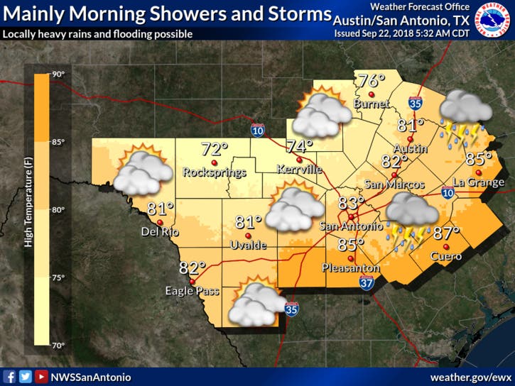
Map via National Weather Service
Often, drivers misjudge the depth of water encountered on roadways or the strength of its currents — sometimes with tragic consequences. So again: Turn Around, Don't Drown.
With more rain expected this weekend and into next week, remember “Turn Around, Don’t Drown” pic.twitter.com/bm1m4l1Pvm
— Austin Fire Info (@AustinFireInfo) September 22, 2018
And there's no rest for the weary as it relates to emergency crews in the storms' aftermath. Fire departments in Austin and the surrounding areas throughout Travis and Williamson counties continue to be dispatched to storm-related calls throughout the region Saturday morning, officials noted.
Austin and surrounding departments in Travis and Williamson County continue to work storm related calls this morning. Earlier this morning Austin Fire assisted in Liberty Hill where 50 people were trapped by rising water at overnight wedding venue. Casa Rio de Color pic.twitter.com/d4uygVxy1k
— Austin Fire Info (@AustinFireInfo) September 22, 2018
It's been an especially wet September, with a recent 15-day streak of continuous rainfall briefly broken only to return. But nature's fury will lessen considerably in the coming days, with decreasing chances for rain throughout the region. Here's the weather outlook from the National Weather Service through Friday, Sept. 28:
Saturday: Mostly cloudy, with a high near 81. North northwest wind 5 to 10 mph. Tonight, mostly cloudy, with a low around 68. Northwest wind around 5 mph.
Sunday: A 20 percent chance of showers and thunderstorms. Mostly cloudy, with a high near 85. Northwest wind around 5 mph. Sunday night mostly cloudy, with a low around 70. North wind around 5 mph becoming calm after midnight.
Monday: A 20 percent chance of showers and thunderstorms. Partly sunny, with a high near 88. Calm wind becoming southwest around 5 mph in the afternoon. Monday night will be partly cloudy, with a low around 71. South wind around 5 mph.
Tuesday: A 30 percent chance of showers and thunderstorms. Partly sunny, with a high near 88. South wind 5 to 10 mph. Tuesday night calls for a 20 percent chance of showers and thunderstorms. Mostly cloudy, with a low around 72. South southeast wind around 5 mph.
Wednesday: A 40 percent chance of showers and thunderstorms. Mostly cloudy, with a high near 85. Southwest wind around 5 mph becoming southeast in the afternoon. By nightfall, there will be a 40 percent chance of showers and thunderstorms. Mostly cloudy, with a low around 70.
Thursday: A 50 percent chance of showers and thunderstorms. Mostly cloudy, with a high near 84. Thursday night will bring a 30 percent chance of showers and thunderstorms. Mostly cloudy, with a low around 69.
Friday: A 30 percent chance of showers and thunderstorms. Mostly cloudy, with a high near 85.
>>> Image via Shutterstock
Get more local news delivered straight to your inbox. Sign up for free Patch newsletters and alerts.


