Neighbor News
Remembering Herndon's History: Colonial Herndon
An overview of who lived in the Herndon area in the 1700s.
Colonial Herndon
By Barbara Glakas
This year marks our country’s 250th anniversary! Although this article is entitled “Colonial Herndon,” the Town of Herndon was not incorporated until 1879.However, did you ever wonder if any people lived in the Herndon area during colonial times? Yes, there were.
Find out what's happening in Herndonfor free with the latest updates from Patch.
Going back to the period before the Revolutionary War, British King Charles II granted “The Northern Neck” portion of Virginia to two members of the Culpeper family, and five of their friends, in 1649.At that time “The Northern Neck Proprietary” referred to a huge tract of land that ran from the Rappahannock River all the way up to the Potomac River, over five million acres.
By 1719, these lands had been inherited by Thomas Fairfax, 6th Lord Fairfax of Cameron. It was during this time that the Fairfax family owned much of Northern Virginia, including the area that is now Herndon.
Find out what's happening in Herndonfor free with the latest updates from Patch.
The Revolutionary War occurred between 1775 and 1783, with the British surrendering at Yorktown in 1781, and the Treaty of Paris signed in 1783.The war affected many Americans’ lives, including those who lived in our area.
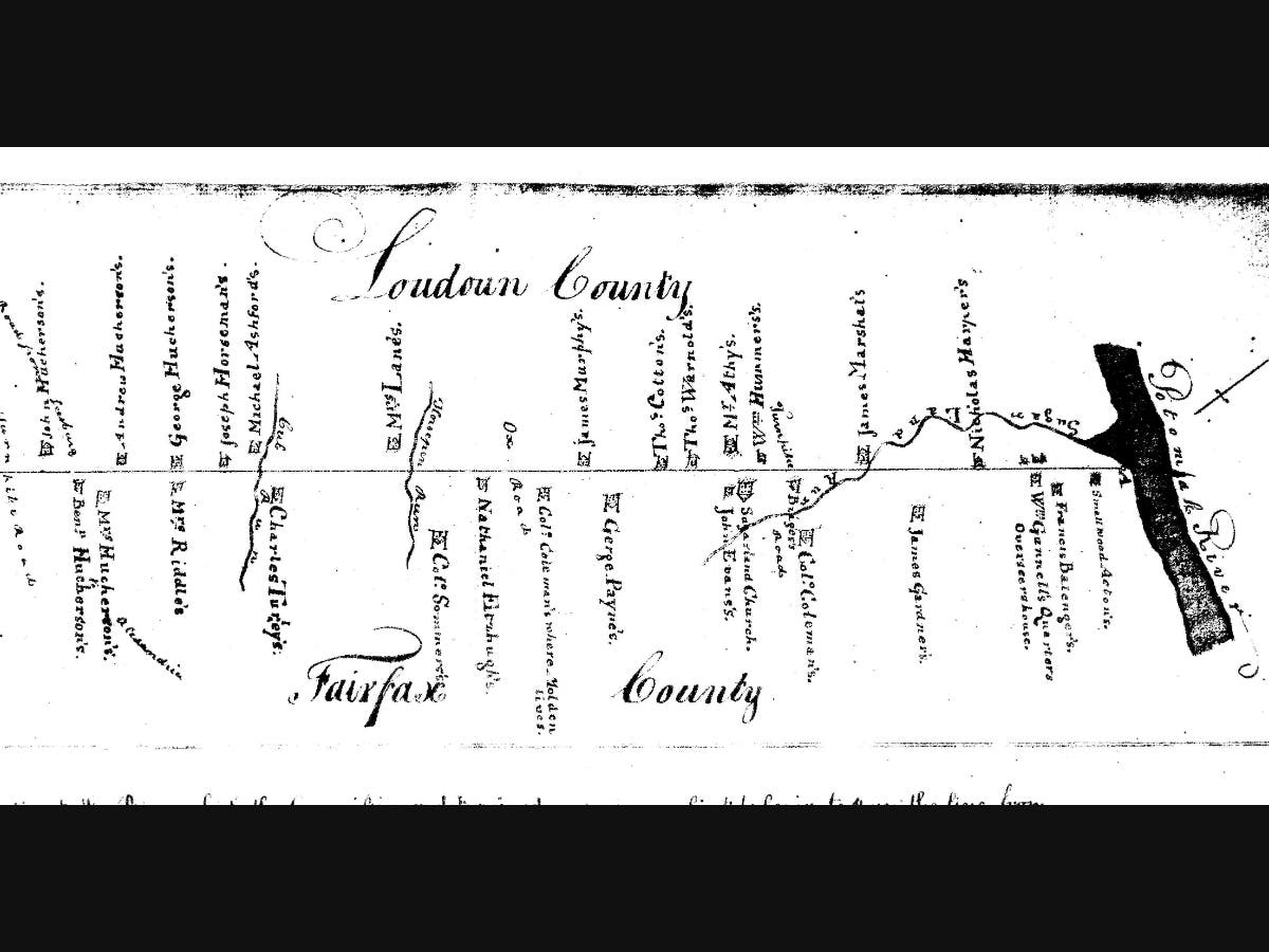
We have found a 1790 survey map, which shows the area between Bull Run and the Potomac River, and between western Fairfax County and eastern Loudoun County. The year 1790 was the same year that George Washington selected the nearby Potomac site for the federal capital. The original 1757 boundary line between Fairfax County and Loudoun County was in dispute. The land was surveyed in 1790 and by 1798 a new boundary line between Loudoun and Fairfax was established. Prior to 1798, Herndon was part of Loudoun County.
,%202.jpg)
Map showing the Fairfax/Loudoun County boundary change in 1798. (Virginia Places)
The 1790 survey map also marked buildings in those areas. The map shows homes located in what is now the town of Herndon corporate limits, specifically, homes for Colonel Coleman and George Payne. Alos, just north of the town limits, in what we often call “greater Herndon,” the map shows a home belonging to John Evans. And just south of the town, somewhere between Horsepen Run (near Floris) and Ox Road (now Old Ox Road or Sterling Road), the map shows a home marked for Nathanial Fitzhugh.
This article outlines the few things we know about some of the events and the residents who lived in our Herndon area in the 1700s.
Sugarland Church
Since the founding of the Virginia Colony in 1607, the Church of England was the official religion in Virginia. Its followers were called Anglicans. The Truro Parish (the ecclesiastical jurisdiction of the Anglican church in Colonial Virginia) was formed in 1732, which covered everywhere north of the Occoquan and Bull Run. This area became Fairfax County in 1742.
The laws of that day required that all adults who were 21-years-old or older attend Anglican Church services at least one sabbath day per month. This required them to spend an entire day travelling to a faraway church by foot, horseback, or wagon. The people who lived in our western Fairfax County area (then eastern Loudoun) petitioned the Virginia General Assembly to build a church that was closer to their homes. As a result, the Cameron Parish was created in 1748 which covered the western part of Fairfax County and the eastern part of Loudoun County. This parish was named after Thomas, 6th Lord Fairfax, Baron of Cameron.
A new Cameron Parish church was then located about 1.5 miles north of what is now the town of Herndon’s corporate limits, between Powell’s Tavern Place (Fairfax Co.) and East Beech Road (Loudoun Co.).It started as a chapel, which was likely a wooden structure, and was believed to have been built in 1749.It is believed that that a newer brick church was later built at that location in 1773. A local couple named Joshua and Martha Evans had deeded three acres of their land for this purpose. The brick church was named the Sugarland Church. A cemetery was located at the church site. There are 11 burials there that have been identified. The surnames of those identified graves are Bridges, Broadwater, Jenkins, Lewis, Owsley, and Self. Their burial years range from 1750 to 1849.More graves are there that have not been identified.
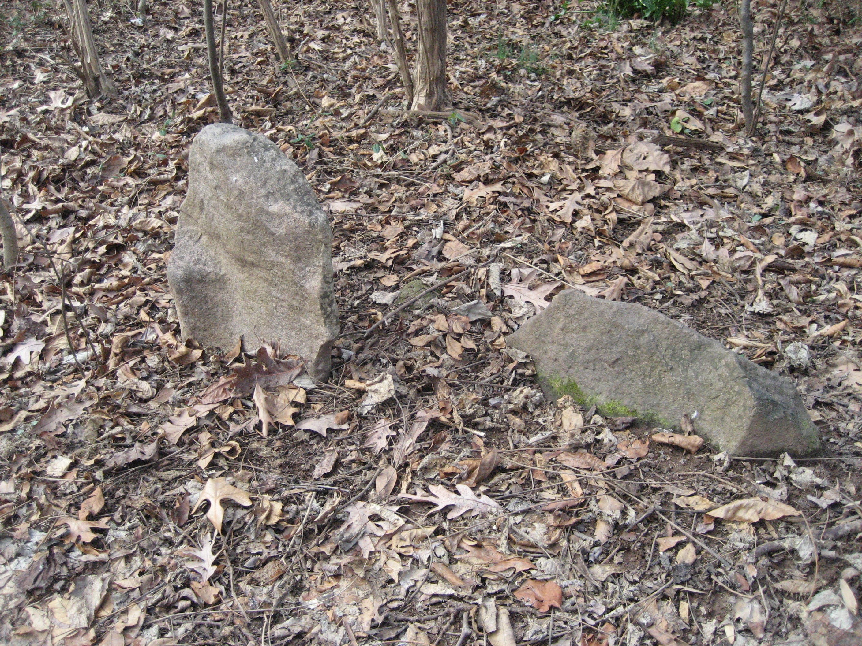
Two grave markers at the Sugarland Church Cemetery. (Barbara Glakas).
According to the Find-a-Grave website, John Owsley I (1734-1764), buried in this cemetery, served in the Loudoun County Virginia Militia, from 1759 until his death in 1764. He was a vestry man of the church and he reportedly also served in the French and Indian War.
After the Revolutionary War, the local people were no longer required to practice the religion of The Church of England. The Sugarland Church eventually fell into disuse. In c. 1850, the bricks in the old Sugarland Church were used to build a new church about 1.5 miles northwest of the former church site. The new church would be called the Liberty Church. That church is now the Dranesville Methodist Church and is located near the intersection of Leesburg Pike (Rt. 7) and the Fairfax County Parkway.
The Colonial-era graves are still located at the original site of the Sugarland Church.
More about Joshua and John Evans
John Evans’s house can be seen marked on a 1790 survey map, located just south of the Sugarland Church. John is the nephew of Joshua and Martha Evans.
Joshua wrote his will on September 30, 1773.It appears that Joshua knew he was not going to live long. His will started, “I, Joshua Evans, of the County of Loudoun, being sick and weak but of sound sense and memory…” Joshua left his wife Martha “one room in the house I now live in which is called her room.” He also instructed his executors to, “build for her a shed room adjoining her room fourteen feet by twelve in the clear with a brick or stone chimney and to finish the whole in a decent manner…”
We are unable to find any mention of Joshua and Martha’s children. However, Joshua left for his nephew, John, “all my real estate to him and the heirs of his body lawfully begotten forever.” Therefore, it appears that the “John Evans” house on the 1790 survey map, may be the former house of Joshua and Martha, inherited by nephew John.
Joshua’s father was also named John (1700-1767).In his will he left his son, Joshua, “the Pine Grove lot and the other half of Creswell joining next to it.” Joshua’s father, John, was blacksmith. Joshua may have been a blacksmith as well. On a website called Founders.archives.gov, we found a reference to a diary entry that said,
“At home all day, Joshua Evans who came here last Night put an Iron Ring upon Patcy (for Fits) and went away after Breakfast.”
The website went on to explain:
“Joshua Evans is probably the blacksmith of that name who was living in Loudoun County at this time and died there in 1773 (Loudoun County Wills, Book B, 71–79, Vi Microfilm). According to an English folk tradition dating from the fourteenth century, certain rings called cramp rings could relieve or cure epileptic convulsions when worn on a finger. These rings varied in design and composition, depending on a particular blessing, inscription, or material for their supposed efficacy.”
There is no evidence that Joshua Evens, and his nephew, John, fought in the Revolutionary War, but they provided services and materials for the American cause. The same website also noted an entry from a General Ledger A, from some of George Washington’s Papers in the Library of Congress: “GW today paid Evans £1 10s. for his service.” We are not sure if Joshua’s nephew, John, carried on with the family blacksmithing business. However, in a document entitled A Loudoun County Revolutionary War Paper Record, it had an entry that said that John Evans received “payments for goods and services supplied to the Army and Militia,” in 1782.
The Coleman House
The first house built in the what is now the town of Herndon was built in c. 1776 by members of the Coleman family, most probably Col. James Coleman. There were many Colemans in the area, especially in the vicinity of Dranesville. The house was located in what is now in the vicinity of the Life Style and Jefferson Mews Condominiums, off Center Street. A Herndon historic marker marks the former entrance to the property on Locust Street.
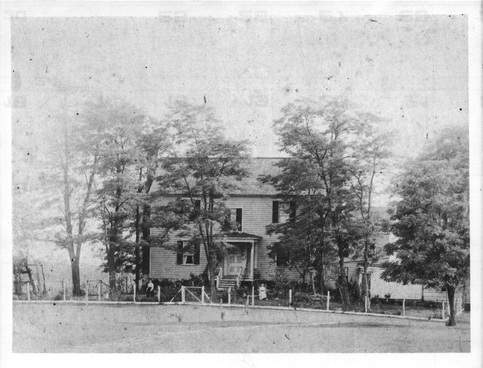
The former Coleman house in c. 1900. (Herndon Historical Society)
There is a little confusion as to who exactly built the house. It was possibly built by either James Coleman, or his son, John Coleman. A 1790 survey map shows the house, marked as “Col. Coleman’s where Molden lives.” Molden may have been a tenant. It was mostly likely built by James Coleman, as according to a document entitled A Loudoun County Revolutionary War Paper Record, as well as the military records website, Fold3, there is a militia officer listed named Col. James Coleman.
A small Coleman Family Cemetery is located about 150 yards west of the home’s former location, not far from the rear of Herndon Middle School. The Colemans were related to the Kitchens by marriage. Records show that William Kitchen, father of Herndon’s well-known resident, Katherine “Kitty” Kitchen Hanna, was also buried there in 1850.He was a veteran of the War of 1812.Kitty Kitchen Hanna is on record saying that her grandmother (Elizabeth Bearcroft Butler) and the grandmother’s half-sister (Susan Cricher Coleman) were buried there as well, under markers bearing their initials. No headstones remain in the cemetery today.
The Coleman’s land and home passed down through other members of the Coleman family, including James and Sarah Bland, and Samuel and Sara Coleman. Later, portions of this land passed to Thomas Carper, Thomas and Elizabeth Cox, John McKelden/McKeldon, Ulysses and Susan Ward, Curtis J. and Anna Gilbert, Thomas King, and Richard and Elizabeth Cissell, and John Luther and Alice Bowers. Most of these Herndon residents were farmers. When the house belonged to the Bowers, the house was known as Eldenwood.
The home was eventually demolished on the 1960s to make way for the International Apartments and other adjacent condos. The overgrown Coleman Family Cemetery is still present, in a patch of woods surrounded by metal fencing.
Lieutenant George Kilgour
First Lieutenant George Kilgour (sometimes spelled Kilgore), was a Revolutionary War Veteran who is buried in Herndon’s Chestnut Grove Cemetery. His birthdate is listed in various documents, ranging anywhere from 1739 to 1744.He died in 1818.
Kilgour was born in Maryland and got married to a woman named Martina in Loudoun County in 1760. They had two children, Thomas and Rebecca. In August of 1779 he enlisted in a Loudoun County Militia Regiment and served for a couple of years.
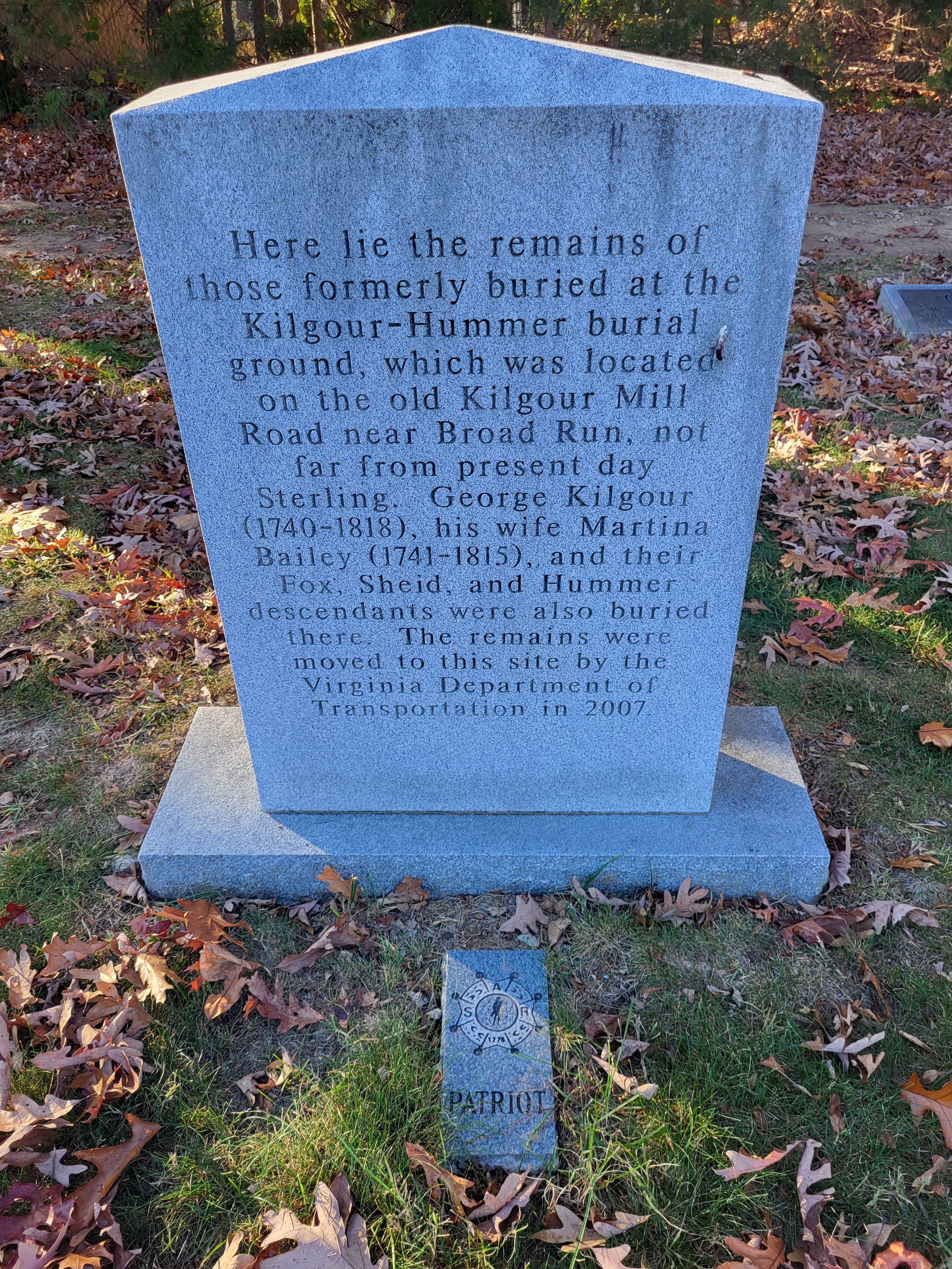
Lt. George Kilgour's grave in Herndon's Chestnut Grove Cemetery. (Suzy Ledgerwood)
Civilian-wise, Kilgore was a mill operator. He owned some land in the Broad Run/Sterling area, where he had a family cemetery, the Kilgour-Hummer Burial Ground. That burial ground was located near the present-day intersection of Route 28 and Nokes Boulevard. When that intersection was improved, the burial ground was documented and then the people who were buried there were disinterred, and then reinterred in Herndon’s Chestnut Grove Cemetery. About 47 graves were moved in 2007. Chestnut Grove has a marker to identify the Kilgour-Hummer graves. The Fairfax Resolves Chapter of the Virginia Society, Sons of the American Revolution, placed a “Patriot” marker by Kilgour’s grave.
Nathaniel Fitzhugh
The Fitzhugh family was prolific in Fairfax County. On various genealogical websites we find that Nathaniel Fitzhugh was born in 1768 in Fairfax County and died in 1800 in Fairfax County, at the age of 32. His spouse was Hannah Eskridge Lane. Nathaniel was her first husband. They were married in 1796.
Just to make things confusing, Fitzhugh’s full name was John Nathaniel Fitzhugh, and apparently went by “Nathaniel.” And his son’s name was John Nathaniel Fitzhugh Jr., and apparently went by the name “John.” The son was born in 1798.
The 1790 survey map referred to the home of “Nathaniel Fitzhugh.” We surmise that this must have been John Nathaniel Fitzhugh, Sr.’s home, since his son with the same name was not born until 1798.
We found an 1867 marriage record for Herndon’s blacksmith, Henry Simms. According to the marriage certificate, Henry and his wife, Annie, were married “at Mr. Fitzhugh[‘s].”It is most likely that the Fitzhugh home in question was the farm of the former Fitzhugh Sr., which was later left to his son, Fitzhugh Jr. The son was still alive at the time of the Simms marriage in 1867, not having died until 1877.
One Herndon Historical Society document indicates that the old Fitzhugh place was within the present-day boundaries of Dulles Airport, and their old burying ground was located “near the bed of Ox Road at the point where Sully Road, Horse Pen Road and the Loudoun County line approach each other.” That location would be southeast of the town of Herndon, about 1.5 miles from the town limits.
The Fitzhughs were also known to have a relationship with David Johnson, a Herndon resident who ran Rawson Lodge in Herndon, St. Timothy’s mission boarding school for boys on Grace Street in Herndon. In the 1870s, Johnson would sometimes send his students to work at the Fitzhugh farm during the summers. In a letter that David Johnson wrote to the mother of one of his students, he explained that her son would spend some of his summer at “Whitehall,” with Mr. Nathaniel Fitzhugh’s family. Johnson explained that the Fitzhughs were “one of our most reputable families, living in the same place their ancestor, Major John Fitzhugh, (of General Washington’s staff) lived.”
On a related note, Hannah Eskridge Lane Fitzhugh’s father, Captain William Lane Sr., earned the rank of Captain in the Loudoun Militia in 1777.After the Revolutionary War, William Lane acquired land and built a house called Oak Hill, which is located south of the town of Herndon, off West Ox Road (for which the current Oak Hill neighborhood takes its name). Hannah later lived there with her second husband, Joseph Evan Rowles.
George Payne
We believe the second oldest house to be built in what is now the town of Herndon was the home of George Payne. The house still stands today and is located at 744 Dranesville Road.
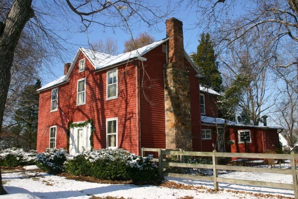
George Payne's home on Dranesville Road. (Courtesy Carol Wright).
We believe the house was built in 1783. A former long-time Herndon resident, Virgie Wynkoop (1878-1981), said the house was built that year. We also found that George was married in 1783 to Mary Coe at the Frying Pan Baptist Meeting House Church, located in Centreville Road. The National Registry of Historic Places says the Meeting House was built between 1783 and 1791. George was 20 years old and Mary was 18 when they got married. George and Mary Payne had five children of their own.
It might make sense that Payne built a house in 1783 for him and his new wife to use. The house can be seen on the 1790 survey map, marked, “Gerge Payne’s.”
George Payne was not a landowner. We believe he lived on rented land that his father rented from Ferdinando Fairfax, a Fairfax family descendent. According to Virgie Wynkoop, George Payne:
“built the house in 1783 and that he was supposedly the nephew of a friend of George Washington’s and built the house on land leased by his father.”
George Payne’s father was Sanford Payne. And his uncle was William Payne, who was a good friend of George Washington. Sanford Payne and his wife, Abigail, had eight children, one of whom was George Payne, born in Fairfax County in 1763.
George Payne was a veteran of the Revolutionary War, serving as an infantryman. He could have been a young soldier, or served later in the war. However, in two documents on TheFreeLibrary.com and Journal of Early Republic, it is explained:
“Officially, soldiers had to be at least 16 years old, but boys as young as 10 sometime enlisted, either with parent’s permission, or by hiding their age. Most of these boys were between 13 and 15 years old, but some were as young as nine.”
A 1798 Loudoun County Militia Journal said, “George Payne exempted from Militia duty during inability.” We are not sure what his “inability” was, but it may have caused his death as he died shortly thereafter in 1799 at the age of 36.
Based on the inventory of his estate property after his death, it appears that Payne may have been a farmer. Over and beyond some typical furniture and tableware, the inventory of his estate included a fair number of livestock (horses, steer, pigs, and sheep), tools to use with those animals and to farm with (hoes, iron wedges, and wagon equipment), as well as two enslaved girls named Charlotte and Mary. We also know that he once paid his rent in tobacco. At that time, it was common for tobacco to be used as currency.
In 1803, George’s widow, Mary, married Nicholas Grymes, a former Fairfax County militia man. They later moved to Kentucky.
Dranesville/Sugarland
Two nearby surrounding areas close to the town of Herndon are: the Dranesville/Sugarland area, and Floris (formerly called Frying Pan). These areas, just north and south of the incorporated town of Herndon, is sometimes colloquially referred to as “greater Herndon.”
The Sugarland area is located just north of Herndon. The first known settlement in the Sugarland area was a tract of about 3,000 acres patented by Daniel McCarty in 1709. “Sugarland” got its name from the many sugar maple trees that lined the banks of Sugarland Run, a stream that ran through that area (and still runs through Herndon today). Pioneers were attracted to the area for its potential to tap maple sap for syrup. McCarty was from Westmoreland County, Virginia. He served in the House of Burgesses in various years between 1705 and 1726.In the 1715 and 1718 sessions he served as the Speaker of the House. He became a lawyer and handled many land transactions for Robert “King” Carter.
His grandson, Col. Daniel McCarty (1758-1801), served in the Revolutionary War, and had fought in the battles of Brandywine and Germantown. He must have retained his grandfather’s Sugarland holdings, because a 1797 letter between McCarty and George Washington indicated a conversation in which McCarty was proposing to exchange part of his Sugarland holdings for some of Washington’s land on the Great Kanawha (in what is now West Virginia). That transaction never occurred.
Richard Coleman, a planter, helped the development of the Sugarland area. He was born in England. He immigrated to Westmoreland, Virginia, around 1720, and later bought about 500 acres in the Sugarland area. By the 1740s he was operating a farm, and had built a mill and an ordinary (what we now call a tavern). Coleman also served as a justice in 1759.In 1755, British and American soldiers, commanded by Col. Sir Peter Halkett, marched through the area. In an orderly book, Halkett described one of their stops as, “Mr. Coleman’s on Sugar Land Run where there is Indian corn, etc.”
Although there were paths in the area in the 1700s, Georgetown Pike and Leesburg Pike (then called Alexandria and Leesburg Pike) were not built until later. The Alexandria and Leesburg Turnpike company was incorporated by an act of Congress in 1813. The area eventually became known as Dranesville, named after Washington Drane, a businessman who moved to this area in 1810 and opened a new tavern and post office near the intersection of Georgetown Turnpike and the Leesburg Pike in circa 1823-1830.This was a perfect location, about halfway between Alexandria and Leesburg. It was during the early 1800s that Dranesville started to grow in earnest.
Frying Pan/Floris
About a mile and half south of Herndon was another area called Frying Pan, which later adopted the name Floris.
The name Frying Pan dates back about 300 years, to the time that Robert “King” Carter (1663-1732), an early land agent for Thomas, Lord Fairfax, formed a company to mine copper in our area. No one is sure of the origins of the name Frying Pan but the name first pops up in Virginia records in a 1728 deed from Lord Fairfax, when Robert “King” Carter bought the land to build a copper mine. Carter issued land grants for a 762-acre tract on Frying Pan Branch to his sons, Robert and Charles Carter, since it exhibited the potential to yield copper ore. The nearby stream branch on a 1720s land grant map is labelled “Frying Pan Branch.”
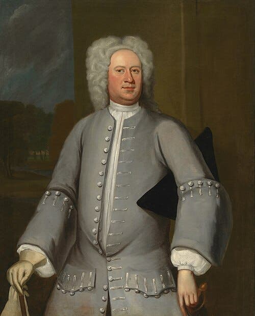
Robert "King" Carter, c. 1720. (Wikipedia).
A National Register of Historic Places form said:
“In 1728, Robert Carter, Sr., sons Robert Carter, Jr. (1704-1732) and Charles Carter, and son-in-law Mann Page, formed the Frying Pan Corporation to operate a copper mine and shared the cost of supplies, including enslaved labor.”
The Frying Pan Copper Mining Company found enough ore to justify continuing the adventure. To help facilitate the transport the ore by wagon, Carter built a landing on the Occoquan River and an ox road that connected Occoquan to the Frying Pan area. Much of this Ox Road still exists today. By 1731 the copper vein had run out.
Benjamin Cockerill, lived in the Frying Pan area in the mid/late-1700s. He was born in 1731 in Northumberland, Virginia. He married his wife, Sarah in 1752, in Fairfax County, Virginia. They had at least seven children which became part of the large Cockerill family of the Herndon area. He died in 1810 and his gravesite is one of the earliest gravesites at the Baptist Frying Pan Meeting House cemetery, his gravestone marked “B.C., 1810 - 79 years.”
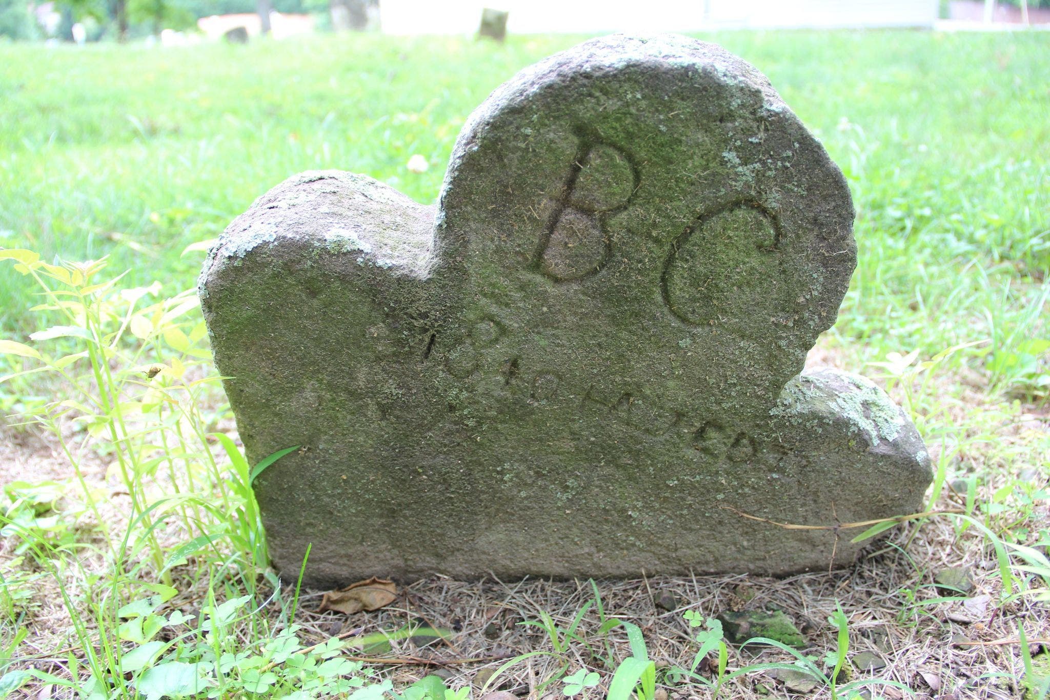
Benjamin Cockerill's grave at the Frying Pan Meeting House Cemetery. (Find-a-Grave).
The Baptist Frying Pan Meeting House, which is still located on Centreville Road today, was constructed between 1783 and 1791.It was Benjamin Cockerill, Daniel Neil [or Neale], and “some residents who lived near Horse Pen Run,” (a stream branch near Frying Pan), who reached out to Robert Carter III by letter, asking for permission to build a Baptist Meeting House on part of Carter’s land. Carter consented. Benjamin Cockerill was appointed as a deacon of the Frying Pan Meeting House in 1791.
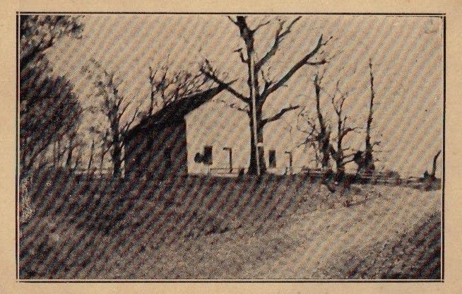
A postcard of the Frying Pan Meeting house, c. 1918. (Herndon Historical Society)
In about 1801, a man named John Davis, a school master, who had been through the Frying Pan area, wrote that, “Frying Pan is comprised of four huts and a meeting house…” As the 1800s progressed, the Frying Pan area became a prosperous dairy farming community and – later still -- became a rural vacation destination for residents of Washington, D.C.
Conclusion
Only a few people lived in the Herndon area in the 1700s. Many of them participated in, or provided supplies for, the Revolutionary War. Growth of the Herndon area was slow between the 1790s and 1850.Some early residents’ writings indicate that up to the year 1840, there were still only a small handful of homes in what would later become the town of Herndon. Then, in 1860, the trains came...
-----------------------------------------
About this column: “Remembering Herndon’s History” is a regular Herndon Patch feature offering stories and anecdotes about Herndon’s past. The articles are written by members of the Herndon Historical Society. Barbara Glakas is a member. A complete list of “Remembering Herndon’s History” columns is available on the Historical Society website at www.herndonhistoricalsociety.org.
The Herndon Historical Society operates a small museum that focuses on local history. It is housed in the Herndon Depot in downtown Herndon on Lynn Street and is open every Sunday from noon until 3:00. Visit the Society’s website at www.herndonhistoricalsociety.org, and the Historical Society’s Facebook page at https://www.facebook.com/HerndonHistory for more information.
Note: The Historical Society is seeking volunteers to help keep the museum open each Sunday. If you have an interest in local history and would like to help, contact HerndonHistoricalSociety@gmail.com.